MyTopo
Classic USGS Jamestown Missouri 7.5'x7.5' Topo Map
Couldn't load pickup availability
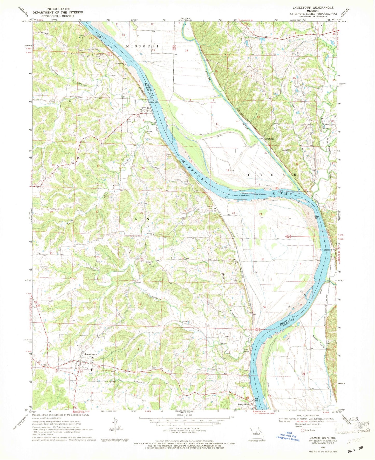
Historical USGS topographic quad map of Jamestown in the state of Missouri. Map scale may vary for some years, but is generally around 1:24,000. Print size is approximately 24" x 27"
This quadrangle is in the following counties: Boone, Moniteau.
The map contains contour lines, roads, rivers, towns, and lakes. Printed on high-quality waterproof paper with UV fade-resistant inks, and shipped rolled.
Contains the following named places: Acton School, Bethel Cemetery, Bethel School, Cave Springs, Cofer Cemetery, Cunningham School, Easley, Factory Creek, Hickam Cemetery, Jamestown, Jamestown C-1 Elementary School, Jamestown C-1 High School, Jamestown Post Office, Jamestown Rural Fire Protection District Station 1, Jamestown Rural Fire Protection District Station 2, Little Bonne Femme Creek, Little Splice Creek, Lupus, Lupus Bend, Maupin Branch, Mayhan Branch, Mount Zion Church, Nashville, Oakland School, Perche Creek, Pettigrew Cemetery, Plow Boy Bend, Providence, Providence Bend, Roche Percee Natural Arch, Smackout, Smith Hatchery Lake, Smith Hatchery Lake Dam, Splice Creek, Thompson Branch, Town of Jamestown, Town of Lupus, Township of Linn, Township of Rock Bridge, Warren School, Woodbine Lake Dam, ZIP Code: 65046