MyTopo
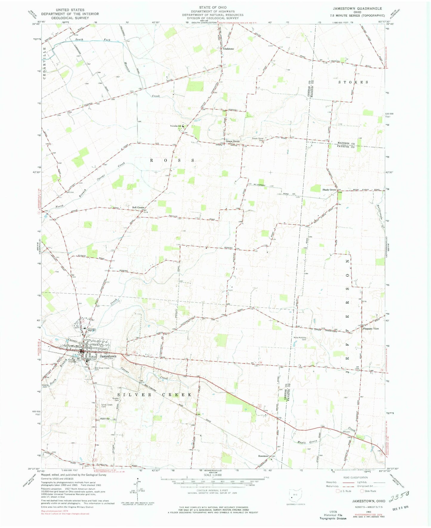
Classic USGS Jamestown Ohio 7.5'x7.5' Topo Map
Couldn't load pickup availability
Historical USGS topographic quad map of Jamestown in the state of Ohio. Map scale may vary for some years, but is generally around 1:24,000. Print size is approximately 24" x 27"
This quadrangle is in the following counties: Fayette, Greene, Madison.
The map contains contour lines, roads, rivers, towns, and lakes. Printed on high-quality waterproof paper with UV fade-resistant inks, and shipped rolled.
Contains the following named places: Aerodrome Les Noyers, Bell Center, Bethel School, Bloom Airport, Camstra Airport, Church of Christ in Christian Union, College Hill School, Gladstone, Gladstone Post Office, Grape Grove, Grape Grove Cemetery, Grape Grove Church, Grapegrove Post Office, Greenview High School, Griffin School, Hickory Grove School, International Pentecostal Church, Jamestown, Jamestown Friends Meeting House, Jamestown Police Department, Jamestown Post Office, Locust Grove School, Maple Grove School, Mechanicsville, Mills - McKillip Cemetery, Oak Grove School, Old Silver Creek Cemetery, Pleasant View, Pleasant View Church of Christ, Pleasant View School, Quaker Cemetery, Rosemoor, Saint Augustine Catholic Church, Shady Grove, Shady Grove School, Sheeley Cemetery, Shiloh School, Silver Creek Cemetery, Silver Ridge School, Silvercreek Township Fire Department, Sugar Grove School, Township of Ross, Township of Silvercreek, Velesky Airport, Village of Jamestown, ZIP Code: 45335