
MyTopo
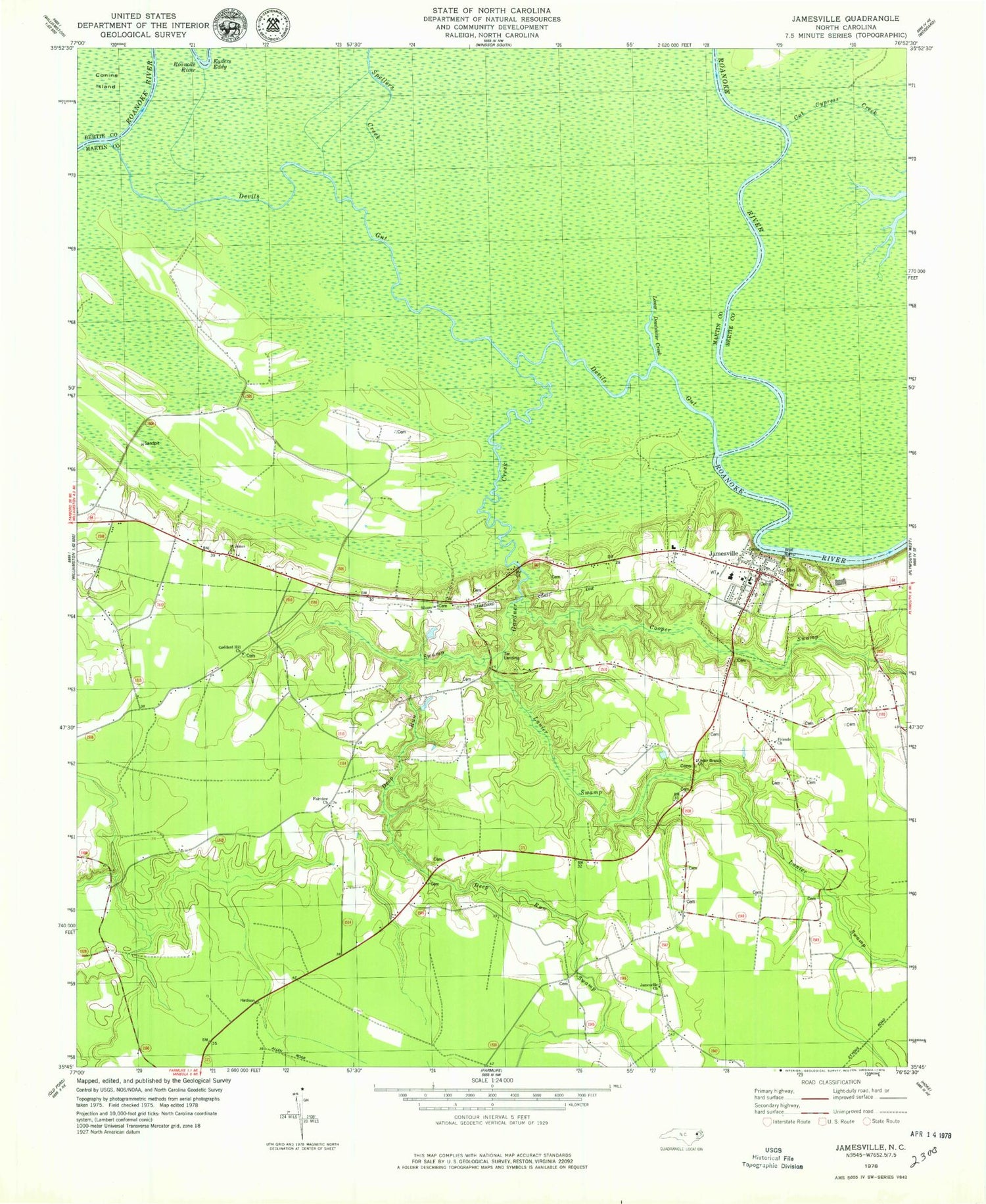
Classic USGS Jamesville North Carolina 7.5'x7.5' Topo Map
Couldn't load pickup availability
Historical USGS topographic quad map of Jamesville in the state of North Carolina. Map scale may vary for some years, but is generally around 1:24,000. Print size is approximately 24" x 27"
This quadrangle is in the following counties: Bertie, Martin.
The map contains contour lines, roads, rivers, towns, and lakes. Printed on high-quality waterproof paper with UV fade-resistant inks, and shipped rolled.
Contains the following named places: Cedar Branch Church, Cooper Swamp, Cut Cypress Creek, Deep Run Swamp, Devils Gut, Fairview Church, Friends Church, Gardner Creek, Goddard Hill Church, Jamesville, Jamesville Baptist Church, Jamesville Church, Jamesville Community Emergency Medical Services and Rescue, Jamesville Community Volunteer Fire Department, Jamesville Post Office, Jamesville Union School, Jamesville United Methodist Church, Kaders Eddy, Lanier Swamp, Lower Deadwater Creek, Saint James Church, Siloam Church, Spellers Creek, Tar Landing, Town of Jamesville, Township of Williams, ZIP Code: 27846


