MyTopo
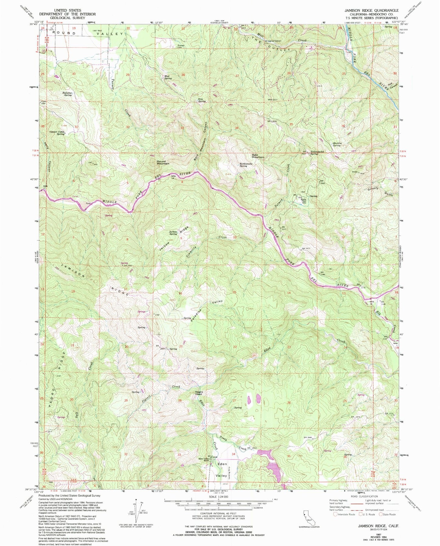
Classic USGS Jamison Ridge California 7.5'x7.5' Topo Map
Couldn't load pickup availability
Historical USGS topographic quad map of Jamison Ridge in the state of California. Map scale may vary for some years, but is generally around 1:24,000. Print size is approximately 24" x 27"
This quadrangle is in the following counties: Mendocino.
The map contains contour lines, roads, rivers, towns, and lakes. Printed on high-quality waterproof paper with UV fade-resistant inks, and shipped rolled.
Contains the following named places: Bald Mountain, Bald Mountain Canyon, Conner Cabin Spring, Doe Canyon, Eden Creek, Eden Valley, Eden Valley Ranch, Elk Creek, Iron Spring, Jamison Ridge, Jarbow Ridge, Jarbow Spring, Kelly Canyon, Marks Place, Martini Spring, Mill Creek, Mud Spring, Negro Head, Old Pioneer Cemetery, Paradise Valley, Pedro Corrals, Pedro Ridge, Pigtail Creek, Rattlesnake Spring, Redwine Spring, Round Mountain, Salmon Creek, Salt Creek Divide, Simmerly Creek, The Outlet, Thrash Ranch, Toney Creek, Yellowjacket Spring