MyTopo
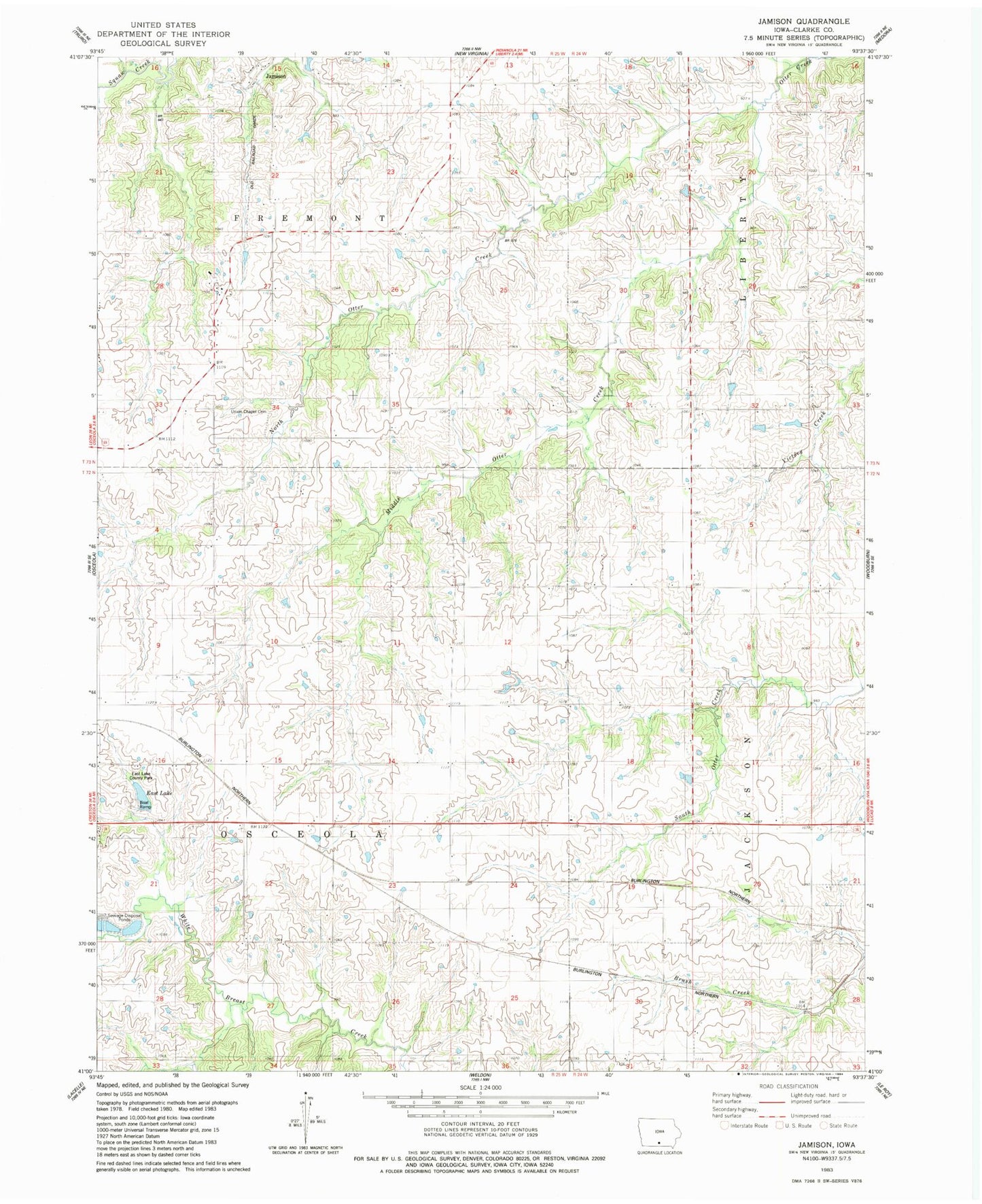
Classic USGS Jamison Iowa 7.5'x7.5' Topo Map
Couldn't load pickup availability
Historical USGS topographic quad map of Jamison in the state of Iowa. Map scale may vary for some years, but is generally around 1:24,000. Print size is approximately 24" x 27"
This quadrangle is in the following counties: Clarke.
The map contains contour lines, roads, rivers, towns, and lakes. Printed on high-quality waterproof paper with UV fade-resistant inks, and shipped rolled.
Contains the following named places: East Lake, East Lake County Park, Eggleston Grove School, Jamison, Jamison Post Office, Middle Otter Creek, North Otter Creek, Nortonville Post Office, Nortonville School, Osceola Municipal Airport, Quiet Dell School, Township of Fremont, Township of Osceola, Twyford Cemetery, Union Chapel Cemetery