MyTopo
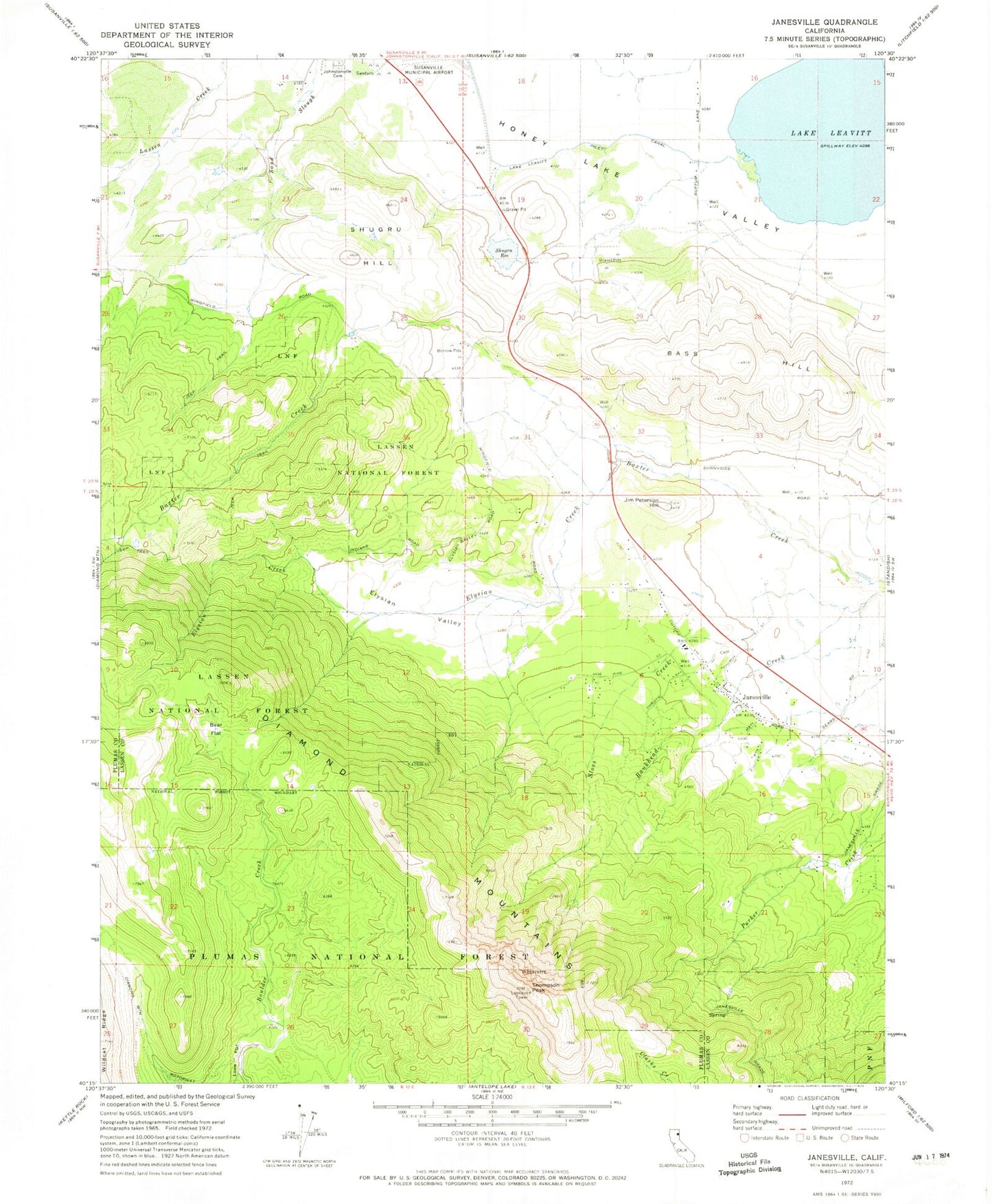
Classic USGS Janesville California 7.5'x7.5' Topo Map
Couldn't load pickup availability
Historical USGS topographic quad map of Janesville in the state of California. Map scale may vary for some years, but is generally around 1:24,000. Print size is approximately 24" x 27"
This quadrangle is in the following counties: Lassen, Plumas.
The map contains contour lines, roads, rivers, towns, and lakes. Printed on high-quality waterproof paper with UV fade-resistant inks, and shipped rolled.
Contains the following named places: Bankhead Creek, Bass Hill, Bass Hill Landfill, Bear Flat, Diamond Crest Cemetery, Diamond Mountains, Elysian Creek, Elysian Valley, Janesville, Janesville Cemetery, Janesville Census Designated Place, Janesville Elementary School, Janesville Fire Protection District, Janesville Post Office, Jim Peterson Hill, Lake Leavitt, Lake Leavitt Inlet Canal, Lowe Flat, Mallery Pit, Shugru 239 Dam, Shugru Hill, Shugru Reservoir, Southern Baptist Church of Janesville, Susan River Fire Protection District Station 2, Thompson Peak