MyTopo
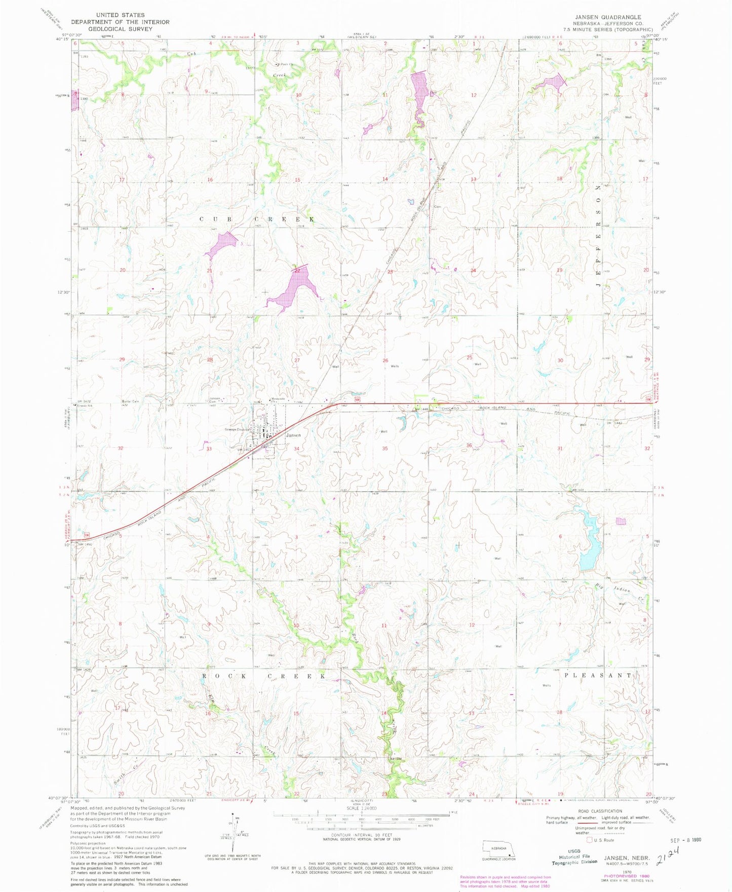
Classic USGS Jansen Nebraska 7.5'x7.5' Topo Map
Couldn't load pickup availability
Historical USGS topographic quad map of Jansen in the state of Nebraska. Map scale may vary for some years, but is generally around 1:24,000. Print size is approximately 24" x 27"
This quadrangle is in the following counties: Jefferson.
The map contains contour lines, roads, rivers, towns, and lakes. Printed on high-quality waterproof paper with UV fade-resistant inks, and shipped rolled.
Contains the following named places: Bartel Cemetery, Big Indian Creek Reservoir 10-A, Cub Creek, Cub Creek Dam 13-C, Cub Creek Dam 14-A, Cub Creek Election Precinct, Cub Creek Reservoir 10-C, Cub Creek Reservoir 12-A, Cub Creek Reservoir 13-C, Cub Creek Reservoir 13-D, Detention Dam 10-A, Detention Dam 10-C, Farmers Co-op Elevator, Floodwater Retarding Dam 12-A, Floodwater Retarding Dam 13-D, Grandy School, Jansen, Jansen Bible Church, Jansen Cemetery, Jansen Historical Marker, Jansen Post Office, Jansen Rural Fire Department, KUTT-FM (Fairbury), Mennonite Church, Rock Creek Election Precinct, Township of Cub Creek, Township of Rock Creek, Village of Jansen, ZIP Code: 68377