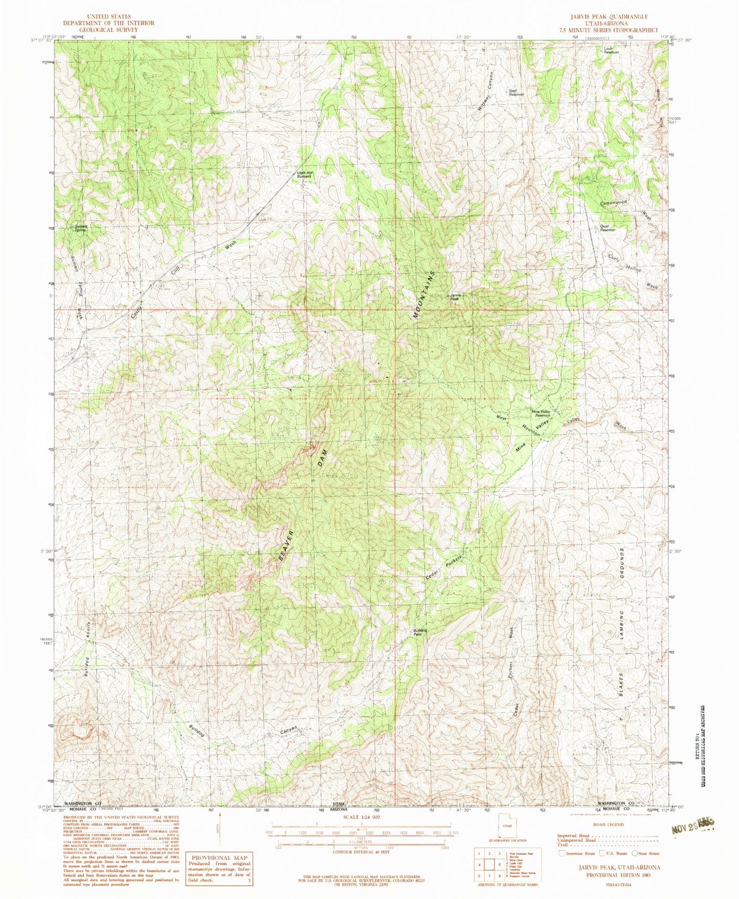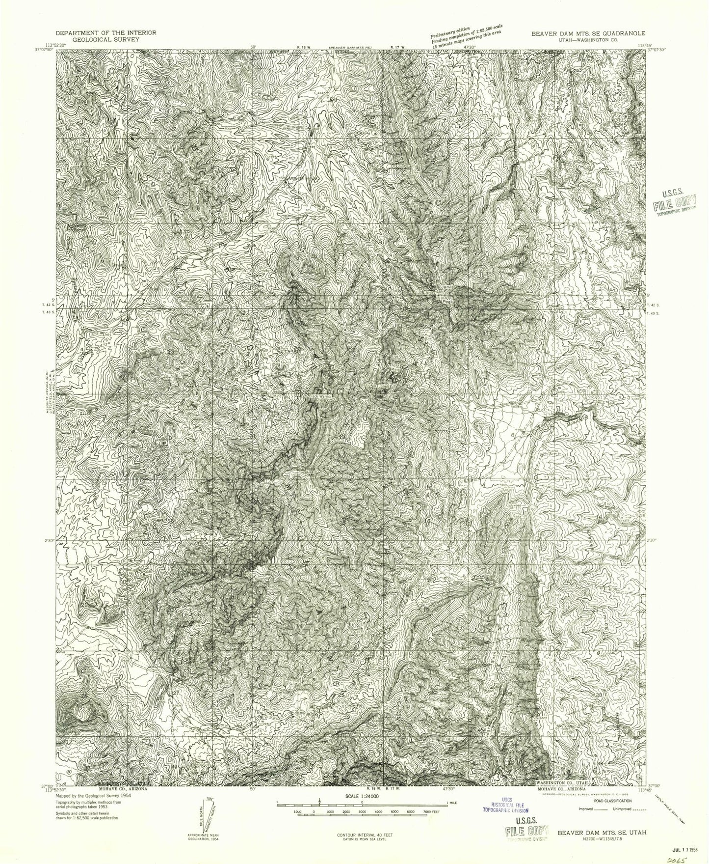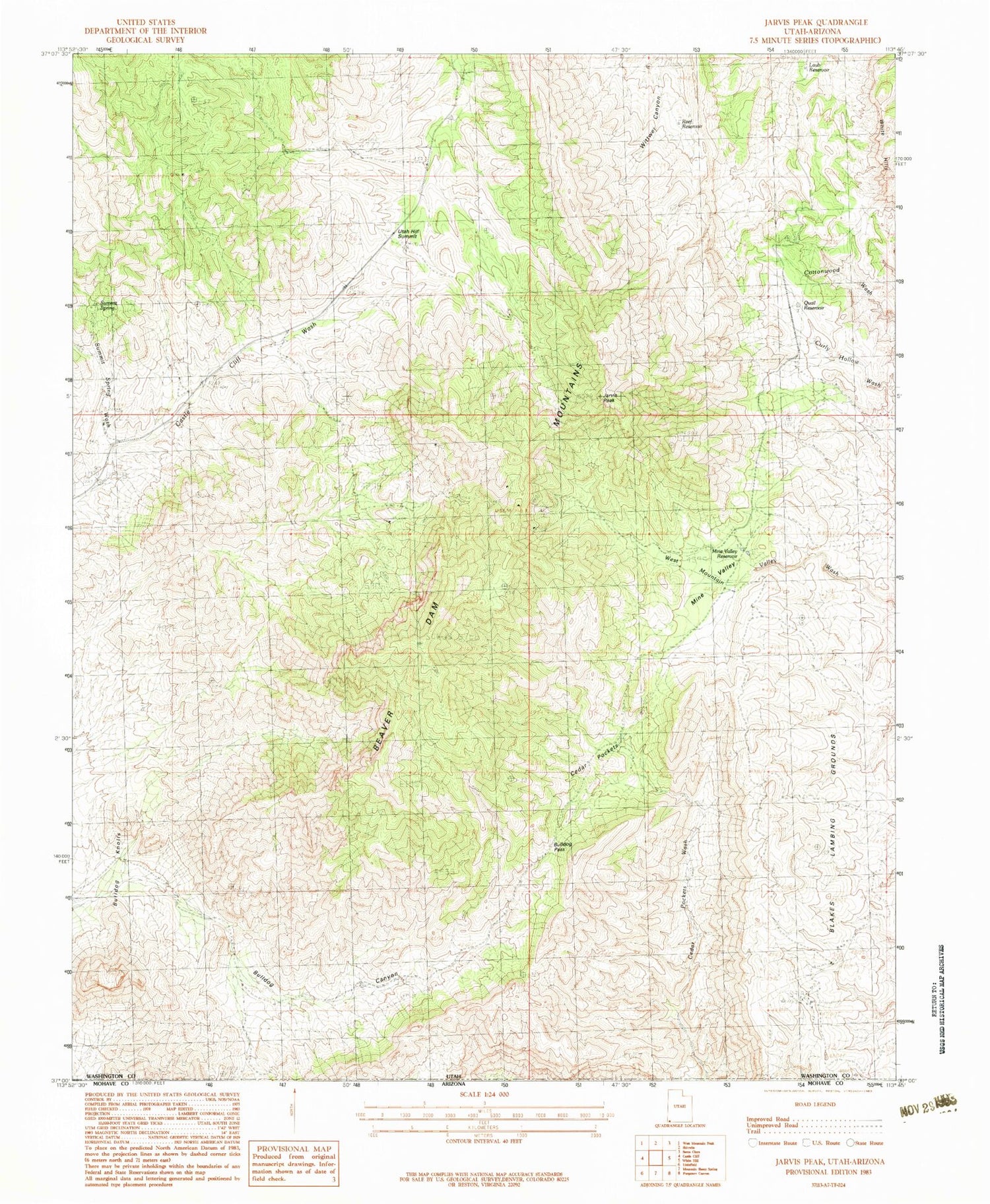
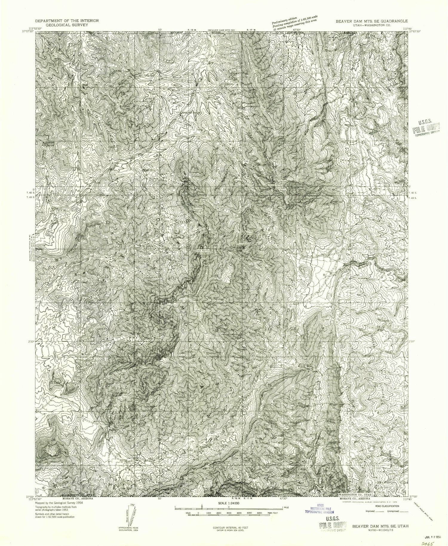
MyTopo
Classic USGS Jarvis Peak Utah 7.5'x7.5' Topo Map
Couldn't load pickup availability
Historical USGS topographic quad map of Jarvis Peak in the state of Utah. Map scale may vary for some years, but is generally around 1:24,000. Print size is approximately 24" x 27"
This quadrangle is in the following counties: Washington.
The map contains contour lines, roads, rivers, towns, and lakes. Printed on high-quality waterproof paper with UV fade-resistant inks, and shipped rolled.
Contains the following named places: Apex Mine, Black Warrior Mine, Bulldog Canyon, Bulldog Knolls, Bulldog Pass, Cedar Pockets, Jarvis Peak, Laub Reservoir, Mine Valley, Mine Valley Reservoir, Paymaster Mine Shaft, Quail Reservoir, Reef Reservoir, Summit Spring, Summit Spring Wash, Tabeau Peak, Tahoari, Utah Hill Summit, Westside Mine