MyTopo
Classic USGS Jasmine Arkansas 7.5'x7.5' Topo Map
Couldn't load pickup availability
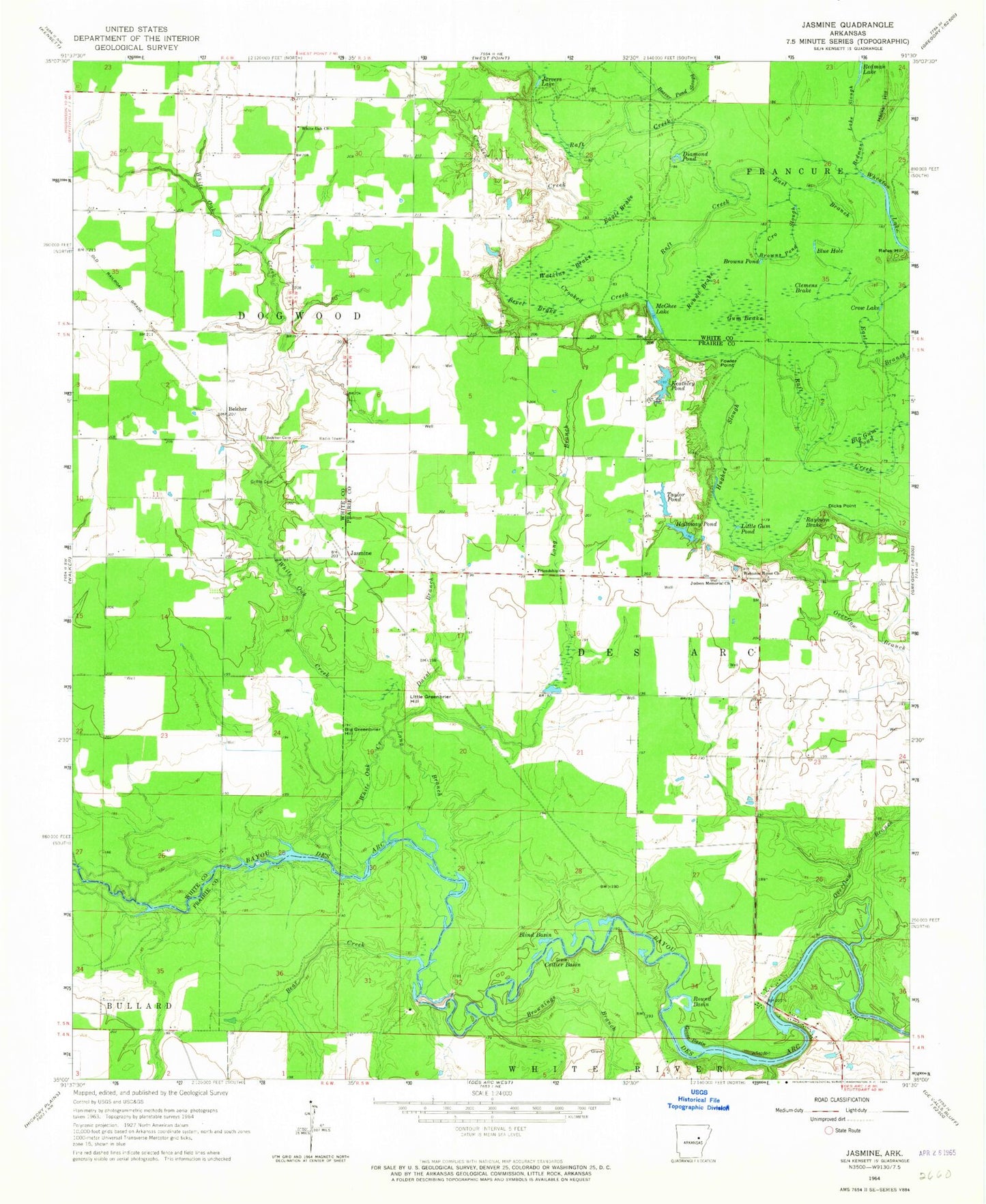
Historical USGS topographic quad map of Jasmine in the state of Arkansas. Map scale may vary for some years, but is generally around 1:24,000. Print size is approximately 24" x 27"
This quadrangle is in the following counties: Prairie, White.
The map contains contour lines, roads, rivers, towns, and lakes. Printed on high-quality waterproof paper with UV fade-resistant inks, and shipped rolled.
Contains the following named places: Bear Creek, Beaver Pond Slough, Belcher, Belcher Cemetery, Bevel Brake, Big Greenbrier Hill, Big Gum Pond, Blind Basin, Blue Hole, Brownings Branch, Browns Pond, Browns Pond Slough, Clemens Brake, Coitier Basin, Crooked Creek, Crow Lake, Darst Branch, Diamond Pond, Dicks Point, Eagle Brake, East Branch Raft Creek, Enarc, Fowler Point, Friendship Church, Goose Basin, Griffin Cemetery, Gum Brake, Hacks Hill, Hicksville, Holloway Memorial State Park, Holloway Pond, Holloway School, Hunterton, Jarvers Lake, Jasmine, Judson Memorial Church, KABK-FM (Augusta), Keathley Pond, Keathley Pond Dam, Lake Des Arc, Lake Des Arc Dam, Little Greenbrier Hill, Little Gum Pond, Long Branch, McGhee Lake, Northside Volunteer Fire Department, Overflow Branch, Rafes Hill, Rayburn Brake, Redman Lake Slough, Round Basin, Round Brake, Showalters Corner, Stineville, Taylor Pond, Township of Des Arc, Township of Dogwood, Tripp Strip, Watkins Brake, Welcome Home Church, Wheaton Lake, White Oak Church, White Oak Creek, White Oak School, Willard, ZIP Code: 72060