
MyTopo
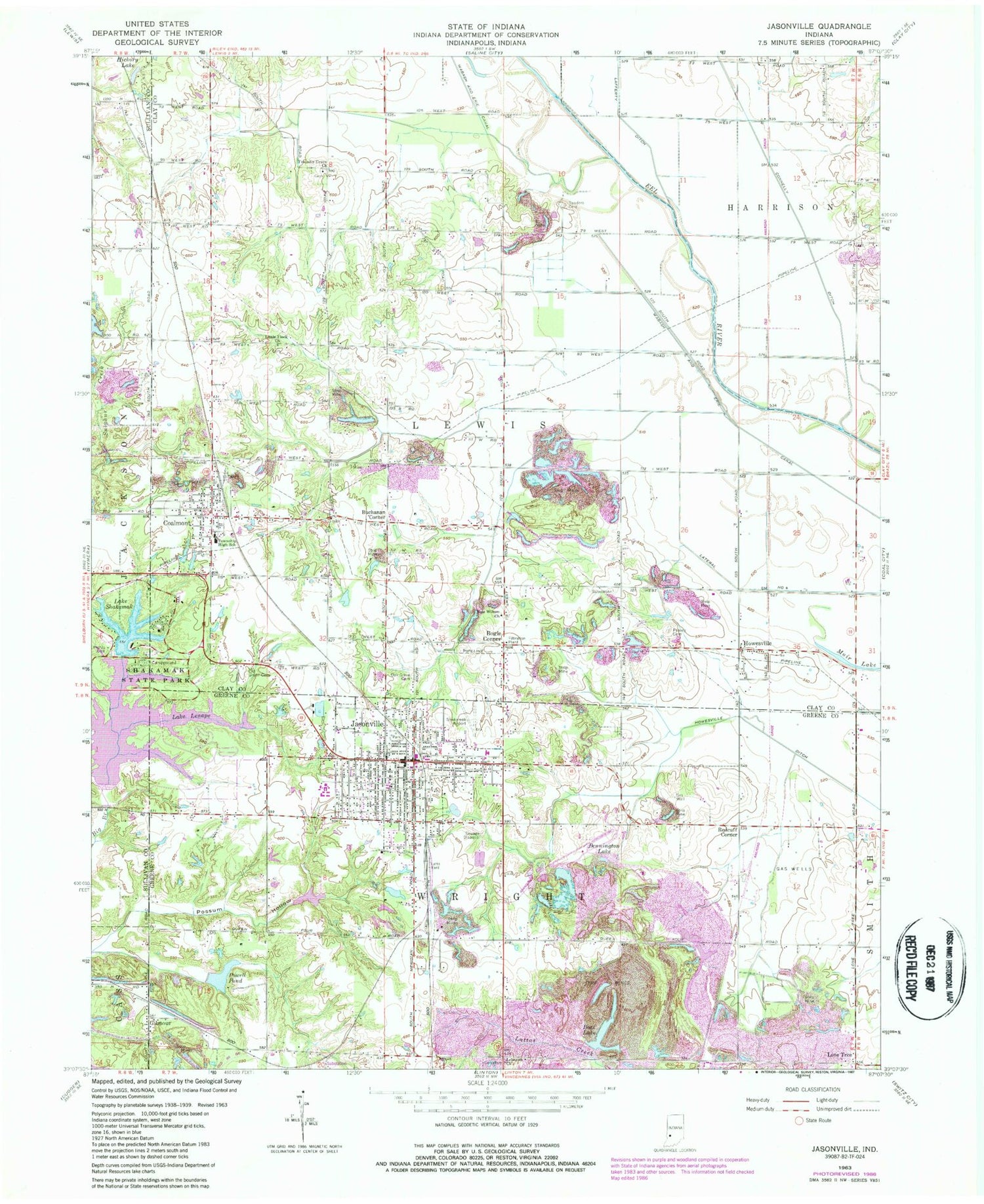
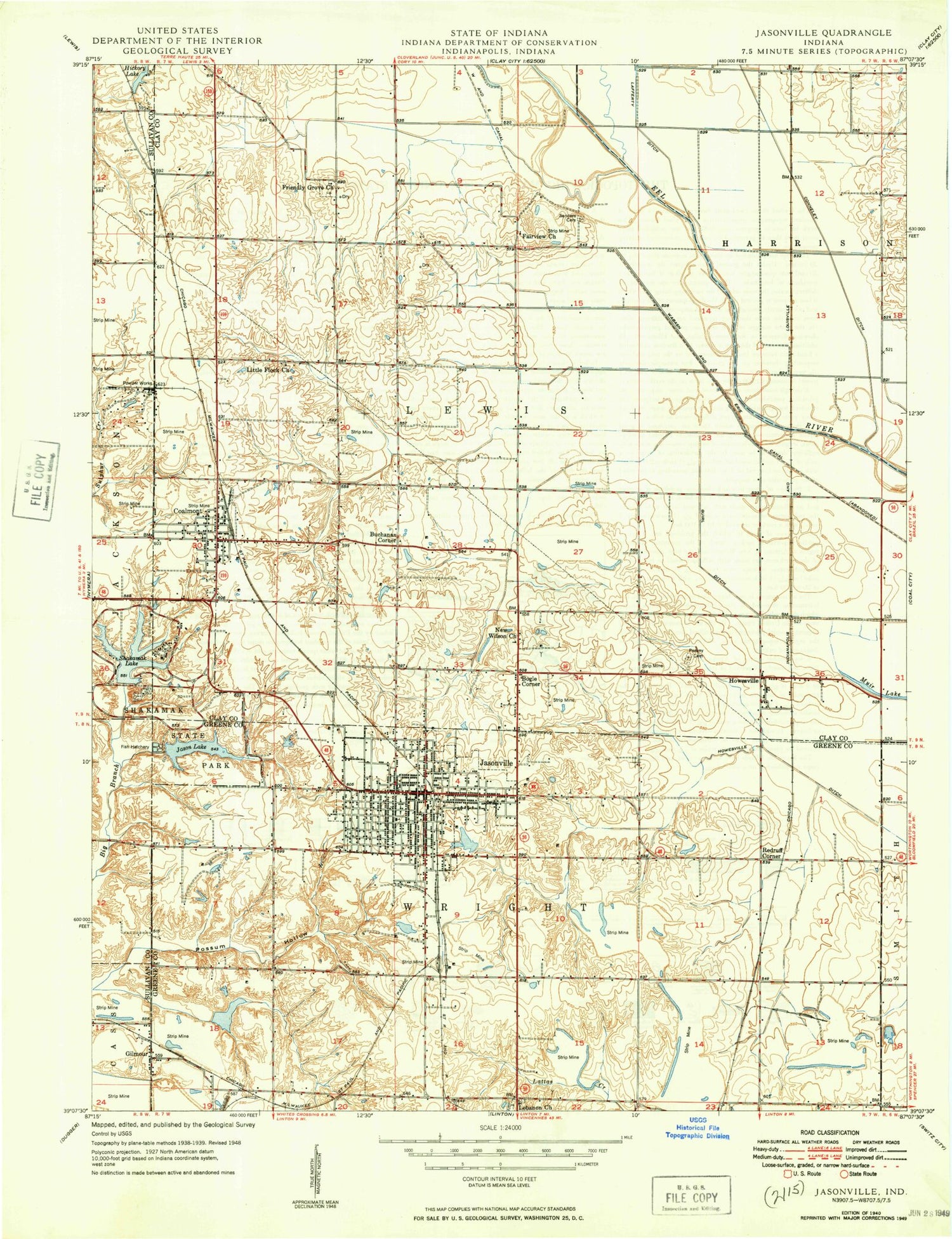
Classic USGS Jasonville Indiana 7.5'x7.5' Topo Map
Couldn't load pickup availability
Historical USGS topographic quad map of Jasonville in the state of Indiana. Map scale may vary for some years, but is generally around 1:24,000. Print size is approximately 24" x 27"
This quadrangle is in the following counties: Clay, Greene, Sullivan.
The map contains contour lines, roads, rivers, towns, and lakes. Printed on high-quality waterproof paper with UV fade-resistant inks, and shipped rolled.
Contains the following named places: Bennington Lake, Boat Lake, Bogle Corner, Buchanan Corner, Busseron Dam Number D-4, Care Ambulance Service, City of Jasonville, Coalmont, Coalmont Census Designated Place, Coalmont Post Office, Coffee Post Office, Eel River Prairie, Friendly Grove Church, Gilmour, Hickory Lake, Howesville, Jason Lake Dam, Jasonville, Jasonville Police Department, Jasonville Post Office, Jasonville Volunteer Fire Department, Lake Kickapoo, Lake Lenape, Lake Shakamak, Lateral Number Four, Latta Yard, Lebanon Cemetery, Lebanon Church, Lewis Township Fire Company, Little Flock Church, Lone Tree, New Wilson Church, Oak Grove Cemetery, Old Union Cemetery, Possum Hollow, Powell Pond, Redcuff Corner, Sanders Cemetery, Shakamak Airport, Shakamak Elementary School, Shakamak High School, Shakamak Lake Dam, Shakamak Middle School, Shakamak State Park, Township of Lewis, Township of Wright, ZIP Code: 47438


