MyTopo
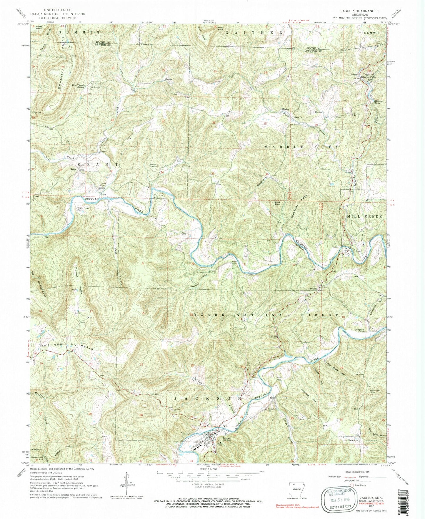
Classic USGS Jasper Arkansas 7.5'x7.5' Topo Map
Couldn't load pickup availability
Historical USGS topographic quad map of Jasper in the state of Arkansas. Typical map scale is 1:24,000, but may vary for certain years, if available. Print size: 24" x 27"
This quadrangle is in the following counties: Boone, Newton.
The map contains contour lines, roads, rivers, towns, and lakes. Printed on high-quality waterproof paper with UV fade-resistant inks, and shipped rolled.
Contains the following named places: Township of Jackson, Township of Marble City (historical), Basin School (historical), Erbie Community Church, Township of Grant (historical), Jasper Elementary School, Jasper High School, Little Buffalo (historical), Spring Bluff, The Basin, Adair Cemetery, Basin Church, Boulder Creek, Brown Cemetery, Buck Point, Carlton Branch, Cherry Grove Cemetery, Conard Fissure (historical), Cove Creek, Dogwood Flat, Erbie, Flatrock Creek, Flatwoods, Grapevine Ridge, Harp Creek, Hoskin Creek, Jasper, Little Blade Hollow, Marble Falls, Mill Creek, Mutton Point, Newberry Point, Panther Creek Mine, Point Rock, Pruitt, Pruitt Cemetery, Sawmill Hollow, Spider Creek, Stringtown Cemetery, Stringtown Hollow, Tadpole Hollow, Tom Thumb Cemetery, Tom Thumb Spring, Webb Branch, Wildcat Hollow, Young Cemetery, Henry Koen Experimental Forest, Buffalo Ranger District Office, Cecil Creek, Dogpatch, Weatherby Lake Dam, Weatherby Lake, Edwards Lake Dam, Edwards Lake, Mill Creek Hollow Dam, Mill Creek Hollow Reservoir, Briar Bluff, Cave Spring, Cove Spring, Goat Bluff, Henry Koen Experimental Forest, North Pond, Shaddox Cemetery, South Pond, Van Dyke Spring, Welch Bluff, Pruitt Post Office (historical), Mount Sherman Rural Fire Department, Newton County Sheriff's Office, Jasper Police Department, City of Jasper, Township of Marble Falls, McFadin Cemetery, Jasper Post Office