MyTopo
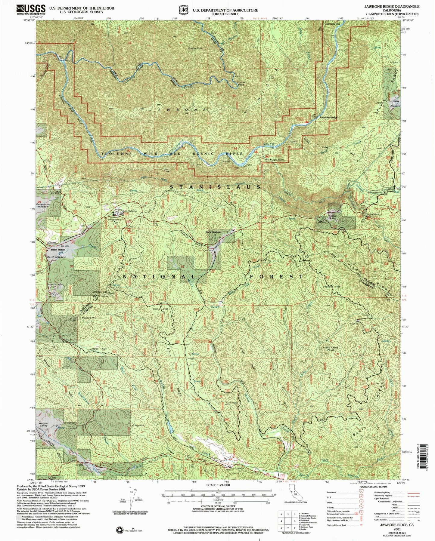
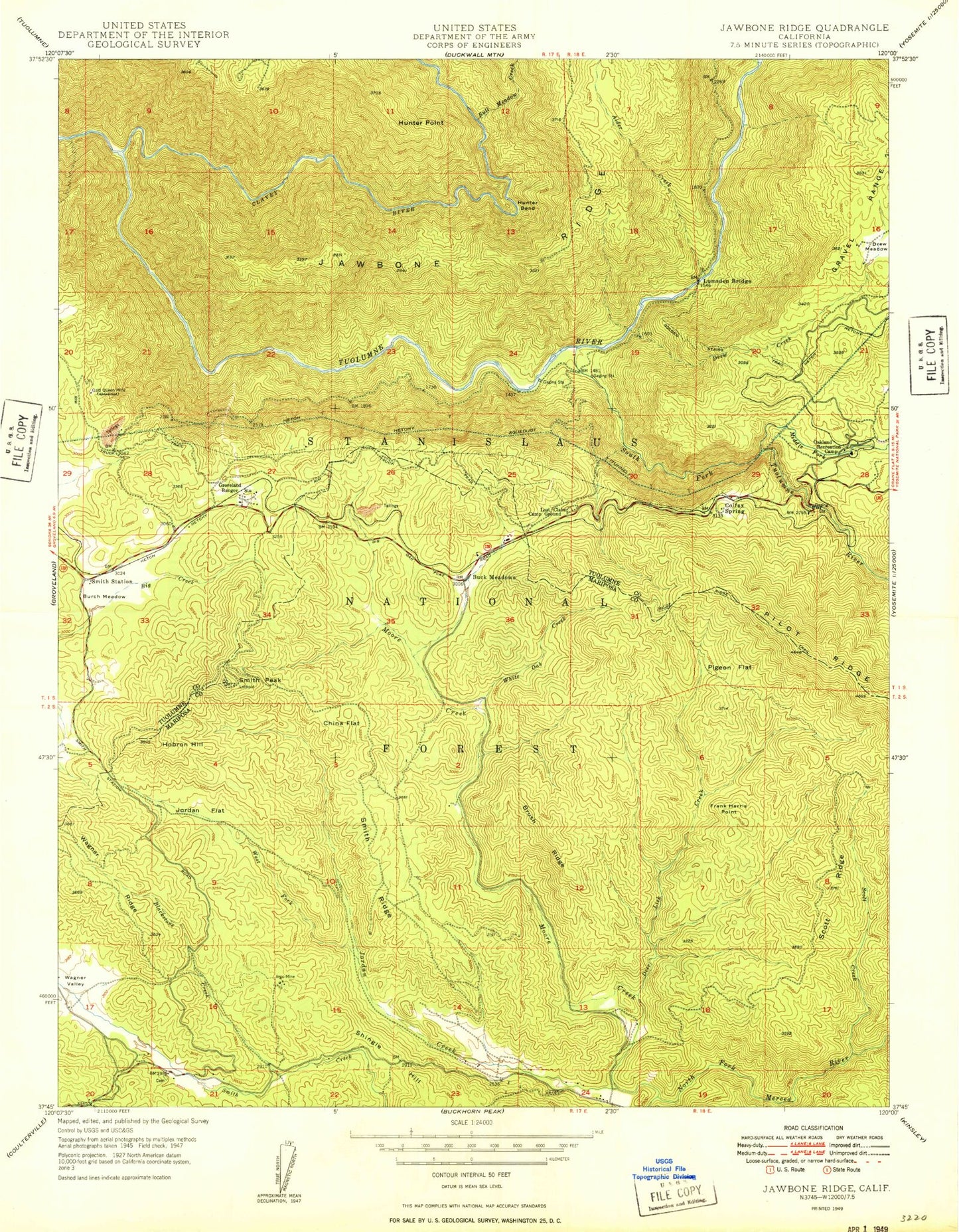
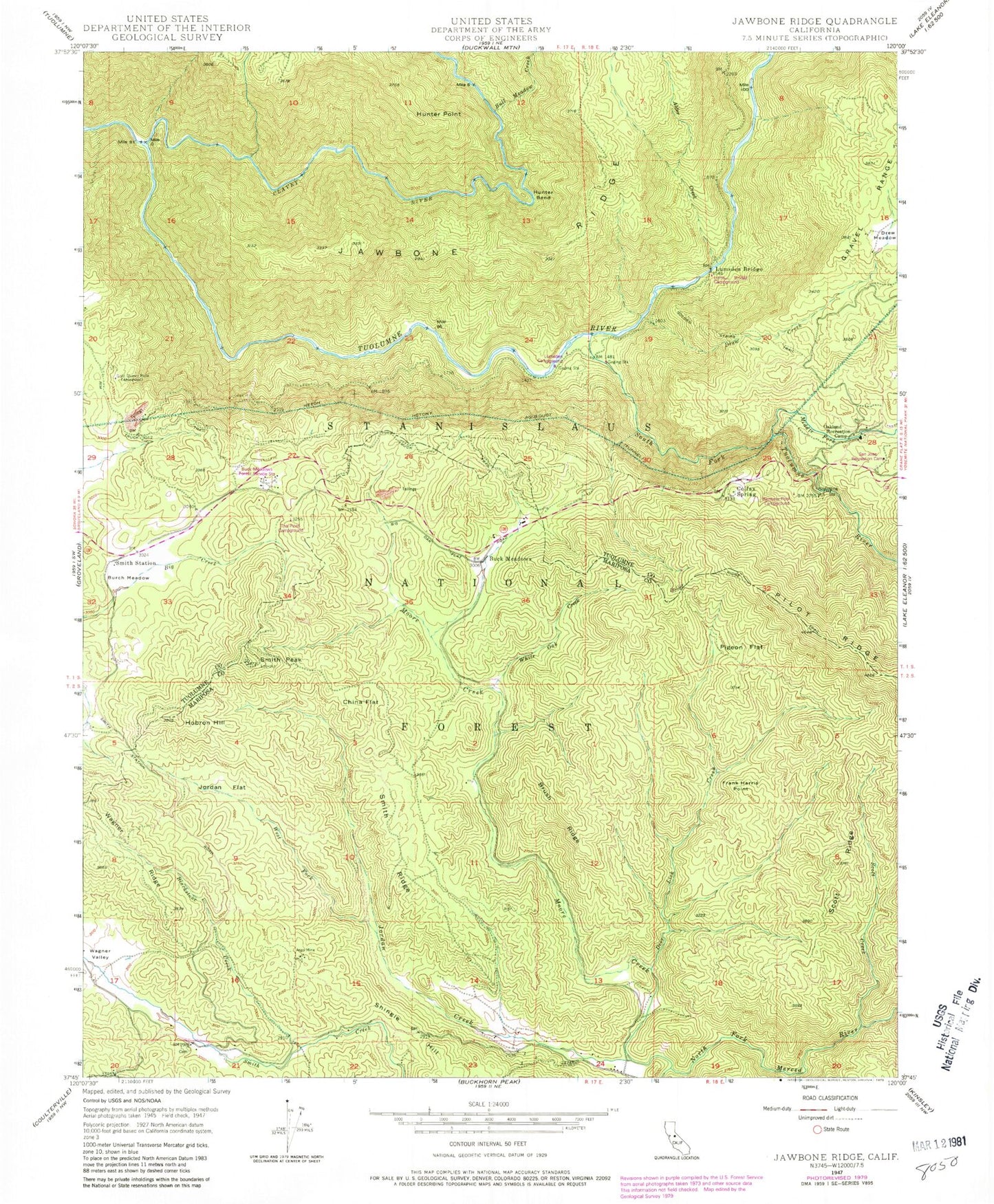
Classic USGS Jawbone Ridge California 7.5'x7.5' Topo Map
Couldn't load pickup availability
Historical USGS topographic quad map of Jawbone Ridge in the state of California. Typical map scale is 1:24,000, but may vary for certain years, if available. Print size: 24" x 27"
This quadrangle is in the following counties: Mariposa, Tuolumne.
The map contains contour lines, roads, rivers, towns, and lakes. Printed on high-quality waterproof paper with UV fade-resistant inks, and shipped rolled.
Contains the following named places: China Flat, Sweetwater Campground, Alder Creek, Argo Mine, Blackstone Creek, Brush Ridge, Buck Meadows, Bull Meadow Creek, Burch Meadow, Colfax Spring, Deer Lick Creek, Drew Creek, Drew Meadow, Gold Queen Mine, Golden Stairs Trail, Groveland Ranger Station, Hobron Hill, Hunter Bend, Jordan Creek, Jordan Flat, Lost Claim Camp Ground, Moore Creek, Oakland Recreation Camp, Pigeon Flat, Pilot Ridge Trail, Scott Creek, Scott Ridge, Smith Peak, Clavey River, Smith Ridge, Smith Station, South Fork Tuolumne River, Lumsden Bridge, Wagner Valley, West Fork Jordan Creek, White Oak Creek, Middle Tuolumne River, South Fork Campground, Sweetwater, Rainbow Pool Picnic Area, Moore Creek Campground, Frank Harris Point, Hunter Point, Shingle Hill, Buck Meadows Forest Service Station, Lumsden Bridge Campground, Lumsden Campground, Rainbow Pool Campground, San Jose Recreation Camp, The Pines Campground, Jordan Oak, Smith Peak Lookout, Buck Meadows Census Designated Place, Greeley Hill Census Designated Place, Dudley Cemetery, China Flat, Sweetwater Campground, Alder Creek, Argo Mine, Blackstone Creek, Brush Ridge, Buck Meadows, Bull Meadow Creek, Burch Meadow, Colfax Spring, Deer Lick Creek, Drew Creek, Drew Meadow, Gold Queen Mine, Golden Stairs Trail, Groveland Ranger Station, Hobron Hill, Hunter Bend, Jordan Creek, Jordan Flat, Lost Claim Camp Ground, Moore Creek, Oakland Recreation Camp, Pigeon Flat, Pilot Ridge Trail, Scott Creek, Scott Ridge, Smith Peak, Clavey River, Smith Ridge, Smith Station, South Fork Tuolumne River, Lumsden Bridge, Wagner Valley, West Fork Jordan Creek, White Oak Creek, Middle Tuolumne River, South Fork Campground, Sweetwater, Rainbow Pool Picnic Area, Moore Creek Campground, Frank Harris Point, Hunter Point, Shingle Hill, Buck Meadows Forest Service Station, Lumsden Bridge Campground, Lumsden Campground, Rainbow Pool Campground, San Jose Recreation Camp, The Pines Campground, Jordan Oak, Smith Peak Lookout, Buck Meadows Census Designated Place, Greeley Hill Census Designated Place, Dudley Cemetery