MyTopo
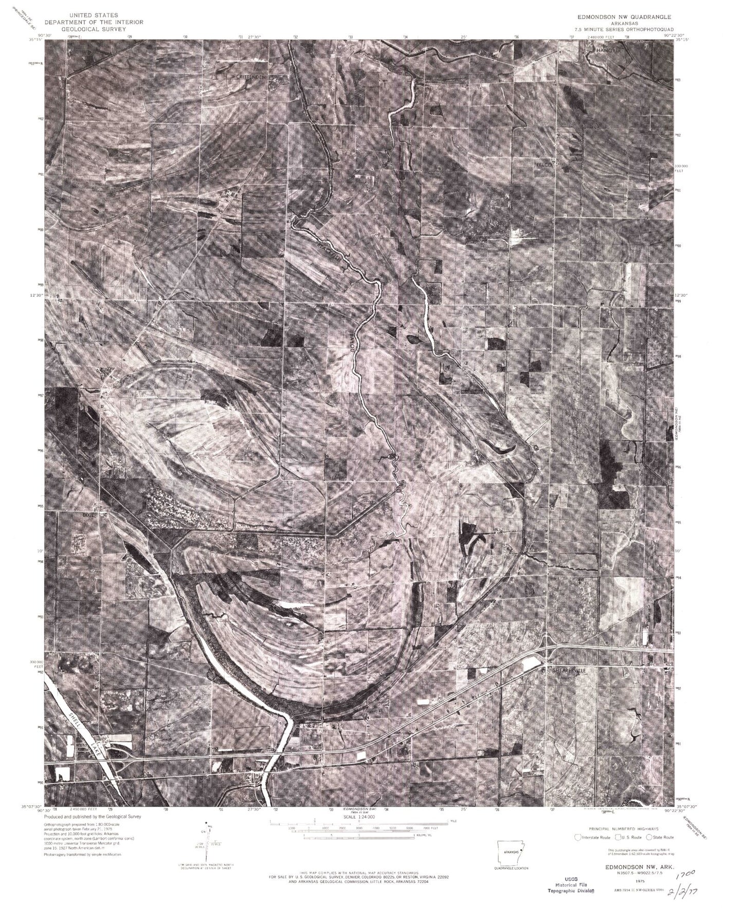
Classic USGS Jeanette Arkansas 7.5'x7.5' Topo Map
Couldn't load pickup availability
Historical USGS topographic quad map of Jeanette in the state of Arkansas. Map scale may vary for some years, but is generally around 1:24,000. Print size is approximately 24" x 27"
This quadrangle is in the following counties: Crittenden, St. Francis.
The map contains contour lines, roads, rivers, towns, and lakes. Printed on high-quality waterproof paper with UV fade-resistant inks, and shipped rolled.
Contains the following named places: Barnes Chapel, Bernard Manor Airport, Big Lake, Buck Lake, Buck Lake Cemetery, Buck Lake Church, Buck Lake School, Burns School, Christ Temple Church, Church of God in Christ, Crittenden, Ditch Number 1, Ditch Number 10, Ditch Number 11, Ditch Number 12, Ditch Number 13, Ditch Number 16, Ditch Number 2, Ditch Number 20, Ditch Number 21, Ditch Number 22, Ditch Number 23, Ditch Number 4, Ditch Number 5, Ditch Number 6, Ditch Number 8, Ditch Number 9, Dixie, Dry Bayou, Felco, Greenwood Church, Heth Post Office, Holden Lake, Jeanette, Jeka Slough, Jennette, Kinsey Cemetery, Lake Grove Church, Lake Grove School, Lansing School, Macedonia Cemetery, Medley Cemetery, Mount Beulah Cemetery, Mount Beulah Church, Mount Hermon Cemetery, Mount Hermon Church, Mount Pilgrim Church, New Bethel Church, New Hope Church, New Shady Grove, New Shady Grove Cemetery, New Shady Grove Church, New Shady Grove School, Pilgrim Rest Cemetery, Pilgrim Rest Church, Pilgrim Rest School, Shady Grove Cemetery, Shady Grove School, Shearerville, Shearerville Church, Shell Lake, Shell Lake School, Smith Perkins School, Stokes Airport, Town of Jennette, Township of Tyronza, Wallace Chapel, Walnut Ridge School, Wildcat, Wildcat Bayou, Zion Field Church