MyTopo
Classic USGS Jeffers Draw Wyoming 7.5'x7.5' Topo Map
Regular price
$16.95
Regular price
Sale price
$16.95
Unit price
per
Couldn't load pickup availability
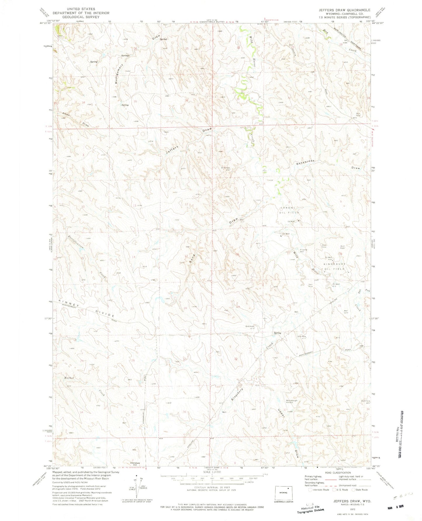
Historical USGS topographic quad map of Jeffers Draw in the state of Wyoming. Map scale may vary for some years, but is generally around 1:24,000. Print size is approximately 24" x 27"
This quadrangle is in the following counties: Campbell.
The map contains contour lines, roads, rivers, towns, and lakes. Printed on high-quality waterproof paper with UV fade-resistant inks, and shipped rolled.
Contains the following named places: Bekebrede Draw, Boyken Number 2 Dam, Boyken Number 2 Reservoir, East Fork Wild Horse Creek, Gates Dam, Gates Reservoir, Jeffers Draw, Kingsbury Creek, Kingsbury Oil Field, Sand Draw, Throne Oil Field, Upper Draw