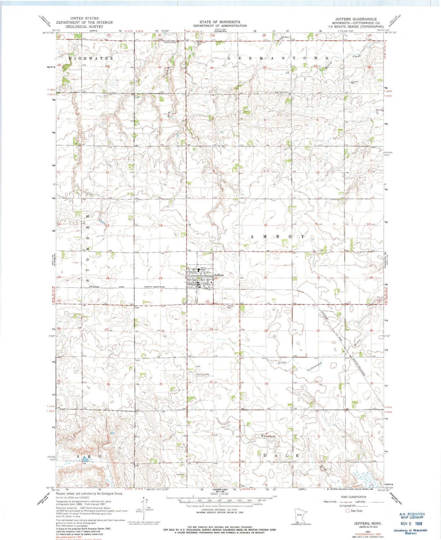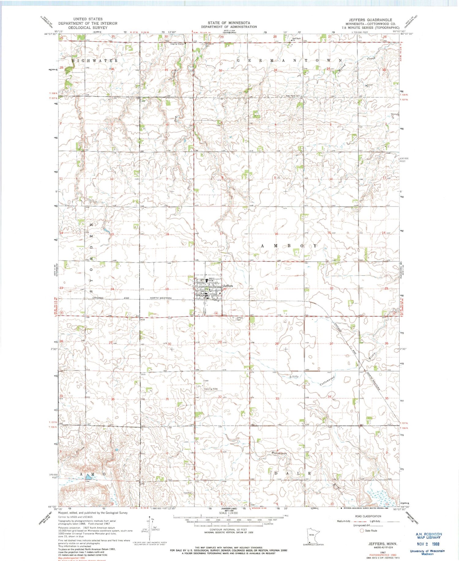
MyTopo
Classic USGS Jeffers Minnesota 7.5'x7.5' Topo Map
Couldn't load pickup availability
Historical USGS topographic quad map of Jeffers in the state of Minnesota. Map scale may vary for some years, but is generally around 1:24,000. Print size is approximately 24" x 27"
This quadrangle is in the following counties: Cottonwood.
The map contains contour lines, roads, rivers, towns, and lakes. Printed on high-quality waterproof paper with UV fade-resistant inks, and shipped rolled.
Contains the following named places: City of Jeffers, Cottonwood County, Ewen Landing Field, Jeffers, Jeffers Ambulance Service, Jeffers Cemetery, Jeffers Post Office, Jeffers Village City Hall, Jeffers Volunteer Fire Department, Red Rock Cemetery, Red Rock Central Elementary School, Red Rock Church, Red Rock United Methodist Church, Saint Johns Cemetery, Township of Amboy, Trinity Lutheran Church, ZIP Code: 56145