MyTopo
Classic USGS Jefferson City NW Missouri 7.5'x7.5' Topo Map
Couldn't load pickup availability
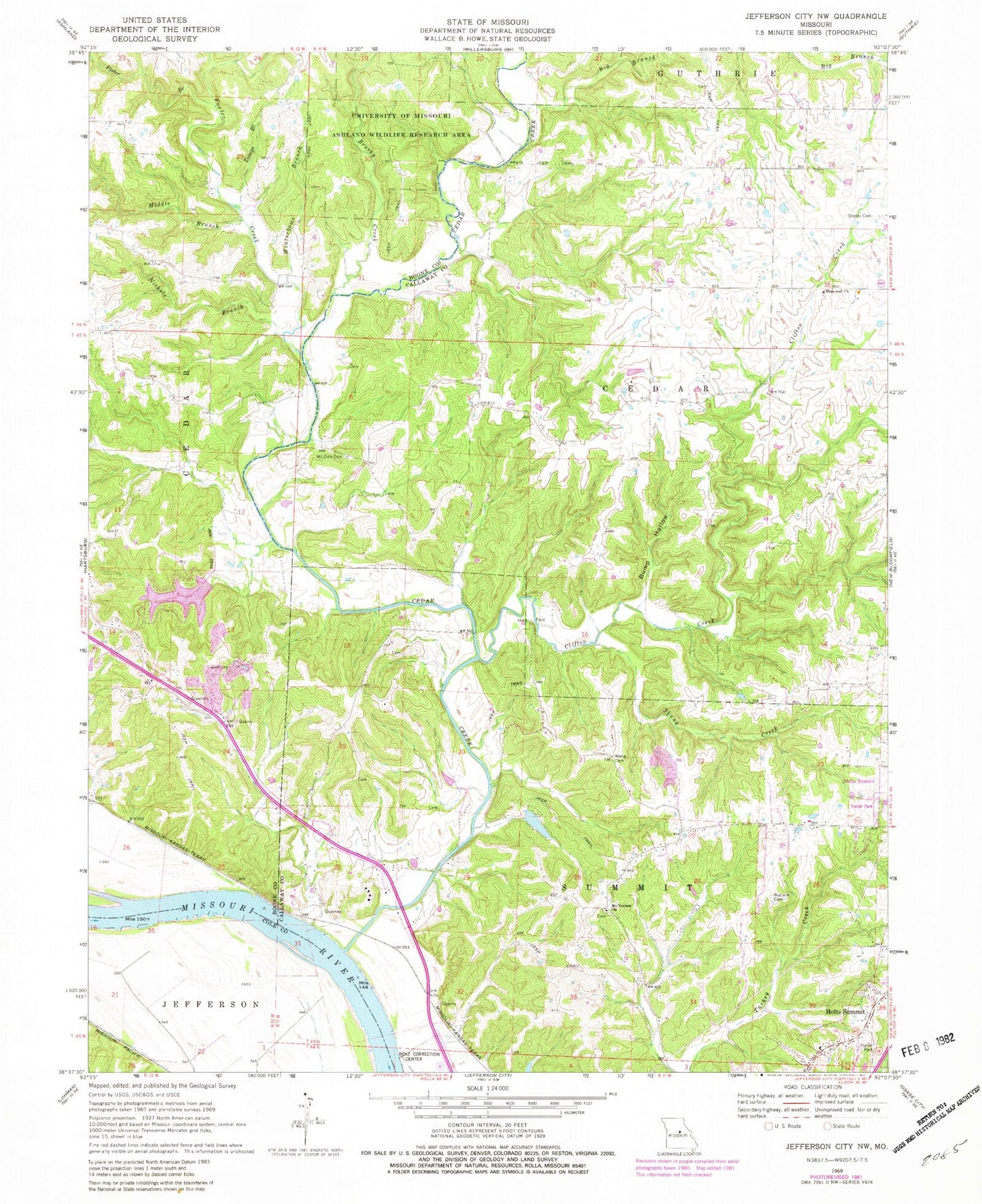
Historical USGS topographic quad map of Jefferson City NW in the state of Missouri. Map scale may vary for some years, but is generally around 1:24,000. Print size is approximately 24" x 27"
This quadrangle is in the following counties: Boone, Callaway, Cole.
The map contains contour lines, roads, rivers, towns, and lakes. Printed on high-quality waterproof paper with UV fade-resistant inks, and shipped rolled.
Contains the following named places: Audrain Prairies, Big Branch, Brushy Creek, Bump Hollow, Burnett School, Cedar Creek, Charlie Howard Lake, Claysville School, Clifton Creek, Conner Creek, Demarco Lake, Folsom, Foster Branch, Fowler Creek, Gravel School, Hall School, Hopewell Church, Howard Lake Dam, Lake Champetra, Lake Champetra Dam, Meng Cemetery, Middle Branch, Mount Vernon Cemetery, Mount Vernon Church, Mount Zion Cemetery, Nichols Branch, Nichols Creek, Oak Grove School, Sheley Cemetery, Skunk Creek, Sycamore School, Toneys Branch, Wallace Cemetery, West Sheely School, Winterbows Branch