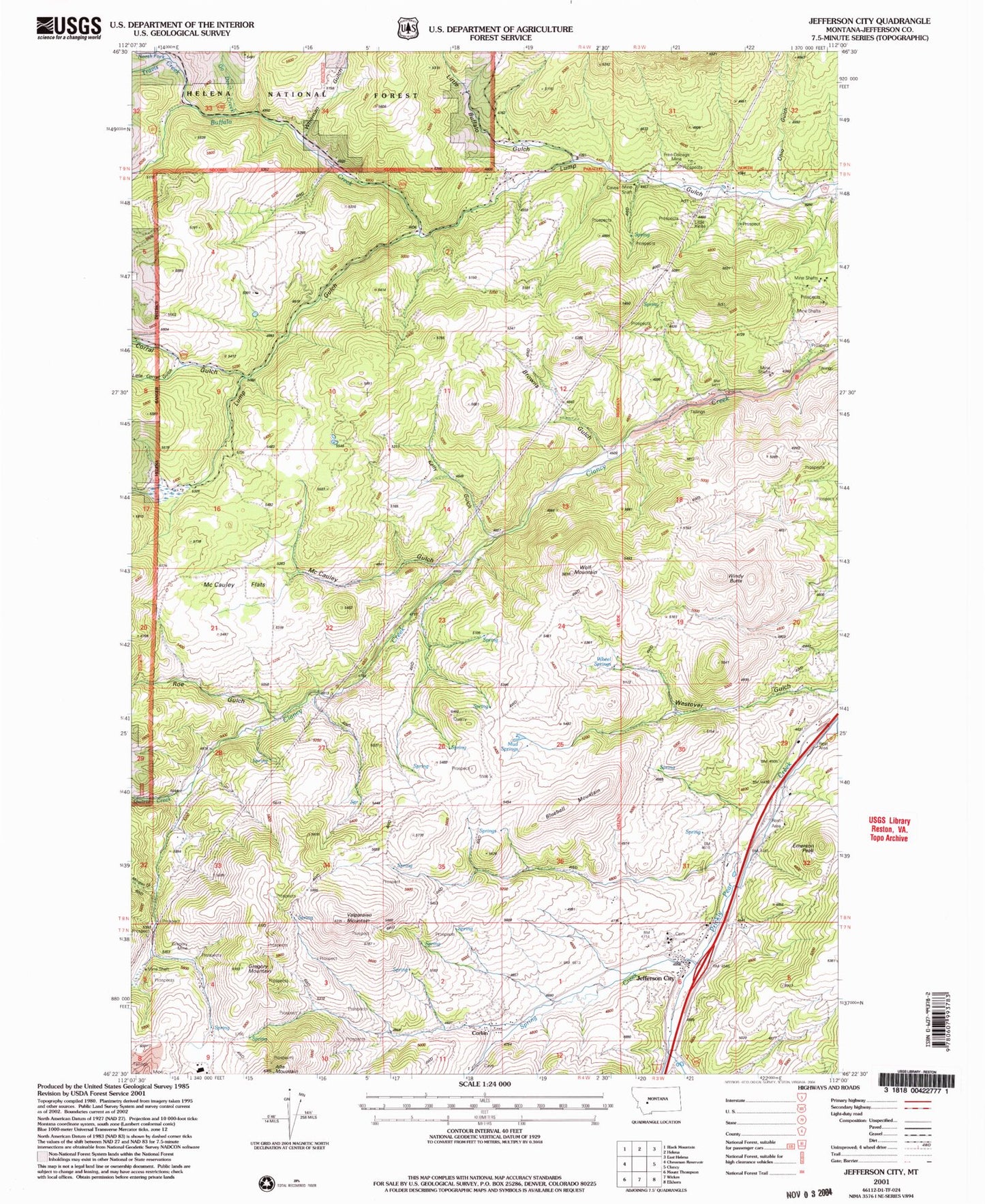
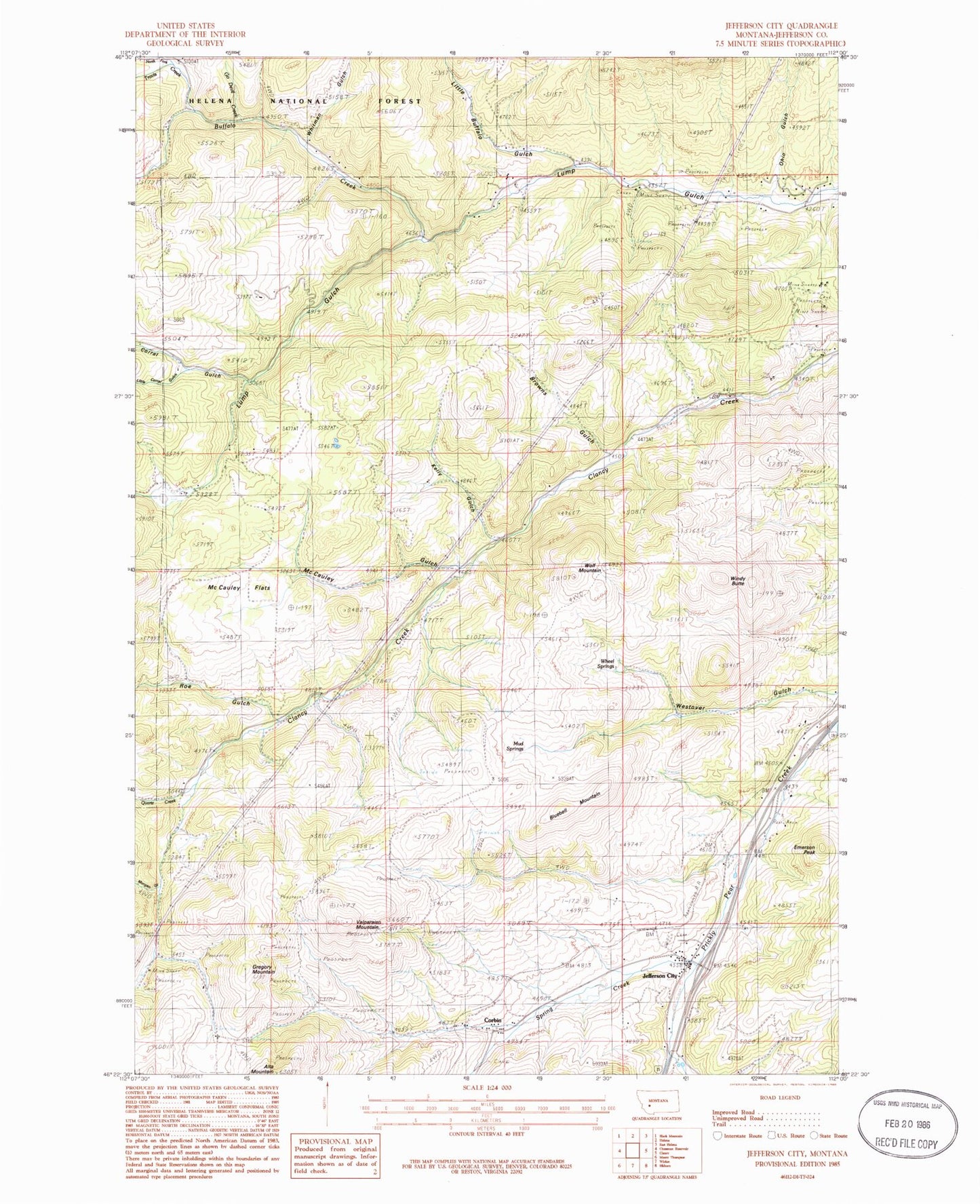
MyTopo
Classic USGS Jefferson City Montana 7.5'x7.5' Topo Map
Couldn't load pickup availability
Historical USGS topographic quad map of Jefferson City in the state of Montana. Map scale may vary for some years, but is generally around 1:24,000. Print size is approximately 24" x 27"
This quadrangle is in the following counties: Jefferson.
The map contains contour lines, roads, rivers, towns, and lakes. Printed on high-quality waterproof paper with UV fade-resistant inks, and shipped rolled.
Contains the following named places: 10N04W11DCAB01 Well, Alta Post Office, Beavertown Creek, Bertha Mine, Black Jack Mine, Blueball Mountain, Browns Gulch, Buffalo Creek, Clancy Census Designated Place, Concentrator, Corbin, Corbin Post Office, Corral Gulch, Emerson Peak, Free Coinage Mine, Freighters Historical Marker, Go Devil Creek, Gregory, Gregory Mine, Gregory Mountain, Gregory Post Office, Hartwell, Jefferson, Jefferson City, Jefferson City Census Designated Place, Jefferson City Fire Company, Jefferson City Post Office, Jefferson City Rest Area, Kelly Gulch, Little Buffalo Gulch, Little Corral Gulch, Little Nellie Mine, Longeway, McCauley Flats, McCauley Gulch, Minnesota Mine, Morgan Gulch, Mudd Springs, North Fork Travis Creek, O K Mine, Ohio Gulch, Quartz Creek, Rarus Mine, Roe Gulch, Roosevelt Mine, SE SE Section 6 Mine, Spring Creek, Superior/Jubilee Mine, SW SE Section 32 Mine, Travis Creek, Valparaiso Mountain, Wheel Springs, Whiteman Gulch, Windy Butte, Wolf Mountain