MyTopo
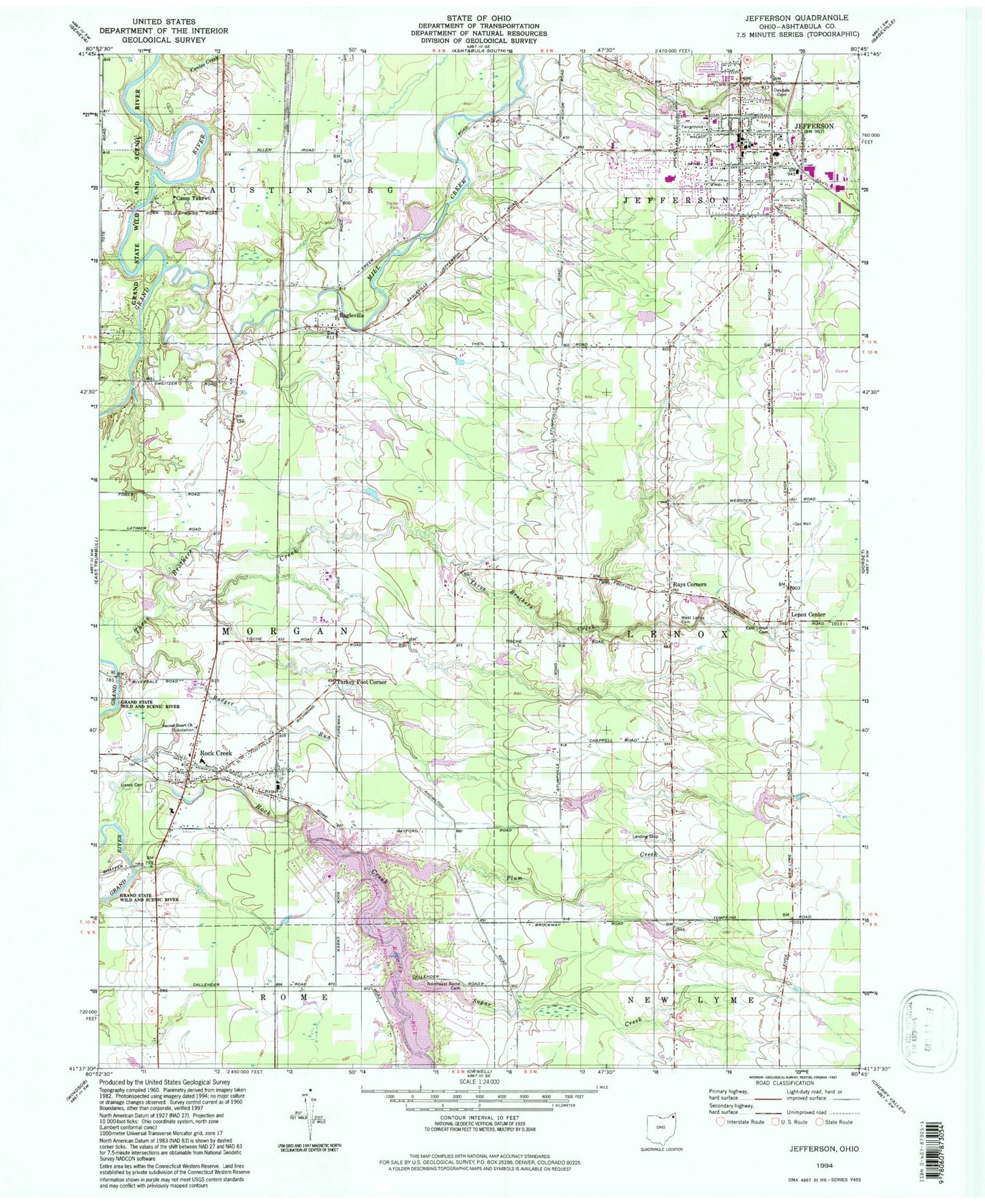
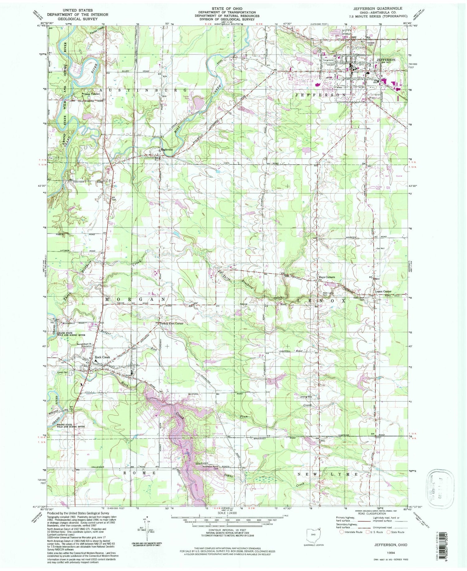
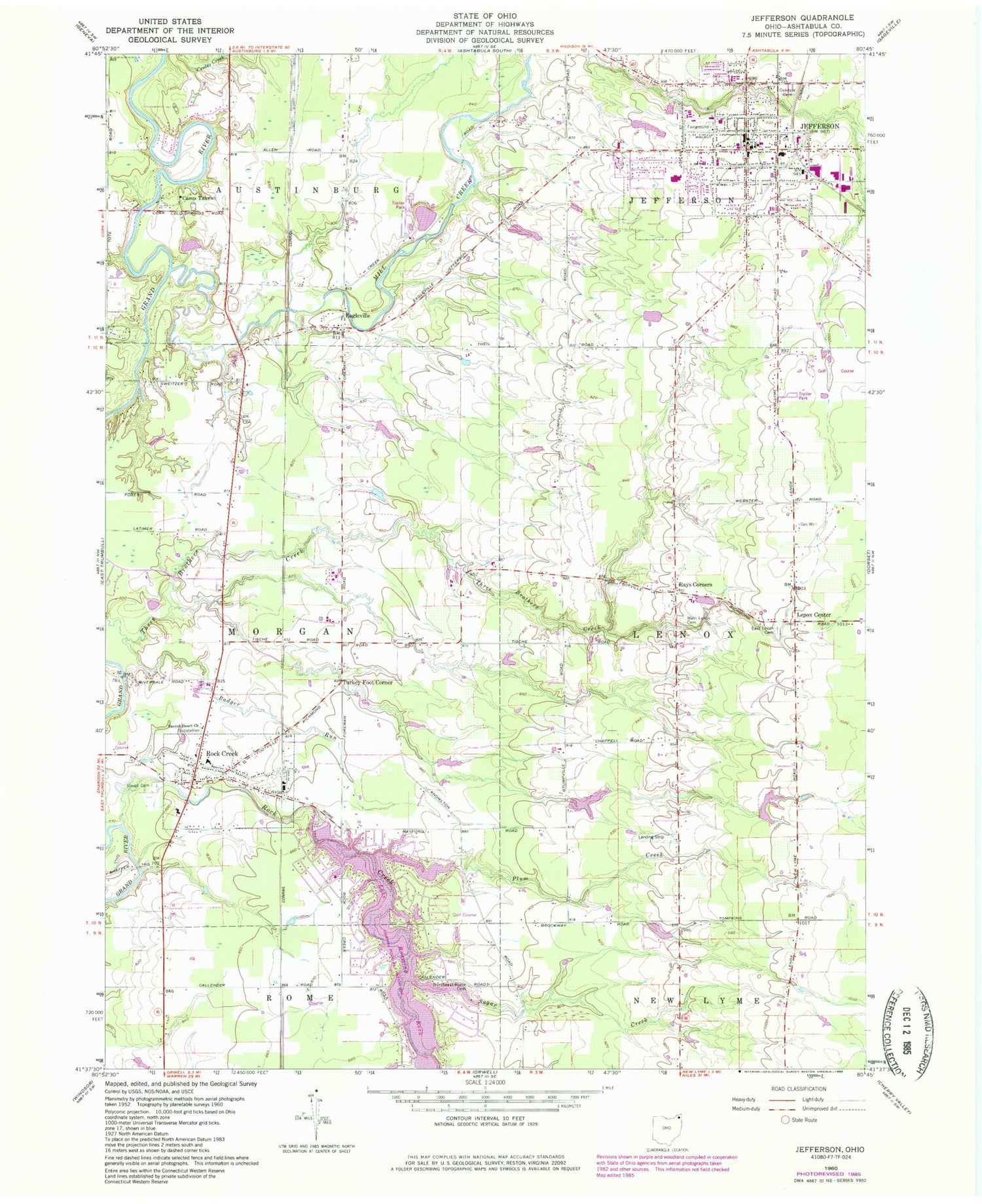
Classic USGS Jefferson Ohio 7.5'x7.5' Topo Map
Couldn't load pickup availability
Historical USGS topographic quad map of Jefferson in the state of Ohio. Typical map scale is 1:24,000, but may vary for certain years, if available. Print size: 24" x 27"
This quadrangle is in the following counties: Ashtabula.
The map contains contour lines, roads, rivers, towns, and lakes. Printed on high-quality waterproof paper with UV fade-resistant inks, and shipped rolled.
Contains the following named places: Camp Yakewi, Eagleville, East Lenox Cemetery, Jefferson, Northeast Rome Cemetery, Oakdale Cemetery, Plum Creek, Rays Corners, Rock Creek, Sugar Creek, Union Cemetery, West Lenox Cemetery, Jefferson Elementary School, Jefferson Area High School, Roaming Shores, Riverdale Bridge, Rock Creek Elementary School, Rock Creek, Turkey Foot Corner, Sacred Heart Church, Cold Springs, Badger Run, Mill Creek, Rock Creek Station (historical), Ashtabula County Courthouse, Agape Chapel, First Congregational Church, First Baptist Church, Jefferson Church of the Nazarene, Saint Joseph Catholic Church, Saint Pauls Lutheran Church, Lenox Center, Roaming Rock Shores Lake Dam, Roaming Rock Shores Lake, Skidmore Lake Dam, Skidmore Lake, Reuschling Pond Dam, Reuschling Pond, Kleinienst Lake Dam, Kleinienst Lake, WCVJ-FM (Jefferson), Lake Roaming Rock, Jefferson United Methodist Church, Ashtabula County Fairgrounds, Ashtabula County Jail, Henderson Memorial Public Library, Jefferson Post Office, Jefferson Town Hall, Trinity Episcopal Church, Township of Lenox, Township of Morgan, Village of Roaming Shores, Rock Creek Post Office, Saybrook Post Office (historical), Village of Jefferson, Village of Rock Creek, Hemlock Field, D F C Mobile Home Park, Witt's End Farm, Carousel Farm, Glenbeigh Specialty Hospital, Morgan Hose Company Volunteer Fire Department, Jefferson Fire Department, Jefferson Emergency Rescue District, Chippers Farms, L and R Farm, Millgate Farms, Smith Creek Farms, Schossler Dairy, Ashtabula County Sheriff's Office, Jefferson Police Department, Ames Theatre (historical)