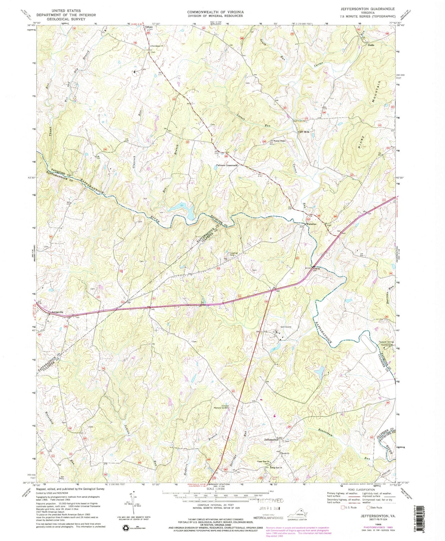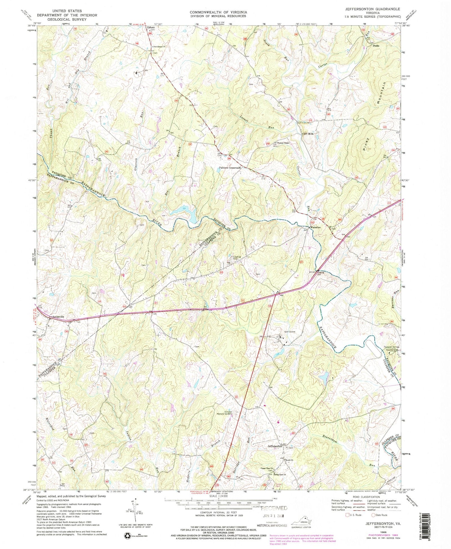
MyTopo
Classic USGS Jeffersonton Virginia 7.5'x7.5' Topo Map
Couldn't load pickup availability
Historical USGS topographic quad map of Jeffersonton in the state of Virginia. Map scale may vary for some years, but is generally around 1:24,000. Print size is approximately 24" x 27"
This quadrangle is in the following counties: Culpeper, Fauquier, Rappahannock.
The map contains contour lines, roads, rivers, towns, and lakes. Printed on high-quality waterproof paper with UV fade-resistant inks, and shipped rolled.
Contains the following named places: Amissville, Amissville Post Office, Beaverdam Run, Bee Branch, Black Hill, Carter Run, Carter Run Church, Cliff Mills, Corbin School, Countryside Estates, Deerfield Estates, Dudie, Erinbrook, Fauquier Springs Country Club, First Baptist Church, Fishback Run, Fox Acres Airport, Glascock Run, Glascock Run Dam, Harts Crossroads, Hillcrest Memory Gardens, Jeffersonton, Jeffersonton Baptist Church, Jeffersonton Post Office, Johnson Dam, Johnson Pond, Locust Run, Magee, Miller Lake, Mission Church, Old Conde, Orlean Methodist Episcopal Church, Palmers Crossroads, Piney Mountain, Piney Mountain School, Providence Church, Rising Zion Church, South Church, South Run, South Wales, South Wales Country Club Dam, South Wales Country Club Lake, South Wales Golf Course, Thumb Run, Upper Zion Church, Waterloo, Waterloo Bridge, Waterloo School, Wesley Chapel, Wet and Dry Branch