
MyTopo
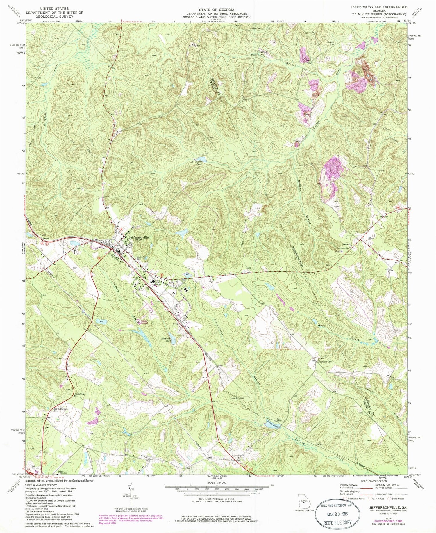
Classic USGS Jeffersonville Georgia 7.5'x7.5' Topo Map
Couldn't load pickup availability
Historical USGS topographic quad map of Jeffersonville in the state of Georgia. Map scale may vary for some years, but is generally around 1:24,000. Print size is approximately 24" x 27"
This quadrangle is in the following counties: Twiggs, Wilkinson.
The map contains contour lines, roads, rivers, towns, and lakes. Printed on high-quality waterproof paper with UV fade-resistant inks, and shipped rolled.
Contains the following named places: Ball Church, Big Branch, Central Georgia Technical College - Twiggs County Center, Church of God, City of Jeffersonville, Concord Cemetery, Faulk Lake East, Faulk Lake East Dam, Faulk Lake West, Faulk Lake West Dam, Faulks Chapel, Gallmore - Chapman Cemetery, Hamrick Lake, Hardy - Durham Cemetery, Higginsville Church, Hogan Lake, Hogan Lake Dam, Hughes Cemetery, Jeffersonville, Jeffersonville Cemetery, Jeffersonville Elementary School, Jeffersonville Fire Department, Jeffersonville Police Dept, Jeffersonville Post Office, Jeffersonville Volunteer Fire Department, King Cemetery, Mallory Branch, McCallum Pond, McCollum Cemetery, Nike Site R-28C, Nike Site R-28L, Pennywinkle Branch, Piney Grove Church, Prospect Church, Prospect School, Providence Church, Snows Pond, Snows Pond Dam, Twiggs County High School, Twiggs County Middle School, Twiggs County Sheriff's Office, Wall Cemetery, Wimberly Cemetery, Worsham Lake, Worsham Lake Dam, WPWB-FM (Byron)


