MyTopo
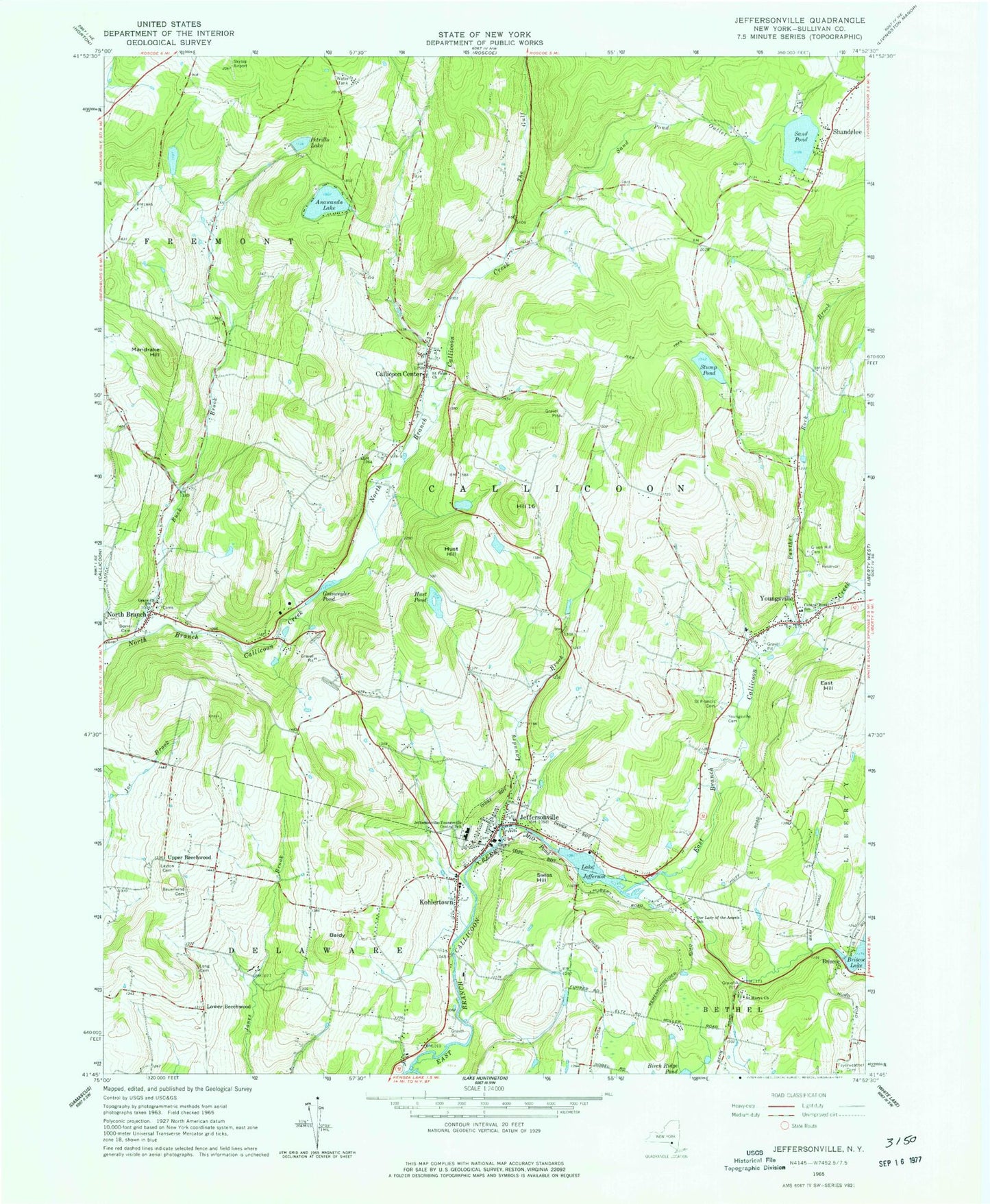
Classic USGS Jeffersonville New York 7.5'x7.5' Topo Map
Couldn't load pickup availability
Historical USGS topographic quad map of Jeffersonville in the state of New York. Typical map scale is 1:24,000, but may vary for certain years, if available. Print size: 24" x 27"
This quadrangle is in the following counties: Sullivan.
The map contains contour lines, roads, rivers, towns, and lakes. Printed on high-quality waterproof paper with UV fade-resistant inks, and shipped rolled.
Contains the following named places: Anawanda Lake, Baldy, Bauernfeind Cemetery, Briscoe, Buck Brook, Callicoon Center, Central Rural School, Dorrer - Inderlied Cemetery, East Hill, Fayerweather Cemetery, Gossweyler Pond, Grace Church, Green Hill Cemetery, Hill 16, Hust Hill, Hust Pond, Lake Jefferson, Jeffersonville, Jeffersonville-Youngsville Central School, Kohlertown, Laundry Brook, Layton Cemetery, Long Cemetery, Mandrake Hill, Mill Pond, North Branch, Our Lady of the Angels School, Panther Rock Brook, Petrillo Lake, Calvary Cemetery, Saint Marys Church, Saint Pauls Church, Sand Pond, Sand Pond Outlet, Stump Pond, Swiss Hill, The Gulf, Youngsville, Youngsville Cemetery, Lower Beechwood, Upper Beechwood, Town of Callicoon, Village of Jeffersonville, Apple Pond Farming Center, Silver Heights Farm, Bridle Hill Farm, Jeffersonville Wastewater Treatment Plant, Saint George's Church, First Lutheran Church, Jeffersonville Post Office, Jeffersonville Senior Living Center, Callicoon Town Hall, Sullivan West Elementary School, North Branch Volunteer Fire Department, Callicoon Center Fire Department, Jeffersonville Fire Department Protection Hose Company 1, Youngsville Volunteer Fire Department, Youngsville Post Office, Callicoon Center Post Office, Callicoon Center Cemetery