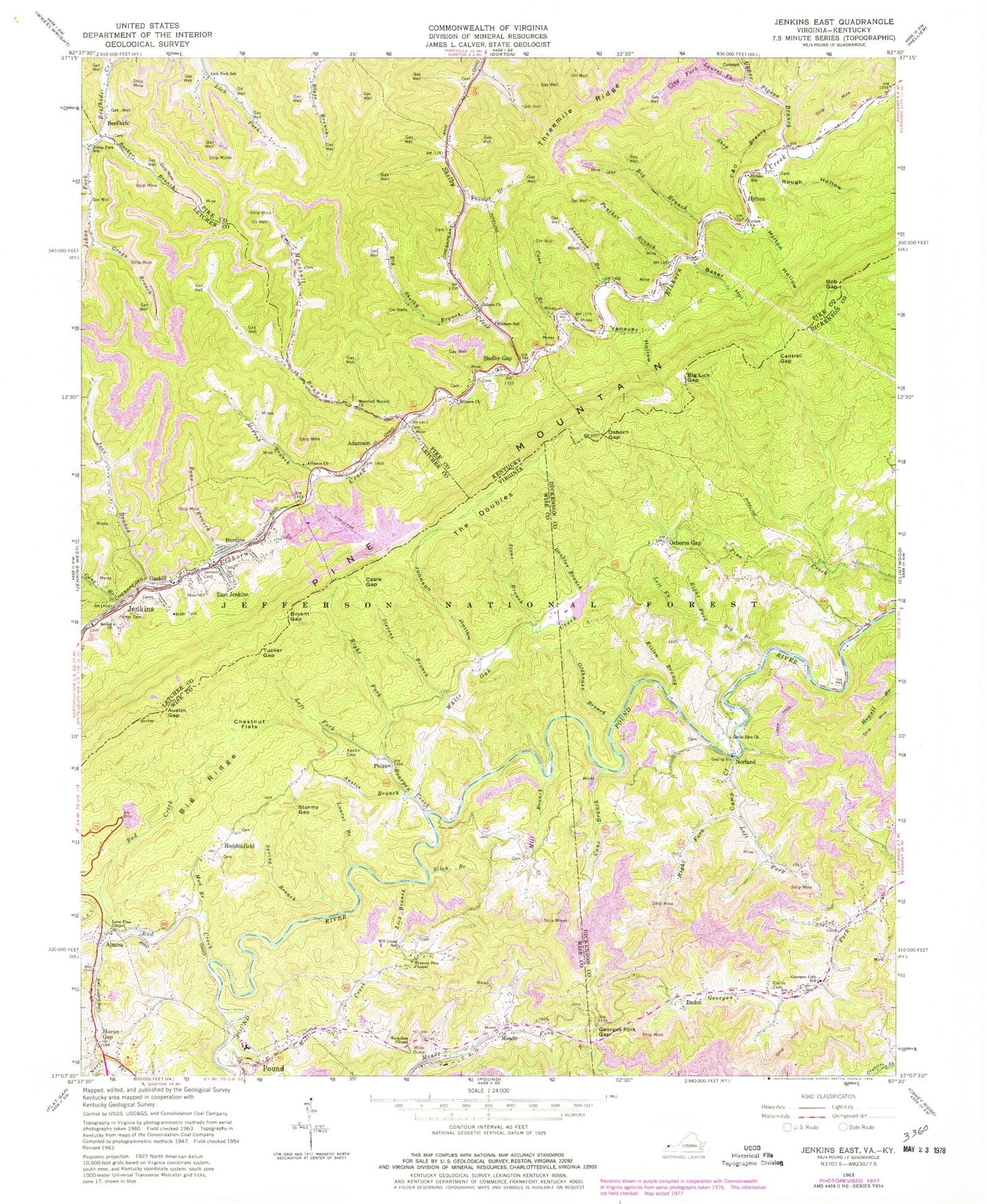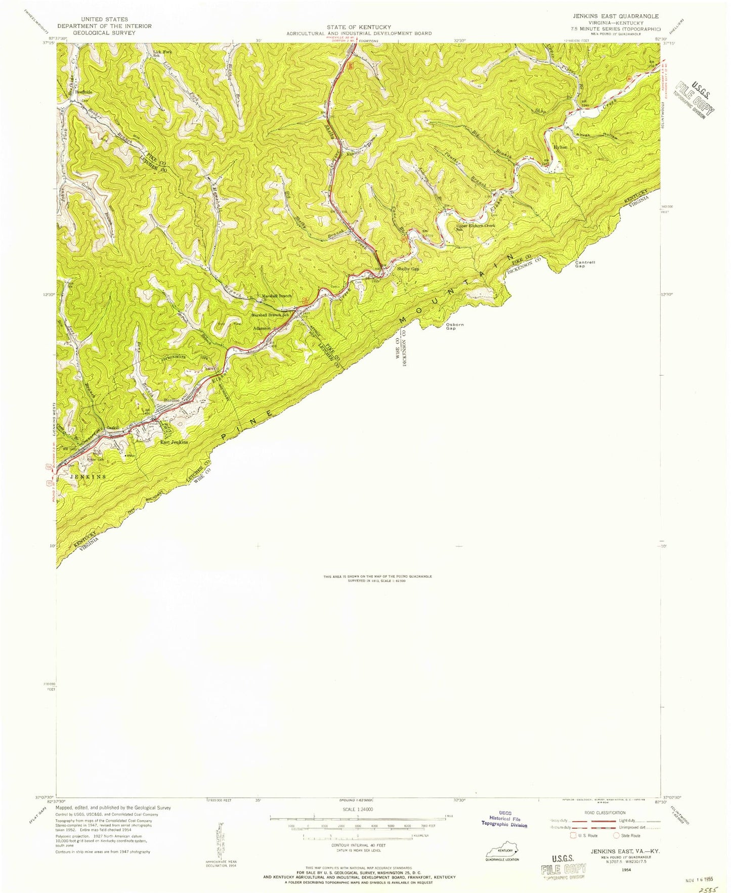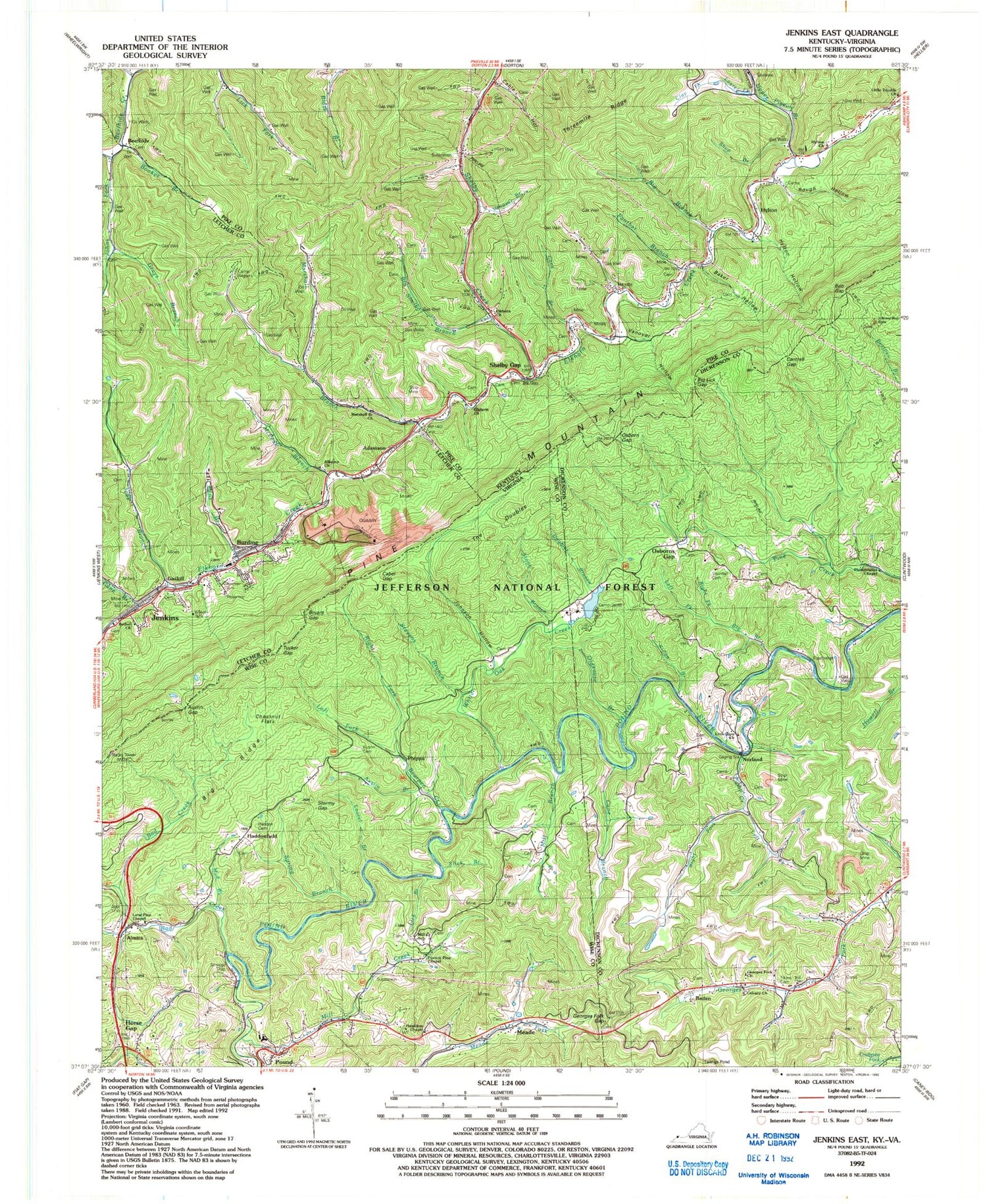
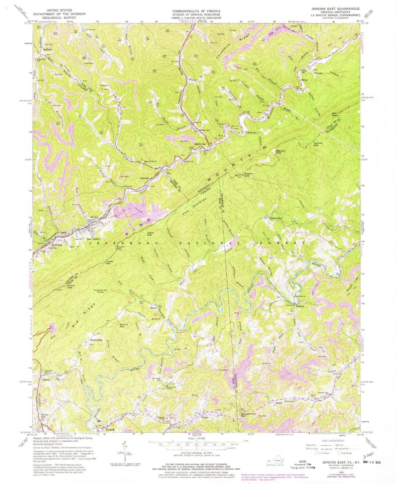

MyTopo
Classic USGS Jenkins East Kentucky 7.5'x7.5' Topo Map
Couldn't load pickup availability
Historical USGS topographic quad map of Jenkins East in the states of Kentucky, Virginia. Map scale may vary for some years, but is generally around 1:24,000. Print size is approximately 24" x 27"
This quadrangle is in the following counties: Dickenson, Letcher, Pike, Wise.
The map contains contour lines, roads, rivers, towns, and lakes. Printed on high-quality waterproof paper with UV fade-resistant inks, and shipped rolled.
Contains the following named places: Adamson, Alliance Church, Almira, Anderson Branch, Austin Branch, Austin Cemetery, Austin Gap, Austin School, Bad Creek, Baden, Baker Hollow, Bear Fork, Bearpen Creek, Bens Branch, Bethel Church, Big Branch, Big Lick Gap, Big Ridge, Big Shelby Branch, Bob Gap, Booker Branch, Bryant Gap, Burdine, Burdine Post Office, Cable Gap, Cable Hollow, Calvary Church, Camp Begomi, Camp Creek, Camp Creek School, Camp Jacob, Cane Branch, Cantrell Gap, Chestnut Flats, Clay Fork, Clintwood District, Cook Cemetery, Democracy Post Office, Doubles Branch, East Jenkins, East Jenkins Station, Elkhorn Church, Elkhorn School, Elkins Cemetery, Francis Pine Chapel, Gaskill, Georges Fork Church, Georges Fork Gap, Georges Fork School, Grays Branch, Haddon Cemetery, Haddonfield, Hamilton Chapel, Horse Gap, Hylton, Hylton Church, Hylton Hollow, Hylton School, Hyton Post Office, Jewell Post Office, Joes Branch, Johnny Bug Rock, Johns Fork, Johns Fork School, Johnson Hollow, Killen Branch, Laurel Branch, Laurel Fork, Left Fork Bearpen Creek, Left Fork Big Branch, Left Fork Camp Creek, Lick Branch, Lick Fork, Lick Fork School, Little Potter Branch, Little Trimble Church, Little Zion Church, Lone Pine Chapel, Marshal Branch School, Marshall Branch, Marshall Branch Church, McPeak Branch, Meade, Mill Branch, Mill Creek, Mill Creek School, Moss Number One Fresh Water Supply Dam, Mud Branch, Norland, Oldhouse Branch, Ore Knob Post Office, Osborn Gap, Osborn Gap School, Osborne Gap Church of Christ, Osborns Gap, Panther Branch, Pebelton Johnson Cemetery, Pevelton Johnson Cemetery, Philadelphia Chapel, Phipps, Pine Mountain, Pine Mountain Trail, Point Twenty Eight Bridge Railroad Stop, Potter Cemetery, Pound High School, Right Fork Bearpen Creek, Right Fork Big Branch, Right Fork Camp Creek, Rough Hollow, Shelby Gap, Shelby Gap Post Office, Shelby Gap Railroad Station, Shop Branch, Slick Branch, Spring Branch, Stevens Branch, Stone Branch, Stormy Gap, Stormy Gap School, Swindall Cemetery, The Doubles, Town of Pound, Tucker Gap, Upper Elkhorn Creek School, Upper Pigeon Branch, Vanover Branch, Vanover Cemetery, Vanover Hollow, White Oak Creek, White Oak Creek Dam, ZIP Codes: 41517, 41537, 41563