MyTopo
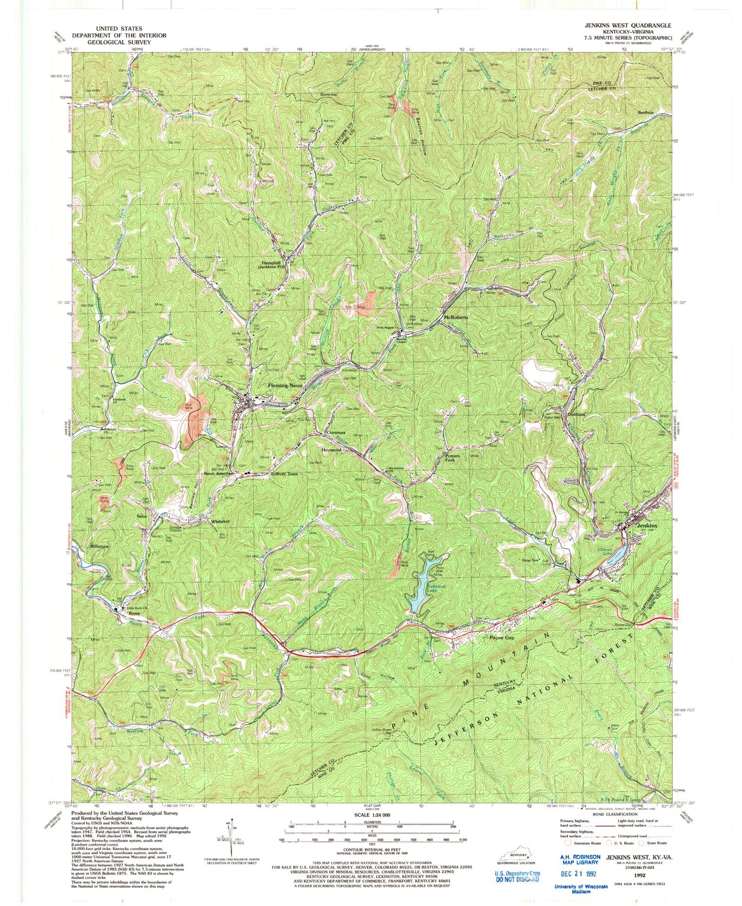
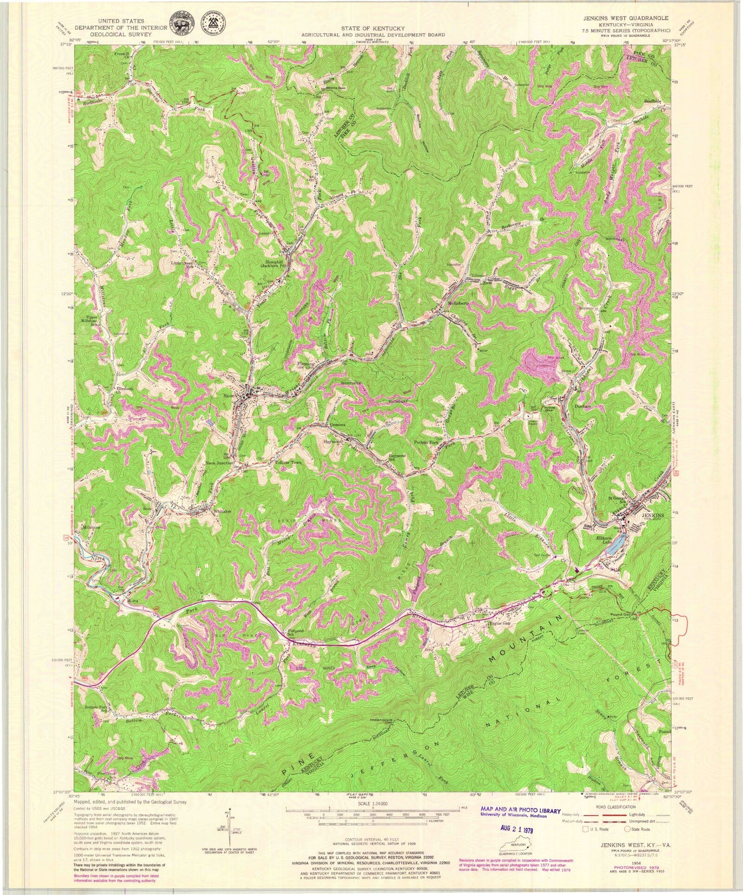
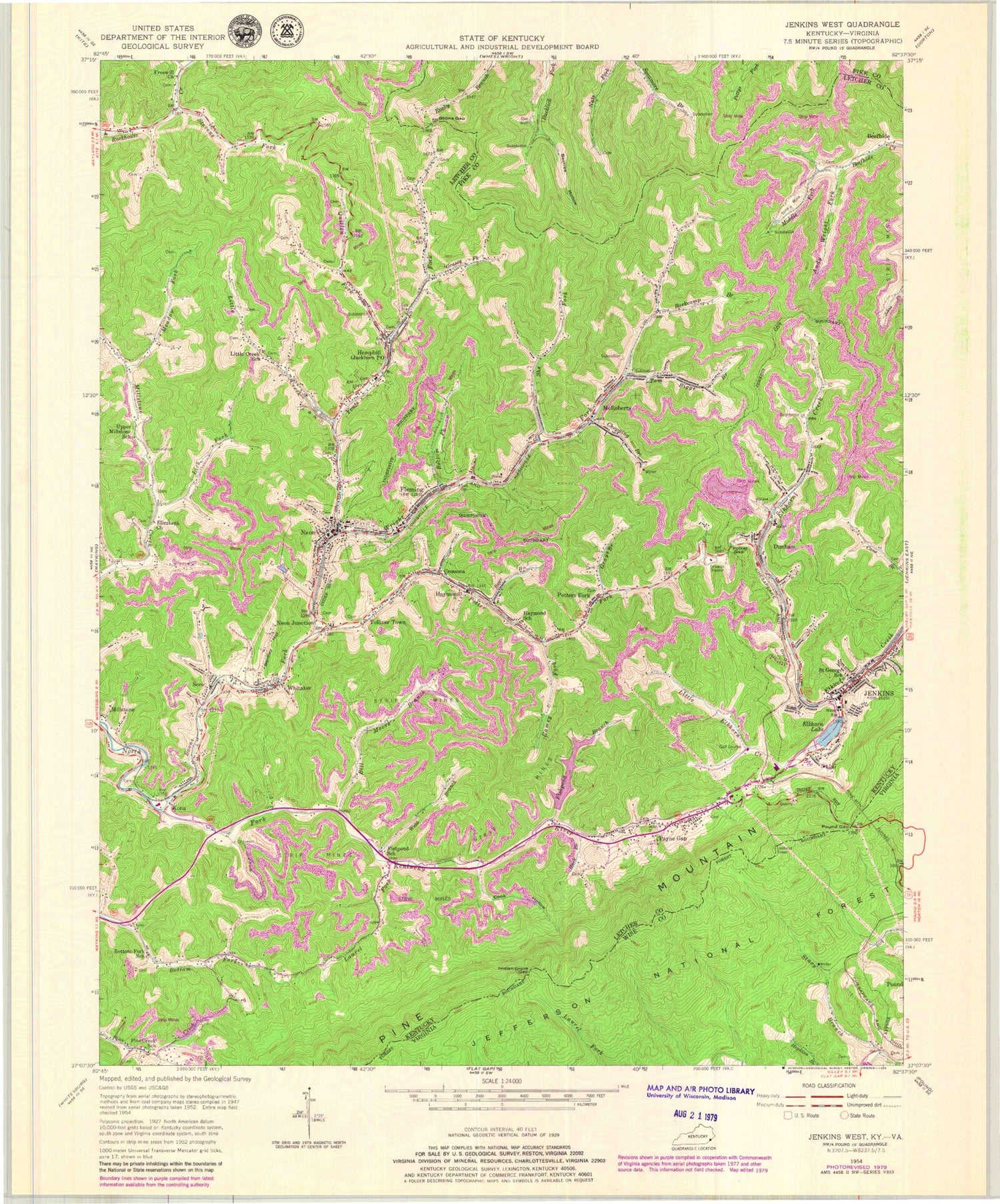
Classic USGS Jenkins West Kentucky 7.5'x7.5' Topo Map
Couldn't load pickup availability
Historical USGS topographic quad map of Jenkins West in the states of Kentucky, Virginia. Map scale may vary for some years, but is generally around 1:24,000. Print size is approximately 24" x 27"
This quadrangle is in the following counties: Letcher, Pike, Wise.
The map contains contour lines, roads, rivers, towns, and lakes. Printed on high-quality waterproof paper with UV fade-resistant inks, and shipped rolled.
Contains the following named places: Baker Post Office, Bandmill Bottom, Bandmill Hill, Barkcamp Branch, Barlow Branch, Bear Branch, Beefhide, Beefhide Post Office, Beetree Hollow, Bentley Hollow, Bentley Post Office, Bill Moore Branch, Bilvia Post Office, Boone Fork, Boone Gap, Boone Mountain, Bottom Fork, Bottom Fork School, Buck Branch, Chip Post Office, Chopping Branch, City of Fleming-Neon, City of Jenkins, Cook Hollow, Craftsville Post Office, Cromona, Cromona Post Office, Cumming Post Office, Dunham, Dunham Post Office, Elizabeth Church, Elkhorn Lake, Fishpond Branch, Fishpond Lake, Fishpond Post Office, Fishpond School, Fleming, Fleming - Neon Police Department, Fleming Post Office, Fleming-Neon, Freewill Church, Gamblers Rock, Grassy Fork, Grays Branch, Haymond, Haymond School, Hemphill, Holy Angels Catholic Church, Horn Post Office, Indian Grave Gap, Jackhorn Post Office, Jenkins, Jenkins Community Hospital, Jenkins Division, Jenkins Fire Department, Jenkins Historical Marker, Jenkins Police Department, Jenkins Post Office, Joel Branch, Kona, Kona Post Office, Kona Railroad Station, Laurel Fork, Lick Fork, Lieutenant Darwin K Kyle Historical Marker, Lima Post Office, Little Creek, Little Creek School, Little Elkhorn Creek, Little Rock Baptist Church, Long Branch, Low Gap Hollow, Mary Jane Potter School, McRoberts, McRoberts Cemetery, McRoberts Census Designated Place, McRoberts Post Office, McRoberts Railroad Station, Meadow Fork, Middle Fork Beefhide Creek, Millstone Baptist Church, Millstone Census Designated Place, Moores Chapel, Moss Post Office, Neon, Neon Junction, Neon Post Office, Neon Volunteer Fire Department, Payne Gap, Payne Gap Census Designated Place, Payne Gap Church, Payne Gap Post Office, Payne Gap School, Pine Creek School, Pine Mountain Lookout, Pine Mountain Tunnel, Potter Fork, Potter Gap, Potters Fork, Potters Fork Post Office, Potters Fork School, Pound Gap, Pound Gap Historical Marker, Quillen Fork, Ramey Fork, Rock Spring, Saint George School, Sam Bentley Cemetery, Seco, Seco Post Office, She Fork, Stacy Branch, Stevens Fork, Tolliver School, Tolliver Town, Tom Biggs Branch, Upper Millstone School, Vilas Post Office, WDXC-FM (Pound), Webb Branch, Whitaker, WNKY-AM (Neon), Wright Fork, Wright Post Office, Yonts Fork, ZIP Codes: 41810, 41825, 41835, 41840, 41849