MyTopo
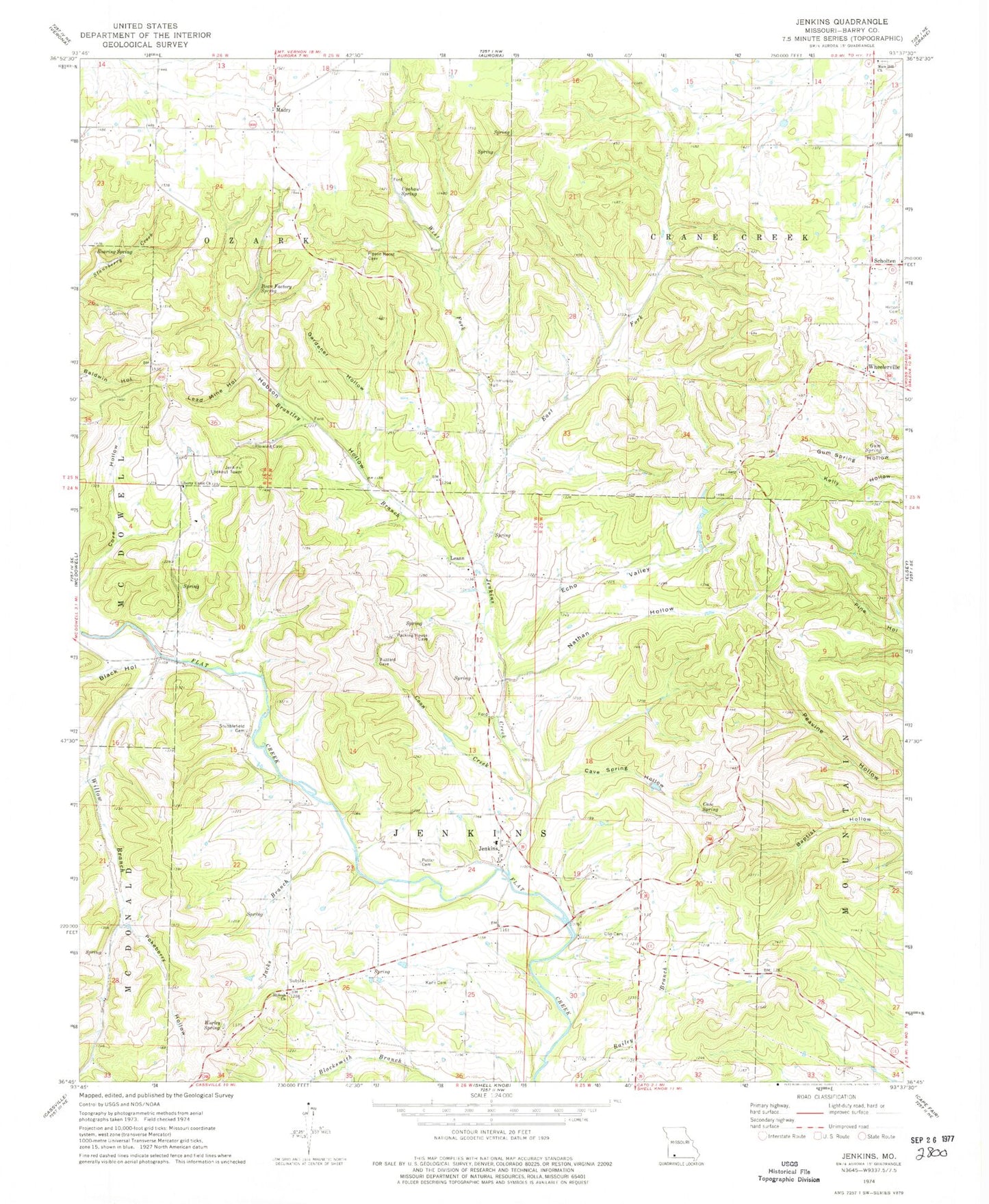
Classic USGS Jenkins Missouri 7.5'x7.5' Topo Map
Couldn't load pickup availability
Historical USGS topographic quad map of Jenkins in the state of Missouri. Map scale may vary for some years, but is generally around 1:24,000. Print size is approximately 24" x 27"
This quadrangle is in the following counties: Barry.
The map contains contour lines, roads, rivers, towns, and lakes. Printed on high-quality waterproof paper with UV fade-resistant inks, and shipped rolled.
Contains the following named places: Aurora Rural Fire Department Station 2, Bean Factory Spring, Black Hollow, Brantley Branch, Cave Spring, Cave Spring Hollow, Clay Hill School, Clio Cemetery, Clio School, Coon Creek, Core Hollow, Echo Valley, Gardener Hollow, Gum Spring, Hilton Cemetery, Hobson Hollow, Jacks Branch, Jenkins, Jenkins Creek, Jenkins Lookout Tower, Jenkins Rural Fire Department, Jenkins School, Kane Cemetery, Lead Mine Hollow, Leann, Leann Cemetery, Leann School, Liberty Union Church, Lone Elm School, Madry, Mars Hill Cemetery, Mars Hill Church, Nathan Hollow, Ozark School, Pokeberry Hollow, Potter Cemetery, Roaring Spring, Roark, Roark Hollow, Roark Post Office, Scholten, Scholten School, Shiloah Church, Stubblefield Cemetery, Township of Crane Creek, Township of Jenkins, Upshaw Spring, West Fork Jenkins Creek, Wheelerville, Willow Branch, Willow Branch School, Worley Spring, ZIP Code: 65605