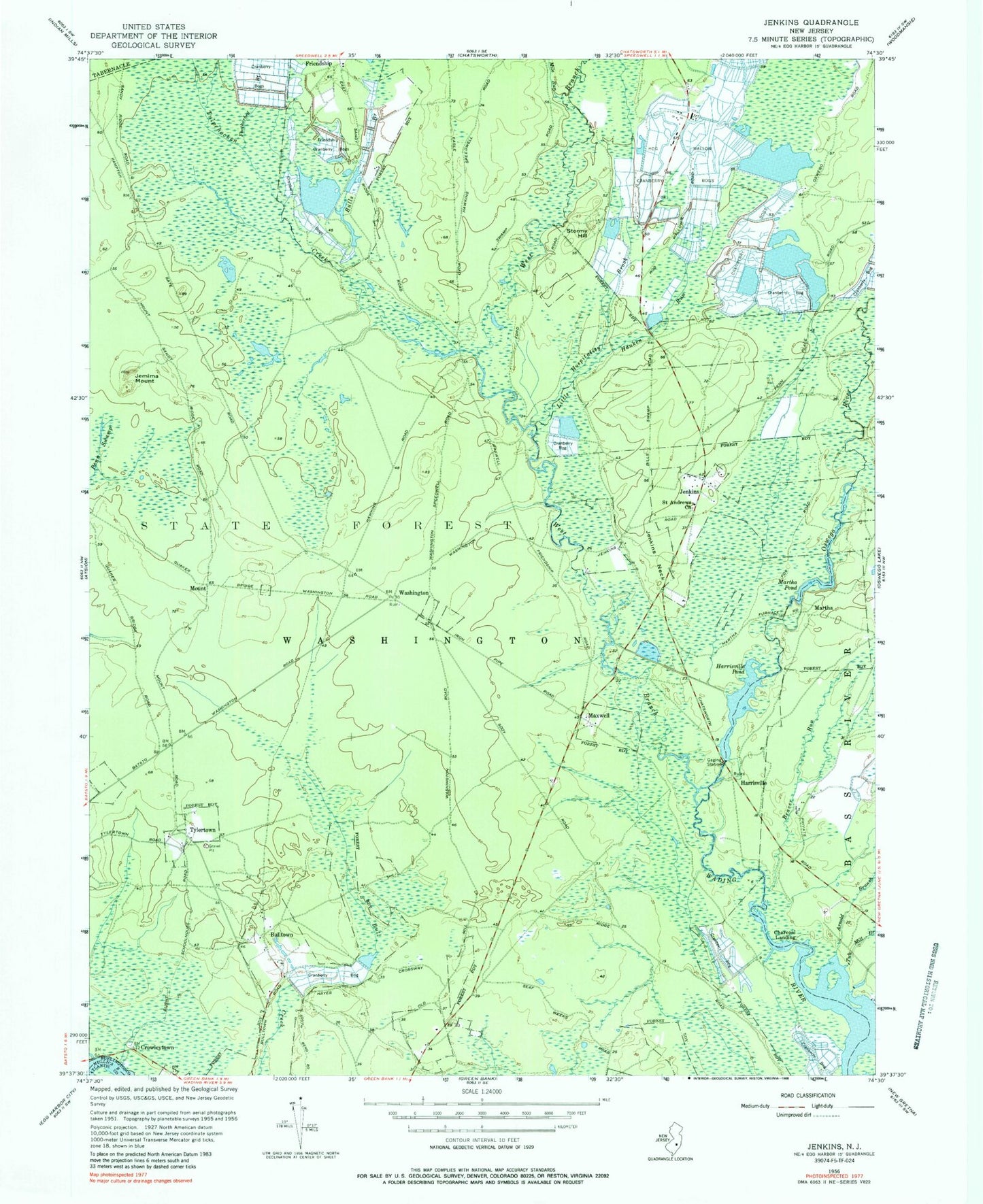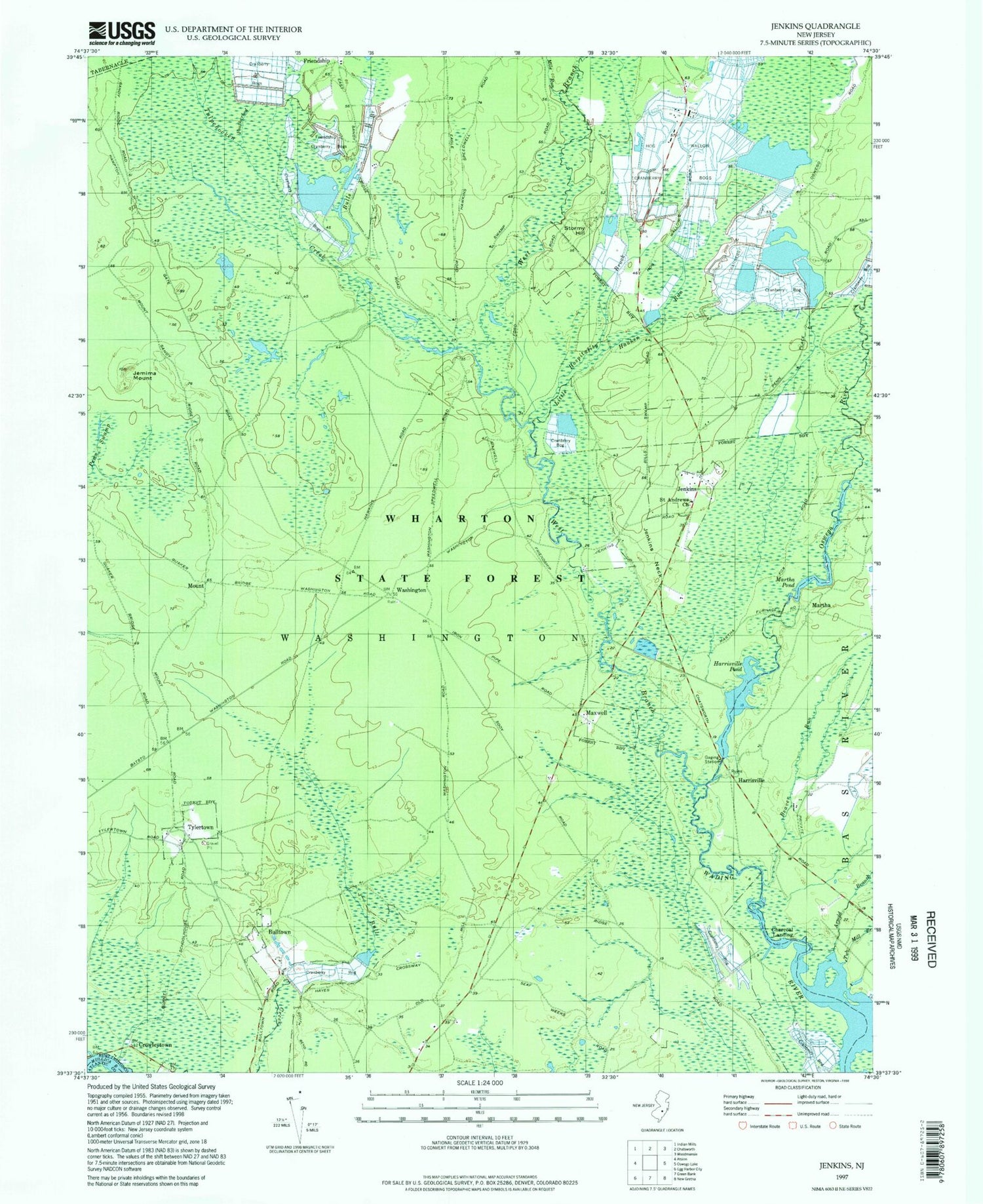

MyTopo
Classic USGS Jenkins New Jersey 7.5'x7.5' Topo Map
Couldn't load pickup availability
Historical USGS topographic quad map of Jenkins in the state of New Jersey. Typical map scale is 1:24,000, but may vary for certain years, if available. Print size: 24" x 27"
This quadrangle is in the following counties: Atlantic, Burlington.
The map contains contour lines, roads, rivers, towns, and lakes. Printed on high-quality waterproof paper with UV fade-resistant inks, and shipped rolled.
Contains the following named places: Arnold Branch, Beaver Branch, Beaver Run, Buck Run, Bulls Branch, Bulltown, Charcoal Landing, Crowleytown, Featherbed Branch, Friendship Cranberry Bogs, Harrisville, Harrisville Pond, Hog Wallow Cranberry Bogs, Hospitality Brook, Jemima Mount, Jenkins, Jenkins Neck, Little Hauken Run, Martha, Martha Pond, Maxwell, Mile Run, Mount, Oswego River, Jenkins Chapel, Stormy Hill, Tub Mill Branch, Tulpehocken Creek, Tylertown, Washington, West Branch Wading River, Township of Washington, Harrisville Dam