MyTopo
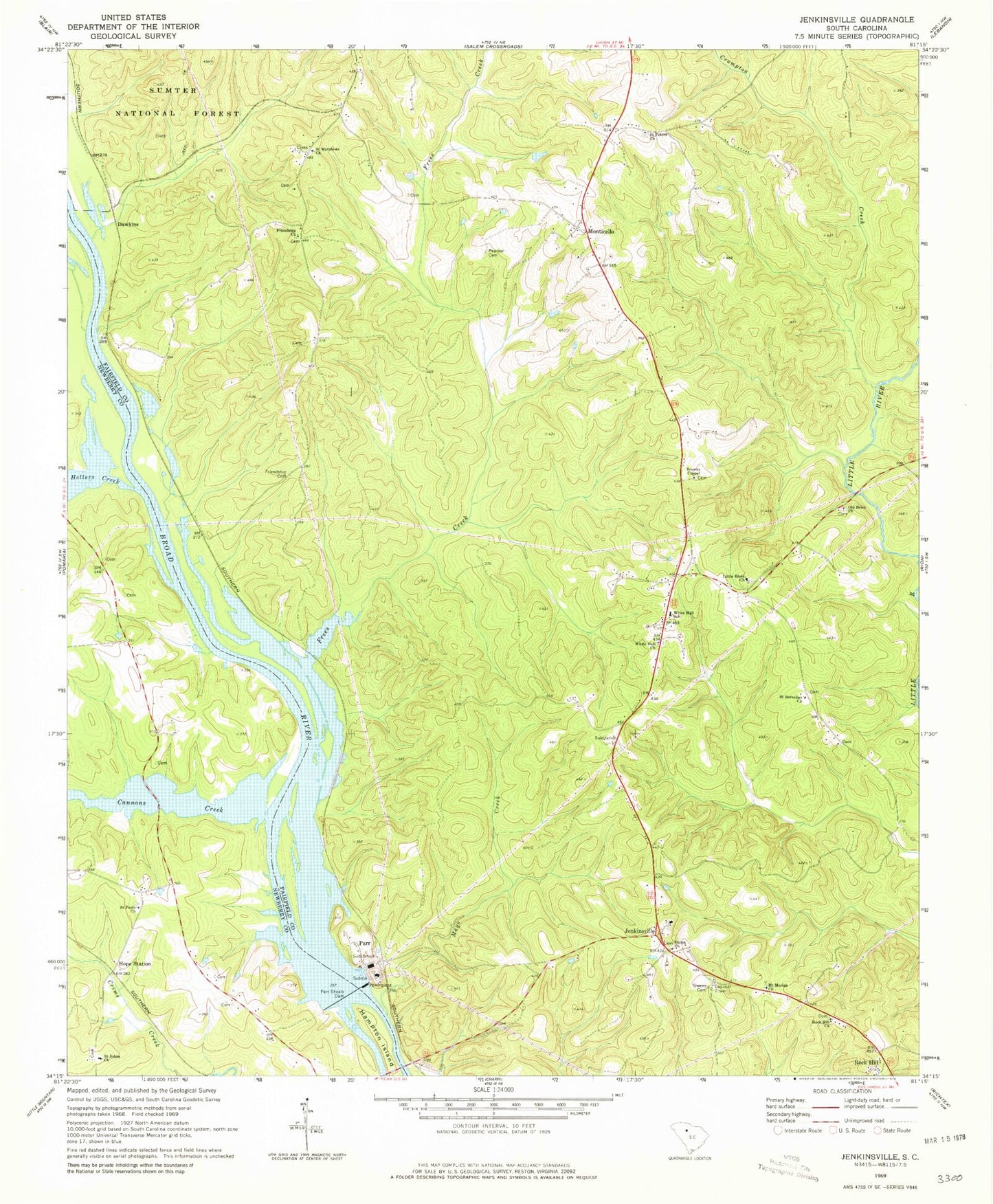
Classic USGS Jenkinsville South Carolina 7.5'x7.5' Topo Map
Couldn't load pickup availability
Historical USGS topographic quad map of Jenkinsville in the state of South Carolina. Map scale may vary for some years, but is generally around 1:24,000. Print size is approximately 24" x 27"
This quadrangle is in the following counties: Fairfield, Newberry.
The map contains contour lines, roads, rivers, towns, and lakes. Printed on high-quality waterproof paper with UV fade-resistant inks, and shipped rolled.
Contains the following named places: Brick Cemetery, Browns Chapel, Cannons Creek, Crumpton Creek, Dawkins, Dawkins Ferry, Fairfield County Fire Department Jenkinsville, Frees Creek, Friendship Cemetery, Friendship Church, Gibson Meeting House, Hampton Island, Hellers Creek, Holiness Church, Hope School, Hope Station, Hugheys Ferry, Jenkinsville, Little River Cemetery, Little River Church, Mathis School, Mayo Creek, Monticello, Monticello Cemetery, Monticello Methodist Church, Monticello Reservoir, Mount Moriah Church, Old Brick Church, Owens Cemetery, Parr, Parr Shoals Dam, Parr Shoals Power Plant, Pearson Cemetery, Pearsons Island, Powells Shoal, Rock Hill, Rock Hill Church, Rock Hill School, Ruffs Ferry, Saint Barnabas Church, Saint Barnabas School, Saint Holiness School, Saint Johns Cemetery, Saint Johns Lutheran Church, Saint Johns School, Saint Matthews Church, Saint Pauls Church, Saint Peters Church, Saint Peters School, Shiloh Cemetery, Shiloh Church, Somers Mill, Sueville, Summers Station Heliport, Town of Jenkinsville, White Hall Church, White Hall School, Wilkinsons Creek, ZIP Code: 29065