MyTopo
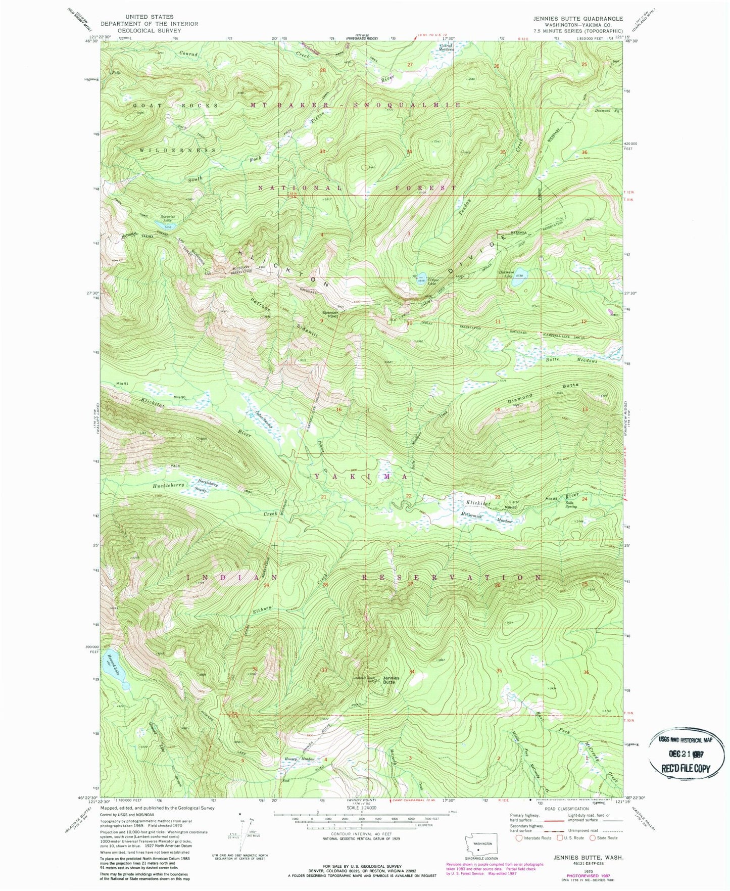
Classic USGS Jennies Butte Washington 7.5'x7.5' Topo Map
Couldn't load pickup availability
Historical USGS topographic quad map of Jennies Butte in the state of Washington. Map scale may vary for some years, but is generally around 1:24,000. Print size is approximately 24" x 27"
This quadrangle is in the following counties: Yakima.
The map contains contour lines, roads, rivers, towns, and lakes. Printed on high-quality waterproof paper with UV fade-resistant inks, and shipped rolled.
Contains the following named places: Butte Meadows, Butte Meadows Creek, Cedar Swamp, Cirque Lake, Conrad Creek, Diamond Butte, Diamond Lake, Elkhorn Creek, Howard Lake, Huckleberry Creek, Huckleberry Swamp, Hussey Meadow, Jennies Butte, McCormick Meadow, Petross Creek, Petross Sidehill, Soda Spring, Spencer Point, Surprise Lake, Tenday Creek