MyTopo
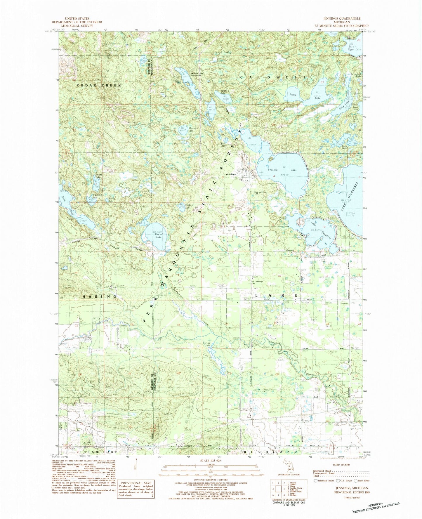
Classic USGS Jennings Michigan 7.5'x7.5' Topo Map
Couldn't load pickup availability
Historical USGS topographic quad map of Jennings in the state of Michigan. Map scale may vary for some years, but is generally around 1:24,000. Print size is approximately 24" x 27"
This quadrangle is in the following counties: Missaukee, Wexford.
The map contains contour lines, roads, rivers, towns, and lakes. Printed on high-quality waterproof paper with UV fade-resistant inks, and shipped rolled.
Contains the following named places: Bullhead Lake, Clear Lake, Crooked Lake, Crooked Lake Park, Dyer Lake, Emmanuel Lutheran Church, Gunnerson Creek, Island Lake, Jennings, Jennings Census Designated Place, Jennings Post Office, Lake Julia, Lake Sapphire, Lake Township Hall, Long Lake, Long Lake State Forest Campground, Mud Lake, New Jennings Cemetery, Old Jennings Cemetery, Reddy Lake, Round Lake, Round Lake Post Office, Shallow Lake, Sheriden Lake, Spring Lake, Township of Lake, Twin Lake, Twin Lakes, Whitlock Lake, Whitlock Lake Campground