MyTopo
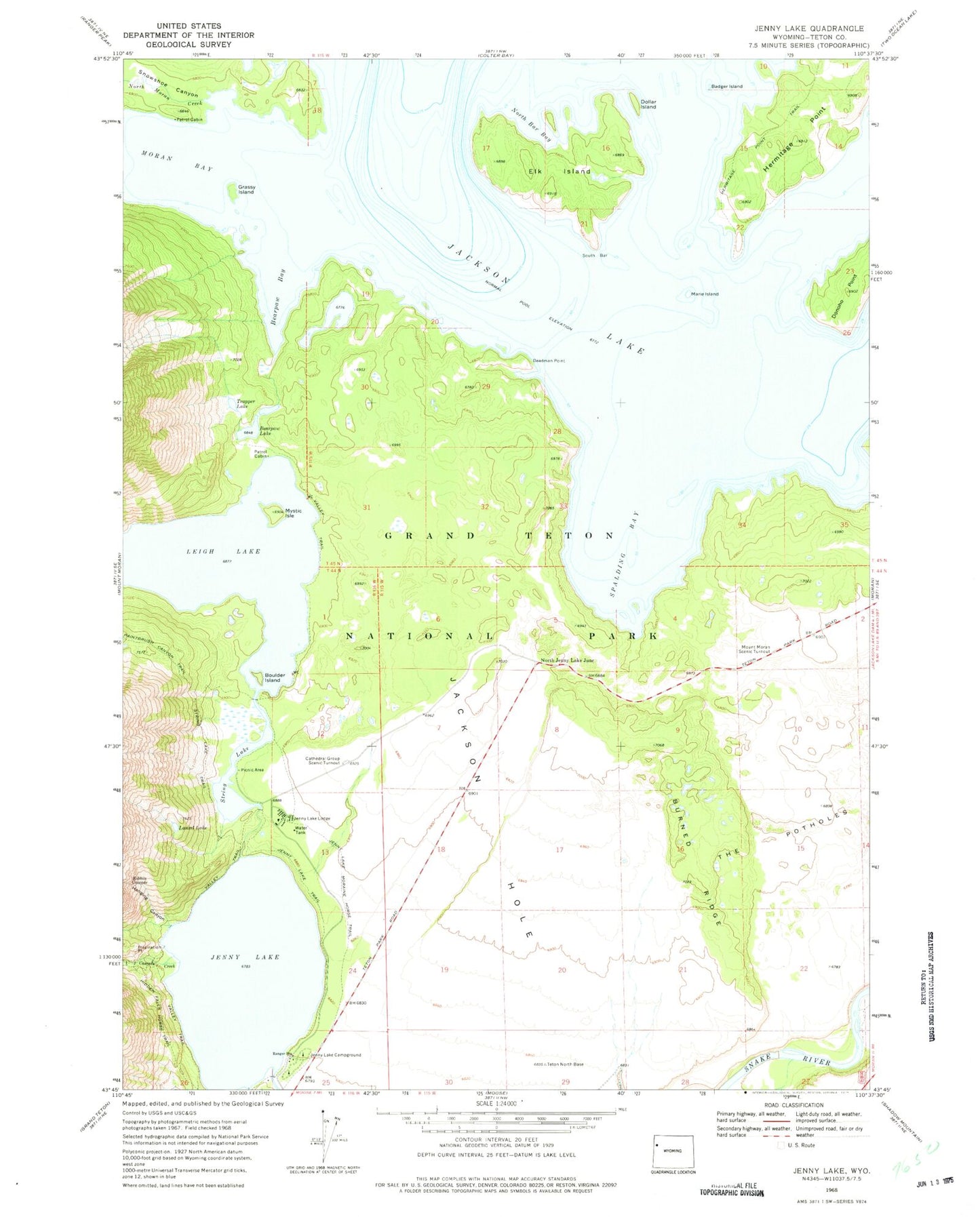
Classic USGS Jenny Lake Wyoming 7.5'x7.5' Topo Map
Couldn't load pickup availability
Historical USGS topographic quad map of Jenny Lake in the state of Wyoming. Typical map scale is 1:24,000, but may vary for certain years, if available. Print size: 24" x 27"
This quadrangle is in the following counties: Teton.
The map contains contour lines, roads, rivers, towns, and lakes. Printed on high-quality waterproof paper with UV fade-resistant inks, and shipped rolled.
Contains the following named places: Badger Island, Bearpaw Bay, Bearpaw Lake, Boulder Island, Cathedral Group Scenic Turnout, Deadman Point, Dollar Island, Elk Island, Grassy Island, Hidden Falls Horse Trail, Inspiration Point, Jenny Lake, Jenny Lake Campground, Jenny Lake Lodge, Jenny Lake Moraine Horse Trail, Jenny Lake Trail, Laurel Lake, Marie Island, Mount Moran Scenic Turnout, Mystic Isle, North Bar Bay, Paintbrush Canyon Trail, Ribbon Cascade, South Bar, Spalding Bay, String Lake Trail, Trapper Lake, Hermitage Point, Burnt Ridge, North Jenny Lake Junction, Grand Teton National Park, Cascade Creek, Hanging Canyon, North Moran Creek, Donoho Point, Leigh Lake, Snowshoe Canyon, Moran Bay, String Lake, Jenny Lake Post Office (historical)