MyTopo
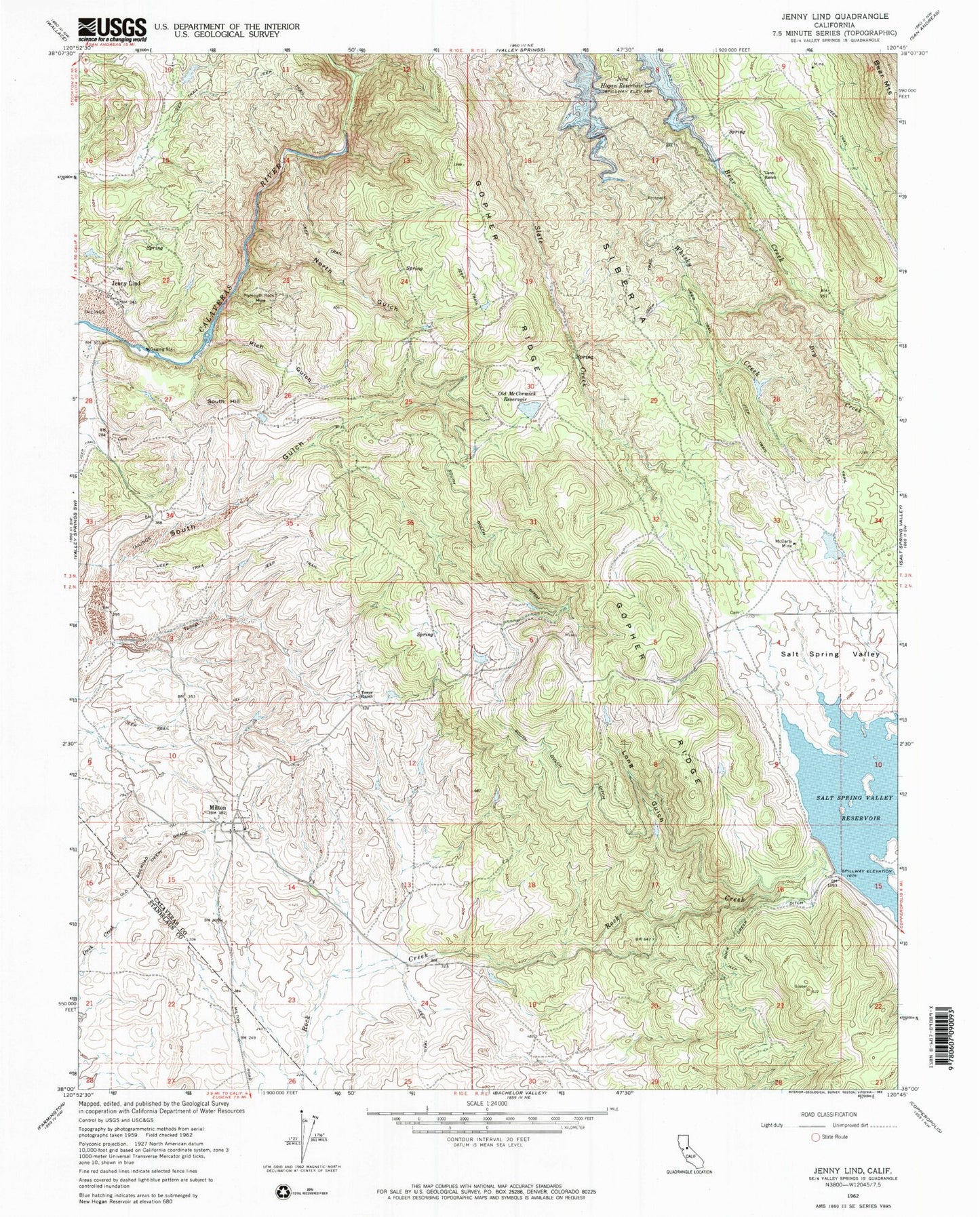
Classic USGS Jenny Lind California 7.5'x7.5' Topo Map
Couldn't load pickup availability
Historical USGS topographic quad map of Jenny Lind in the state of California. Map scale may vary for some years, but is generally around 1:24,000. Print size is approximately 24" x 27"
This quadrangle is in the following counties: Calaveras, Stanislaus.
The map contains contour lines, roads, rivers, towns, and lakes. Printed on high-quality waterproof paper with UV fade-resistant inks, and shipped rolled.
Contains the following named places: Dry Creek, Gann Ranch, Gopher Ridge, Jenny Lind, Jenny Lind Fire Protection District Station 3, Jenny Lind International Order of Odd Fellows Cemetery, Jenny Lind State Historic Landmark, Long Gulch, McCarty Mine, Milton, Milton Masonic Cemetery, North Gulch, Old McCormick Reservoir, Plymouth Rock Mine, Rancho Calaveras Census Designated Place, Rich Gulch, Rock Creek Ditch, Salt Spring Valley Reservoir, Salt Springs Valley 496 Dam, Scenic Valley Ranchos, Siberia, South Gulch Ditch, South Hill, Tower Ranch