MyTopo
Classic USGS Jensen Ridge Utah 7.5'x7.5' Topo Map
Regular price
$16.95
Regular price
Sale price
$16.95
Unit price
per
Couldn't load pickup availability
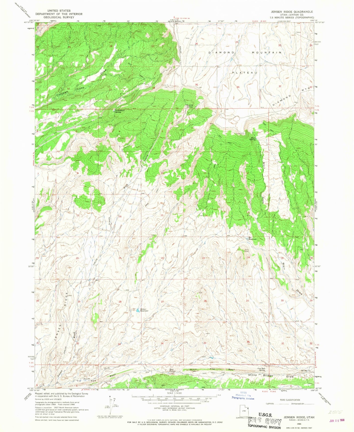
Historical USGS topographic quad map of Jensen Ridge in the state of Utah. Map scale may vary for some years, but is generally around 1:24,000. Print size is approximately 24" x 27"
This quadrangle is in the following counties: Uintah.
The map contains contour lines, roads, rivers, towns, and lakes. Printed on high-quality waterproof paper with UV fade-resistant inks, and shipped rolled.
Contains the following named places: Bear Wallow, Blair Spring, Bowrey Spring, Box Reservoir, Coal Bed Spring, Jensen Ridge, Shiner Reservoir, South Fork Jensen Wash, Switchback Spring, The Reef