MyTopo
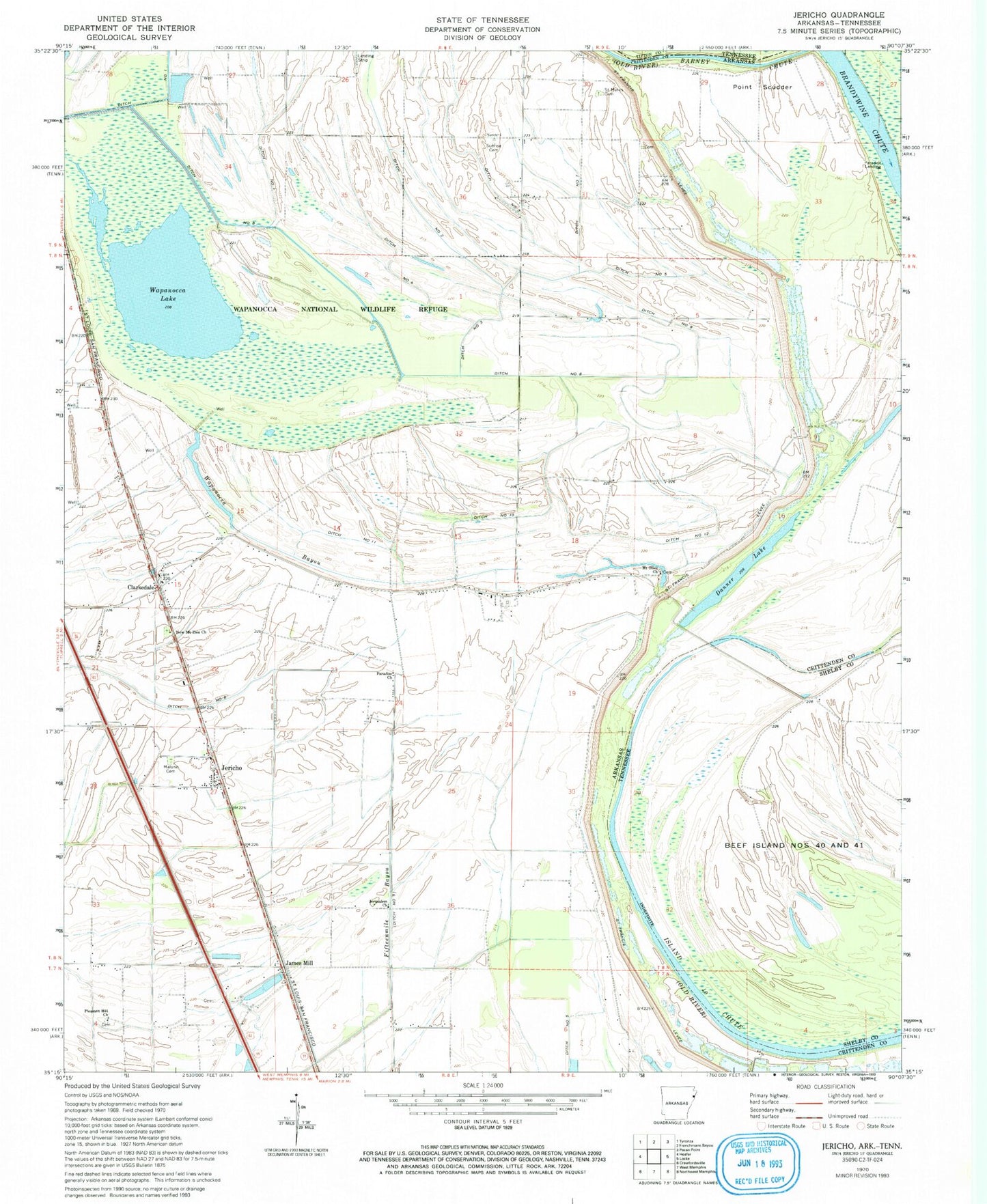
Classic USGS Jericho Arkansas 7.5'x7.5' Topo Map
Couldn't load pickup availability
Historical USGS topographic quad map of Jericho in the states of Arkansas, Tennessee. Map scale may vary for some years, but is generally around 1:24,000. Print size is approximately 24" x 27"
This quadrangle is in the following counties: Crittenden, Shelby, Tipton.
The map contains contour lines, roads, rivers, towns, and lakes. Printed on high-quality waterproof paper with UV fade-resistant inks, and shipped rolled.
Contains the following named places: Beef Island, Bledsoe Cemetery, Bradley Landing, City of Clarkedale, Clarkedale, Clarkedale Post Office, Clarkedale School, Danner Lake, Ditch Number 1, Ditch Number 10, Ditch Number 11, Ditch Number 12, Ditch Number 13, Ditch Number 2, Ditch Number 3, Ditch Number 4, Ditch Number 5, Ditch Number 7, Ditch Number 8, Ditch Number 9, Friendship Cemetery, Island Forty, Island Forty Church, Island Forty Chute, James Mill, Jericho, Jericho Fire Department, Jericho Police Department, Jerusalem Church, Jerusalem School, Lake Grove Church, Lincoln School, Malone Cemetery, Mount Olive Cemetery, Mount Olive Church, Mount Olive School, New Mount Zion Cemetery, New Mount Zion Church, Paradise Church, Paradise Landing, Pecan Ridge, Pleasant Hill Church, Point Scudder, Saint Mark Church, Saint Marks Cemetery, Salem Church, Scanlan, Sunrise Cemetery, Sunrise Church, Town of Jericho, Township of Brandywine, Wapanocca Bayou, Wapanocca Lake, Wapanocca National Wildlife Refuge, ZIP Code: 72325