MyTopo
Classic USGS Jericho Louisiana 7.5'x7.5' Topo Map
Couldn't load pickup availability
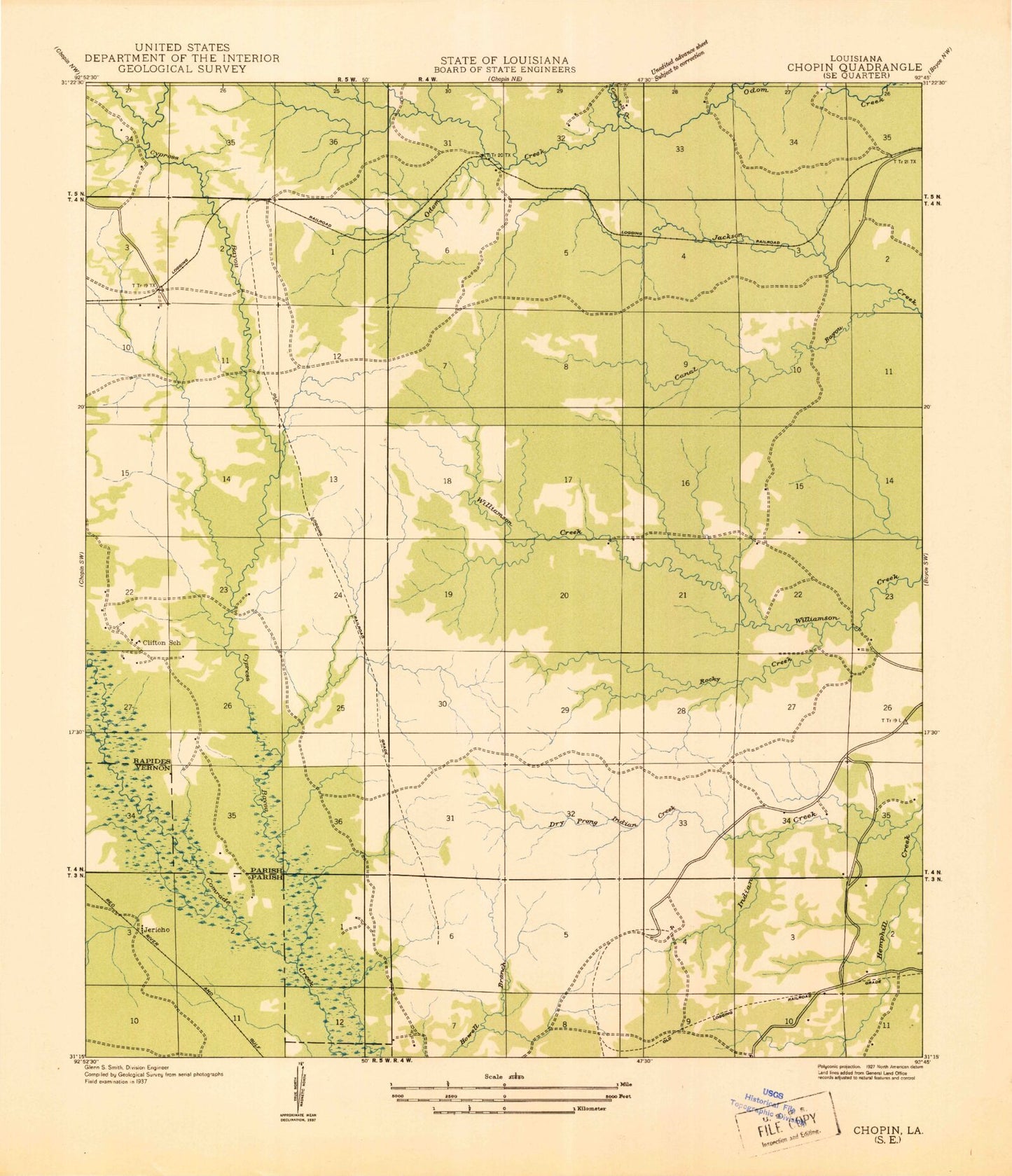
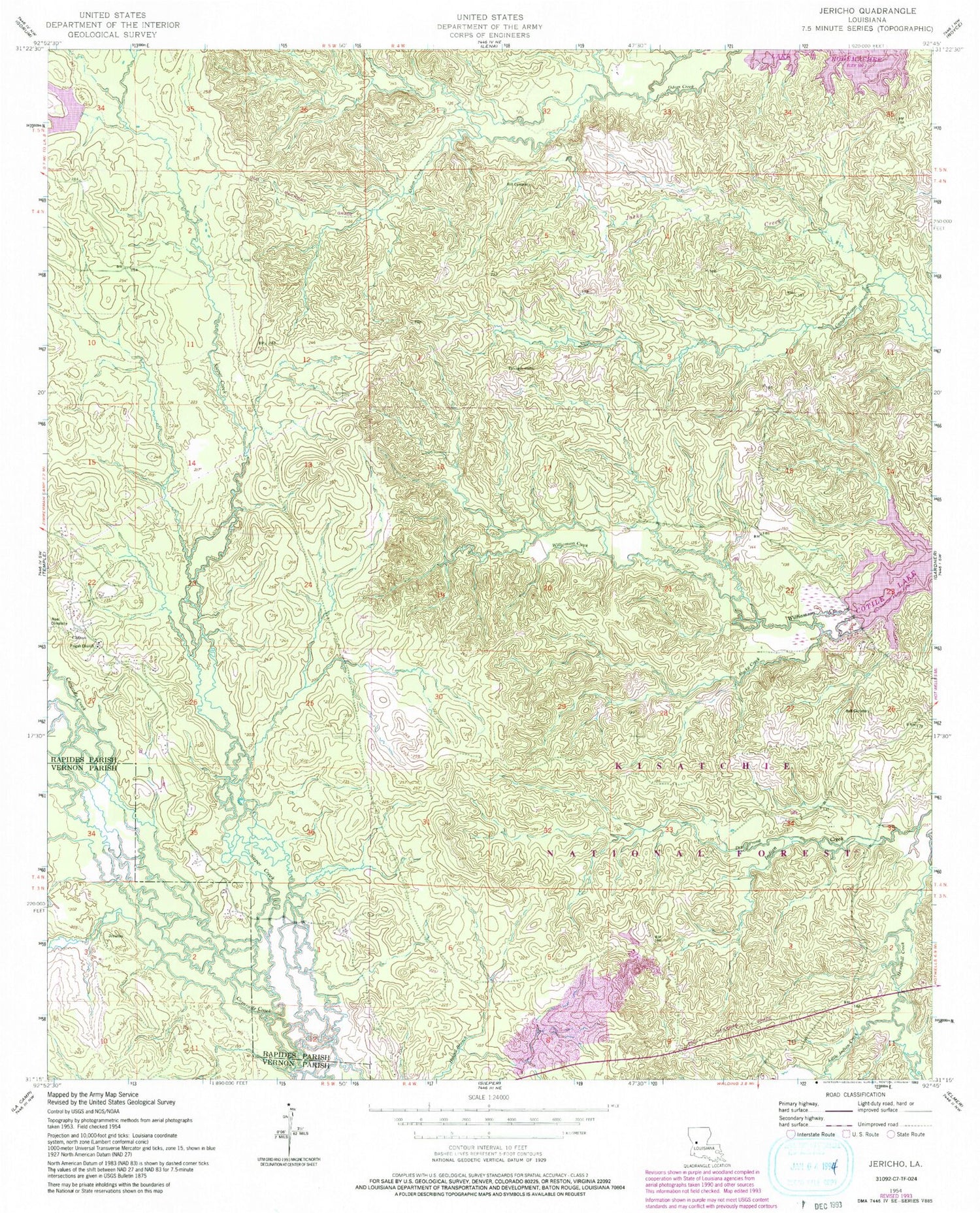
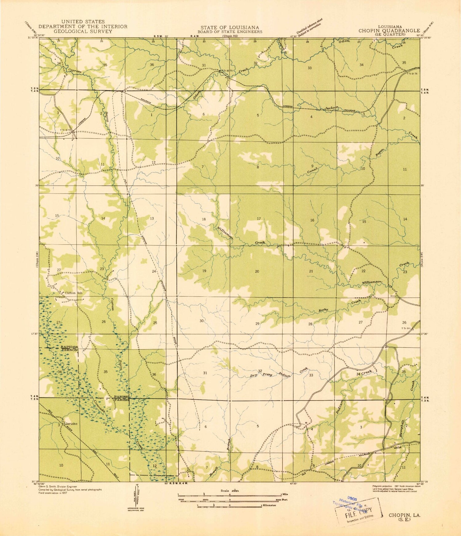
Historical USGS topographic quad map of Jericho in the state of Louisiana. Map scale may vary for some years, but is generally around 1:24,000. Print size is approximately 24" x 27"
This quadrangle is in the following counties: Rapides, Vernon.
The map contains contour lines, roads, rivers, towns, and lakes. Printed on high-quality waterproof paper with UV fade-resistant inks, and shipped rolled.
Contains the following named places: Ball Cemetery, Campbell Creek, Canal Bayou, Clifton, Clifton Choctaw State Designated Tribal Statistical Area, Clifton School, Cypress School, Dough Hills, Dry Prong, Hill Cemetery, Jericho, Little Indian Creek, Noel Cemetery, Odom, Pisgah Church, Rocky Creek, Waldon Church, Williamson Creek