MyTopo
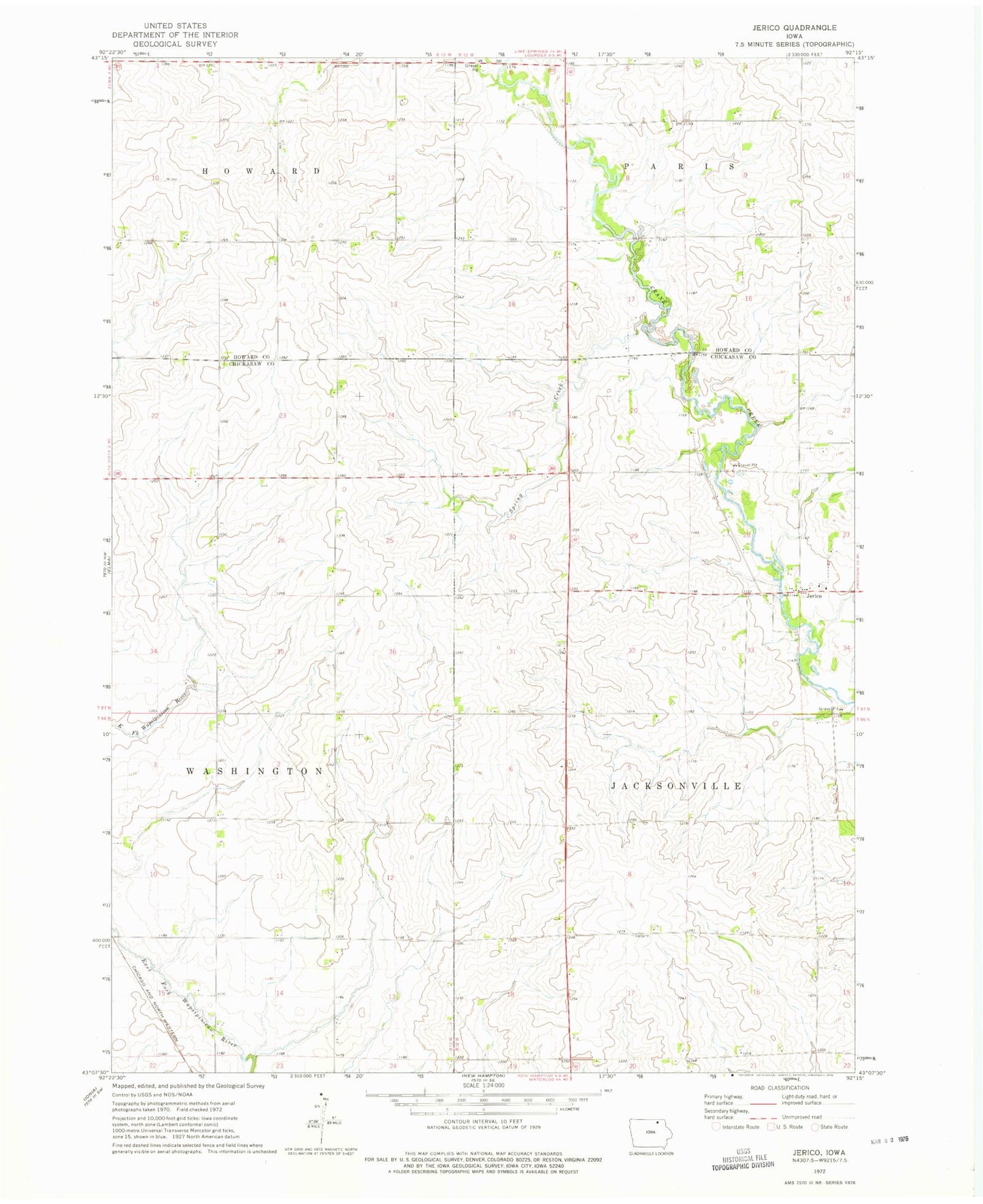
Classic USGS Jerico Iowa 7.5'x7.5' Topo Map
Regular price
$16.95
Regular price
Sale price
$16.95
Unit price
per
Couldn't load pickup availability
Historical USGS topographic quad map of Jerico in the state of Iowa. Map scale may vary for some years, but is generally around 1:24,000. Print size is approximately 24" x 27"
This quadrangle is in the following counties: Chickasaw, Howard.
The map contains contour lines, roads, rivers, towns, and lakes. Printed on high-quality waterproof paper with UV fade-resistant inks, and shipped rolled.
Contains the following named places: Crane Creek Wildlife Area, Freidhof Creek, Jerico, Jerico Lutheran Cemetery, Jerico Lutheran Church and Jericho Lutheran Cemetery, Jerico Post Office, Jerico Wildlife Area, Johnny Walnut Seed Conservation Area, Sargeant Farm Cemetery, Sturgis Post Office, Township of Jacksonville