MyTopo
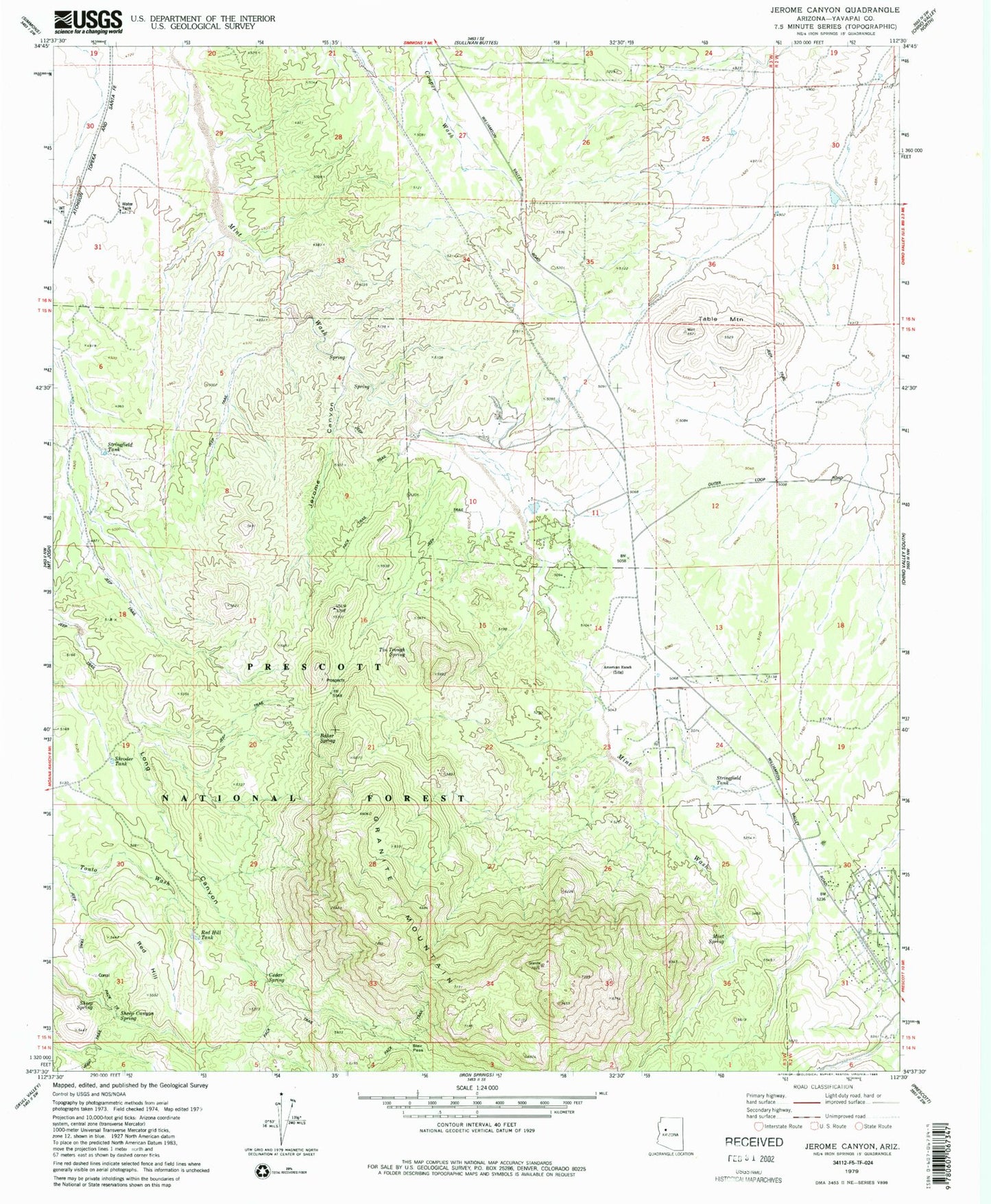
Classic USGS Jerome Canyon Arizona 7.5'x7.5' Topo Map
Couldn't load pickup availability
Historical USGS topographic quad map of Jerome Canyon in the state of Arizona. Typical map scale is 1:24,000, but may vary for certain years, if available. Print size: 24" x 27"
This quadrangle is in the following counties: Yavapai.
The map contains contour lines, roads, rivers, towns, and lakes. Printed on high-quality waterproof paper with UV fade-resistant inks, and shipped rolled.
Contains the following named places: American Ranch, Baker Spring, Blair Pass, Cedar Spring, Jerome Canyon, Mint Spring, Red Hill, Red Hill Tank, Sheep Canyon Spring, Sheep Spring, Shroder Tank, Table Mountain, Tin Trough Spring, Alkali Spring, White Rock Spring, Granite Mountain, Stringfield Tank, Mint, Stringfield, Granite Mountain Spring, Seep Spring, Stringfield Ranch, Mint Wash Waters, Chimbley Tank, Granite Mountain Wilderness, Stringfield Tank, Goat Camp, Williamson, Lon Stringfield Ranch, Williamson Census Designated Place, Central Yavapai Fire District Station 57, Yavapai County Sheriff's Office Williamson Valley