MyTopo
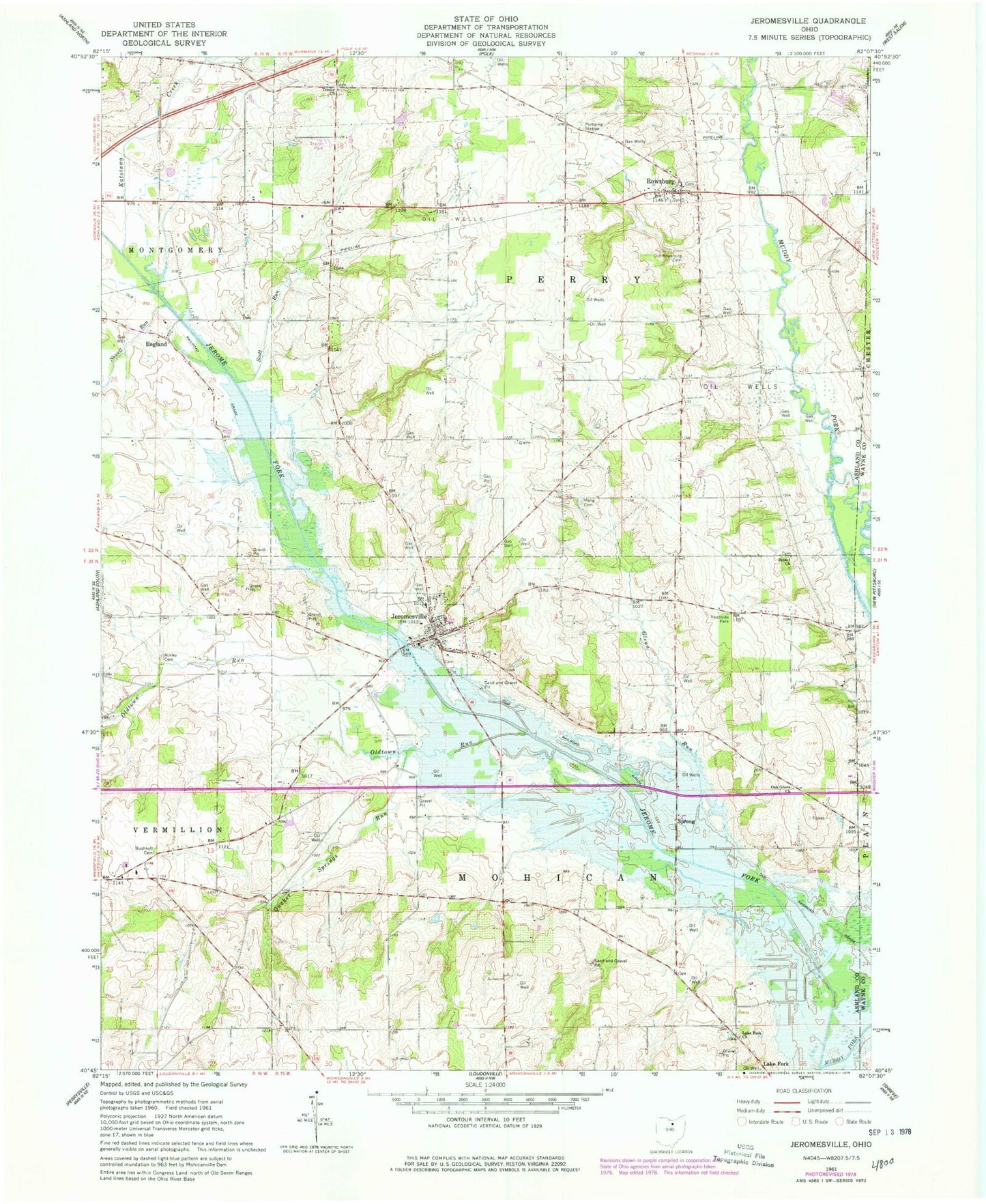
Classic USGS Jeromesville Ohio 7.5'x7.5' Topo Map
Couldn't load pickup availability
Historical USGS topographic quad map of Jeromesville in the state of Ohio. Map scale may vary for some years, but is generally around 1:24,000. Print size is approximately 24" x 27"
This quadrangle is in the following counties: Ashland, Wayne.
The map contains contour lines, roads, rivers, towns, and lakes. Printed on high-quality waterproof paper with UV fade-resistant inks, and shipped rolled.
Contains the following named places: Ackley Cemetery, Apple Barn Farm, Bethel Cemetery, Bethel Church, Brandt Cemetery, Bushnell Cemetery, Cliff Cemetery, England, Glenn Run, Hillsdale High School, Jerome Fork, Jeromesville, Jeromesville Cemetery, Jeromesville Elementary School, Jeromesville Post Office, Jeromesville Volunteer Fire Department, Katotawa Creek, Lake Fork Church, Lakefork Cemetery, Lakefork School, Meng Cemetery, Methodist Cemetery, Mohican Hills Golf Course, Muddy Fork, Newell Run, Oak Grove Church, Old Rowsburg Cemetery, Oldtown Run, Quaker Springs Run, Rowsburg, Rowsburg Cemetery, Scott Run, Spreng, Township of Mohican, Township of Perry, Treaton, Trinity Cemetery, Trinity Church, Village of Jeromesville, ZIP Code: 44840