MyTopo
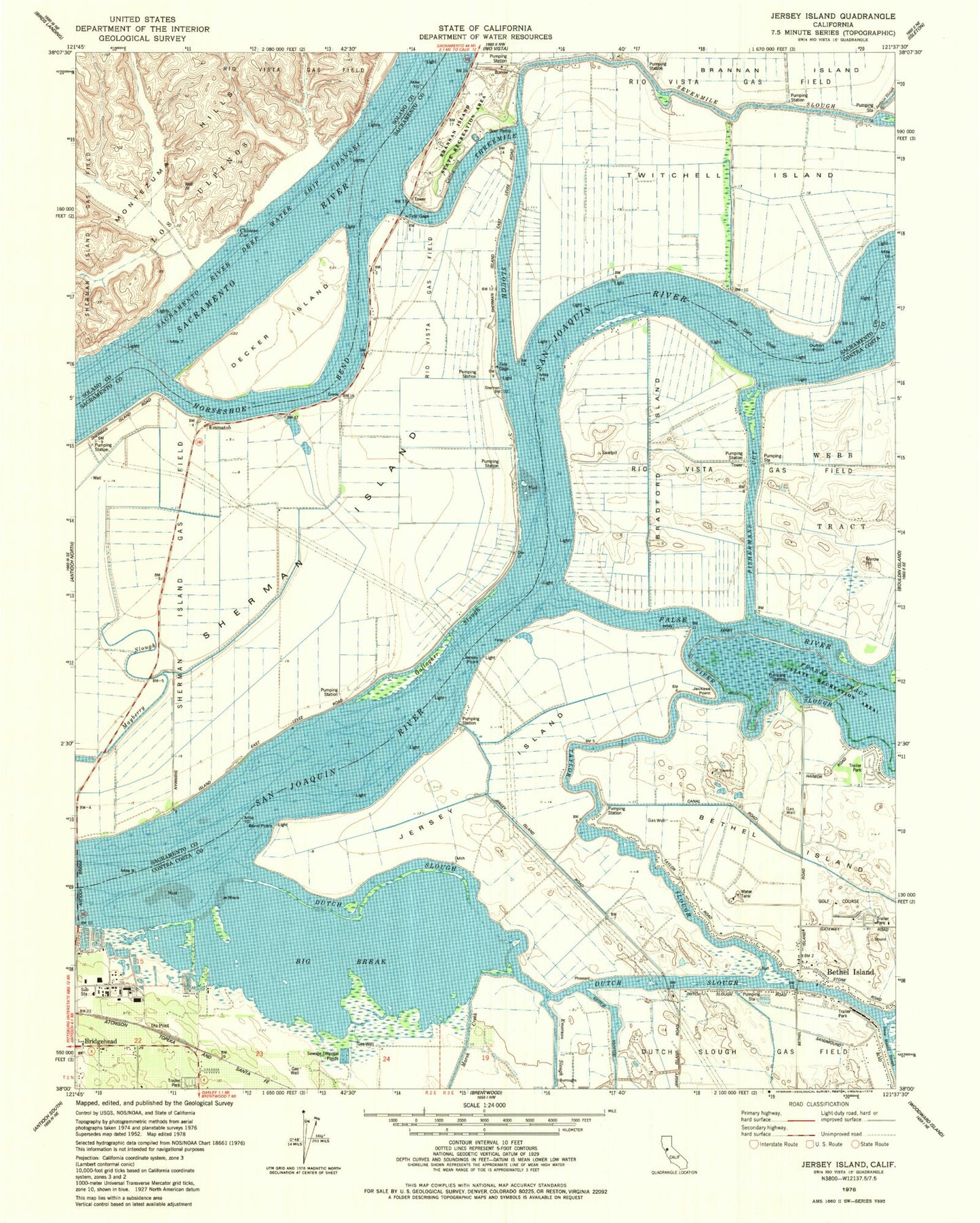
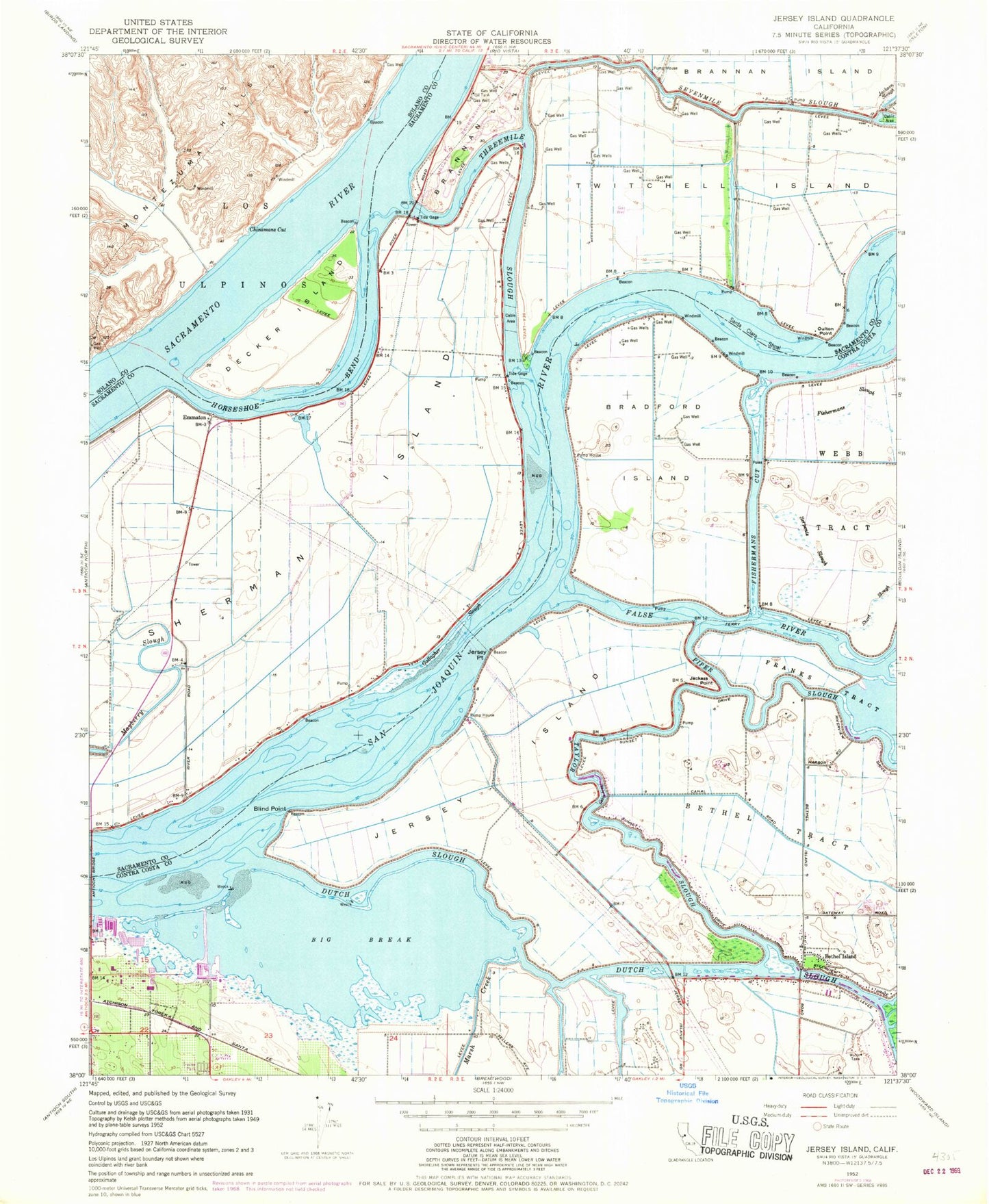
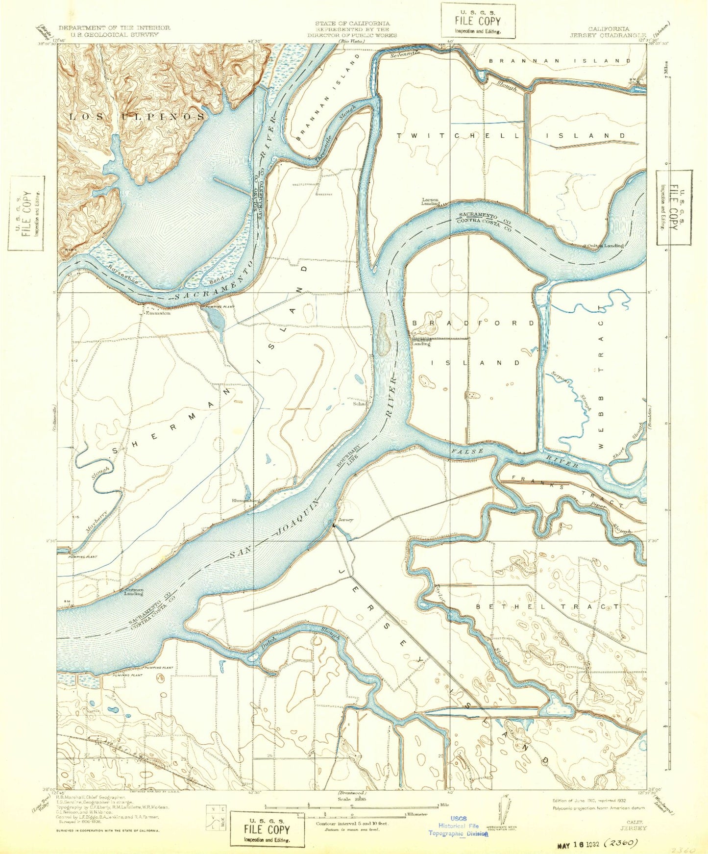
Classic USGS Jersey Island California 7.5'x7.5' Topo Map
Couldn't load pickup availability
Historical USGS topographic quad map of Jersey Island in the state of California. Map scale may vary for some years, but is generally around 1:24,000. Print size is approximately 24" x 27"
This quadrangle is in the following counties: Contra Costa, Sacramento, Solano.
The map contains contour lines, roads, rivers, towns, and lakes. Printed on high-quality waterproof paper with UV fade-resistant inks, and shipped rolled.
Contains the following named places: Baldocchi Landing, Bethel Island, Bethel Island Census Designated Place, Bethel Island Post Office, Big Break, Big Break Marina, Blind Point, Blumenberg, Bradford Island, Bradford Landing, Brannan Island State Recreation Area Visitor Center, Brannon Island State Recreational Area, Chinese Cut, Cottonwood Campground, Cypress Shopping Center, Decker Island, Decker Landing, Delta Vista Berthing Area, Driftwood Marina, Dutch Slough, East Contra Costa Fire Protection District Station 95, Eddos Harbor, Emmaton, False River, Fishermans Cut, Fishermans Slough, Franks Tract State Recreation Area, Gallagher Slough, Gutman Landing, Horseshoe Bend, Jackass Point, Jersey Headquarters Landing, Jersey Island, Jersey Point, Larsen Landing, Lauritzen Yacht Harbor, Leisure Landing, Little Franks Tract, Mackenson, Marsh Creek, Noverd, Oulton Point, Piper Slough, Santa Clara Shoal, Serpents Slough, Sevenmile Slough, Sherman Island, Shima-Shima Landing, Short Slough, Taylor Slough, The Island Club, Threemile Bridge, Threemile Slough, Toland Landing, Twitchell Island, Willow Campground, ZIP Code: 94511