MyTopo
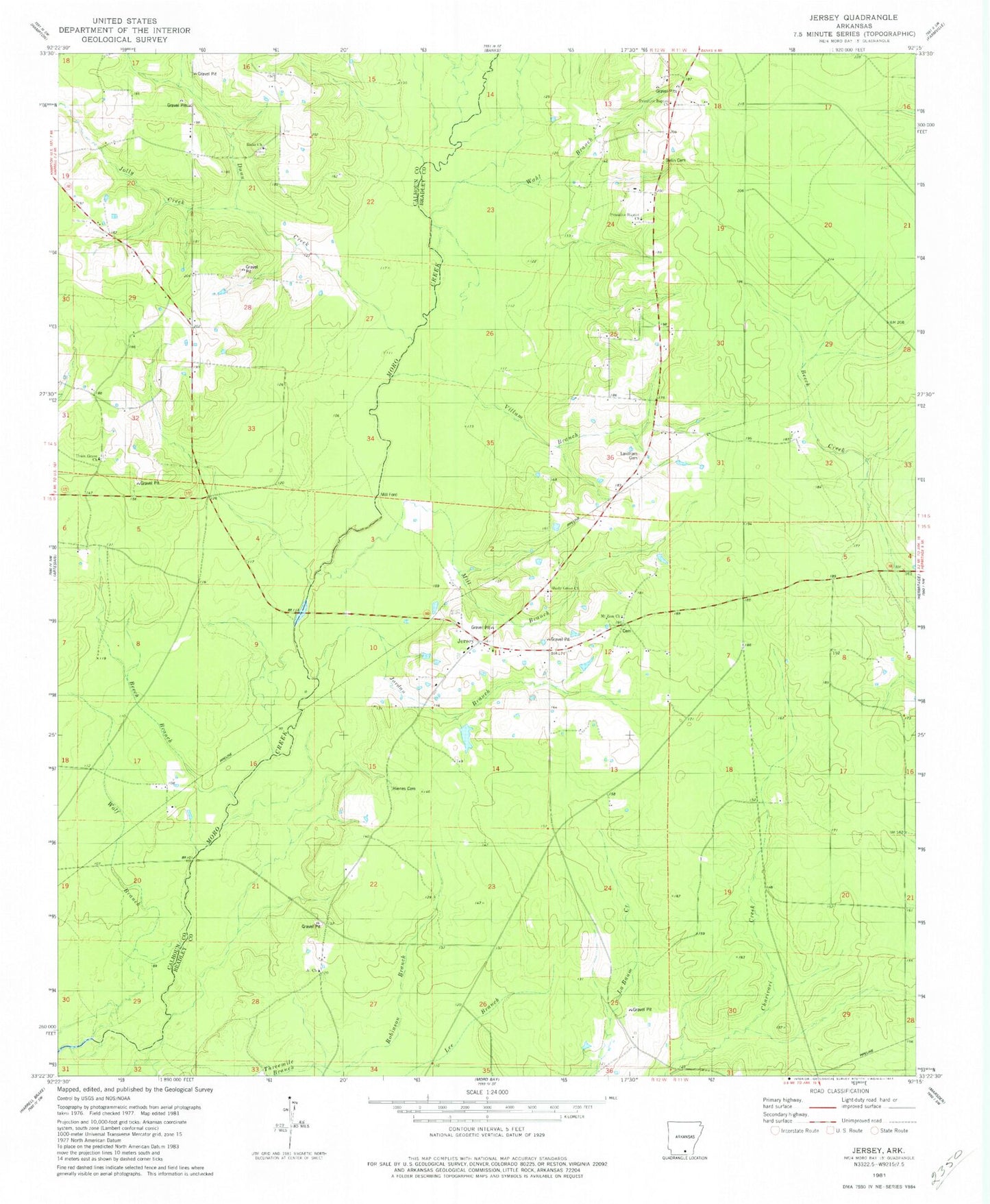
Classic USGS Jersey Arkansas 7.5'x7.5' Topo Map
Couldn't load pickup availability
Historical USGS topographic quad map of Jersey in the state of Arkansas. Map scale may vary for some years, but is generally around 1:24,000. Print size is approximately 24" x 27"
This quadrangle is in the following counties: Bradley, Calhoun.
The map contains contour lines, roads, rivers, towns, and lakes. Printed on high-quality waterproof paper with UV fade-resistant inks, and shipped rolled.
Contains the following named places: At Church, Bailey Ford, Beech Branch, Belin Cemetery, Child School, Dunn Creek, Hines Cemetery, Jersey, Jersey Methodist Church, Jersey Post Office, Jersey Rural Fire Department, Jersey School, Jolly Creek, Jordan Branch, Lavilliam Cemetery, Lee Branch, Mill Branch, Mill Ford, Mount Zion Baptist Church, Mount Zion Cemetery, Mud Springs, Pin Oak Flat, Primitive Baptist Church, Ricks Cemetery, Ricks Church, Robinson Branch, Saint Lena School, Shady Grove Cemetery, Shady Grove Missionary Baptist Church, Township of Jackson, Township of Sumpter, Union Grove Church, Villum Branch, Wahl Branch