MyTopo
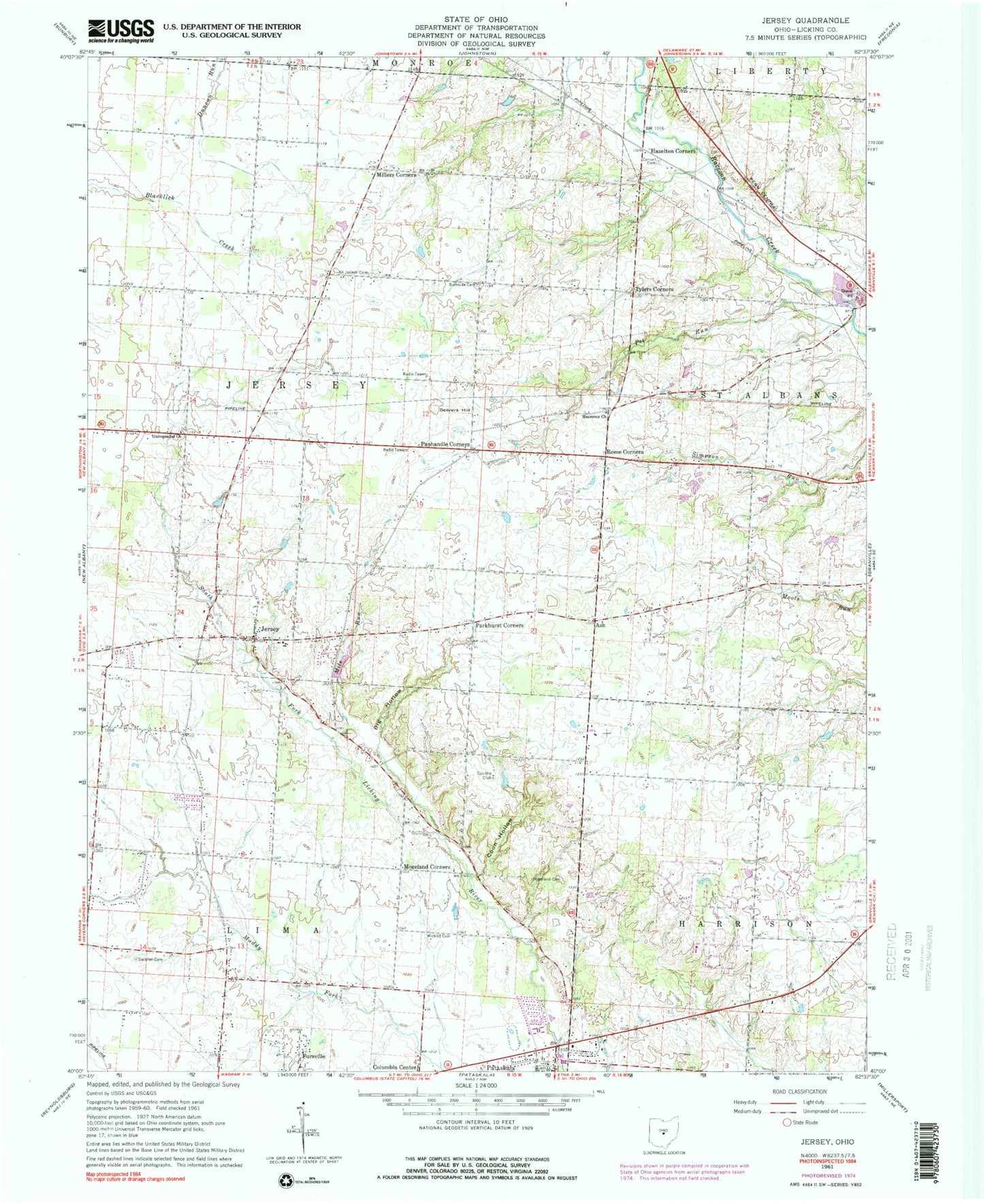
Classic USGS Jersey Ohio 7.5'x7.5' Topo Map
Couldn't load pickup availability
Historical USGS topographic quad map of Jersey in the state of Ohio. Map scale may vary for some years, but is generally around 1:24,000. Print size is approximately 24" x 27"
This quadrangle is in the following counties: Licking.
The map contains contour lines, roads, rivers, towns, and lakes. Printed on high-quality waterproof paper with UV fade-resistant inks, and shipped rolled.
Contains the following named places: Alexandria Sand and Gravel Pit, Alward School, Angevine School, Ash, Ash Post Office, Beavers Hill, Beech School, Beechwood Trails, Beechwood Trails Census Designated Place, Big Hollow, Brown School, Burkam School, Burnside Cemetery, Burnside School, City of Pataskala, Coon Hollow, Cornell Cemetery, Cornell Run, Eden Church, Fursville, Gardner Pond, Gardner Pond Dam, Green Chapel, Green School, Harmony Church, Hazelton Corners, Jersey, Jersey Census Designated Place, Jersey Elementary School, Jersey Post Office, Jersey Presbyterian Cemetery, Jersey Reformed Presbyterian Church, Jersey Universalist Cemetery, Kearns Airport, Lennington School, Lynd Fruit Farm, Mile Run, Miley School, Millers Corners, Monroe School, Moreland Cemetery, Moreland Corners, Myers School, Panhandle Corners, Parker School, Parkhurst Corners, Pataskala Post Office, Pet Run, Peters School, Reese Corners, Remington Heliport, Robinette School, Rowe School, Saint Joseph Cemetery, Saint Josephs Church, Slough School, Swisher Cemetery, Township of Jersey, Township of Lima, Tylers Corners, Universalist Church, West Licking Joint Fire District Station 1 Headquarters, Wickliff Cemetery, ZIP Code: 43062