MyTopo
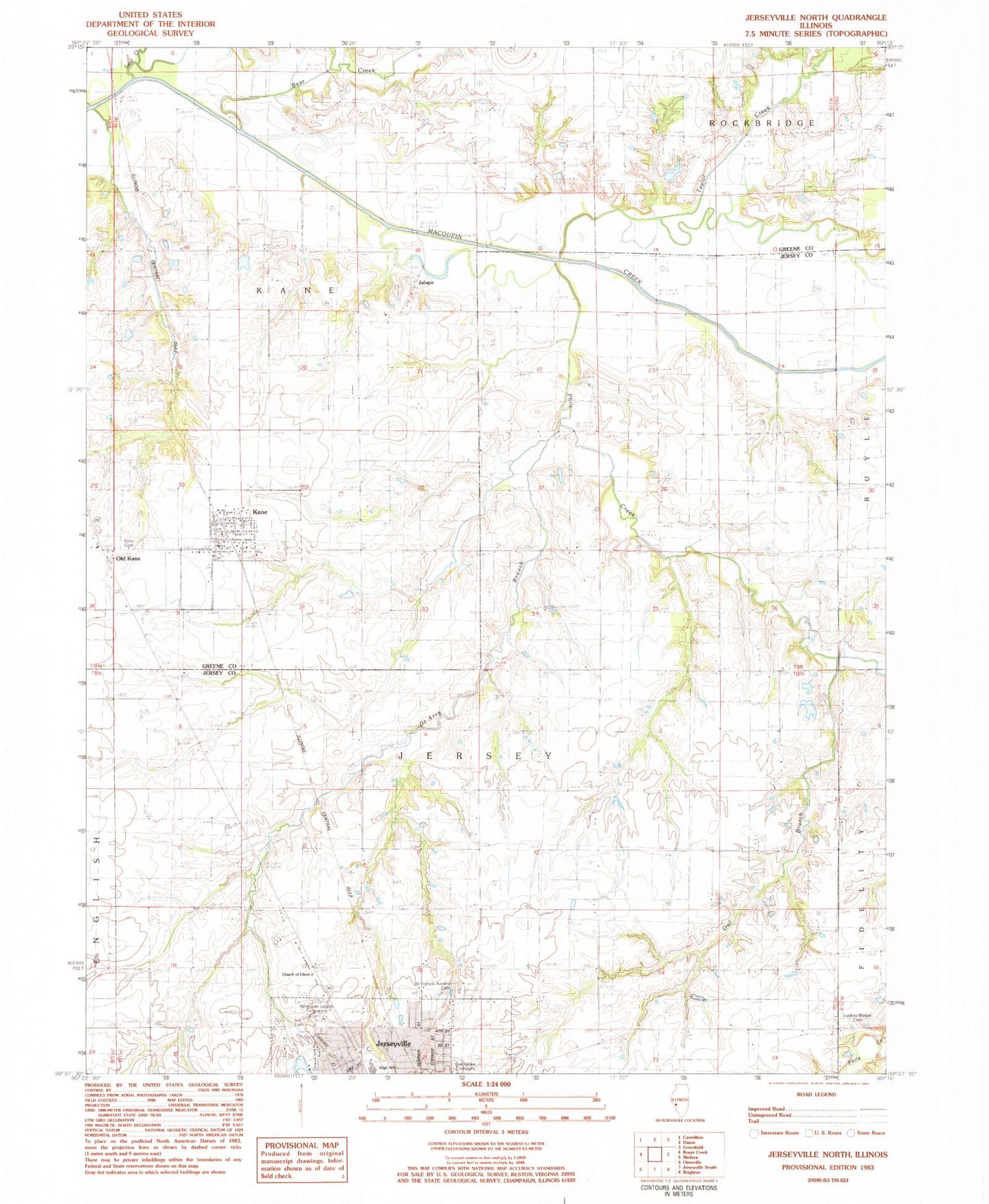
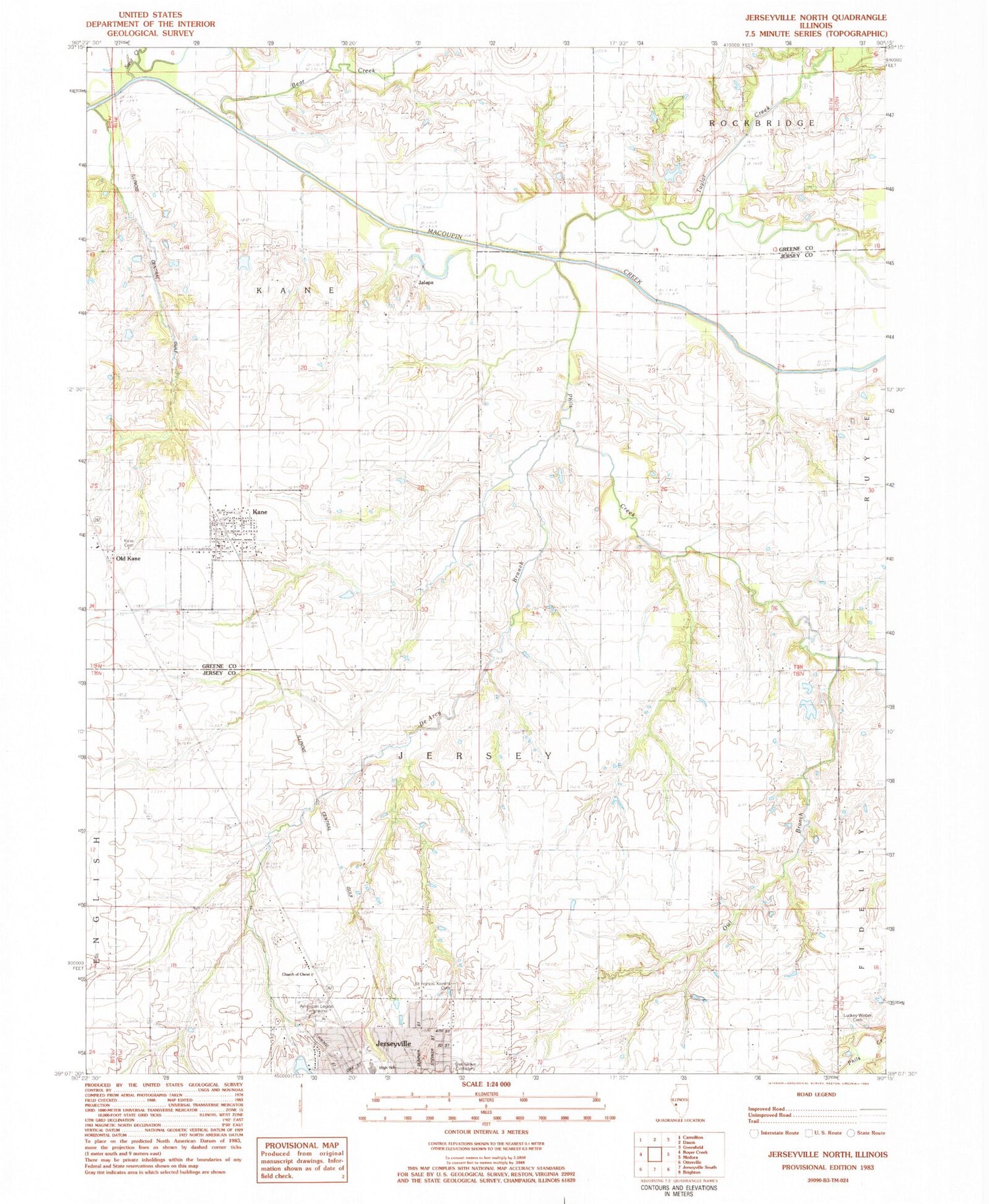
Classic USGS Jerseyville North Illinois 7.5'x7.5' Topo Map
Couldn't load pickup availability
Historical USGS topographic quad map of Jerseyville North in the state of Illinois. Map scale may vary for some years, but is generally around 1:24,000. Print size is approximately 24" x 27"
This quadrangle is in the following counties: Greene, Jersey.
The map contains contour lines, roads, rivers, towns, and lakes. Printed on high-quality waterproof paper with UV fade-resistant inks, and shipped rolled.
Contains the following named places: American Legion Fairground, Bear Creek, Burch Cemetery, De Arcy Branch, Green Persimmon School, Heild Pond, Heild Pond Dam, Hope Lutheran Church, Jalapa, Jersey Community High School, Jerseyville Church of Christ, Kane, Kane Baptist Church, Kane Cemetery, Kane Post Office, Keller Cemetery, Link Branch, Little Bear Rough, Luckey - Weber Cemetery, Mount Pleasant School, Oak Grove Cemetery, Old Kane, Owl Branch, Phils Creek, Pleasant Hill School, Saint Francis Xaviers Cemetery, Sand Creek, Sherman School, Taylor Creek, Tolman School, Township of Jersey, Victory School, Village of Kane, Westlake Golf Course, White Rose School, White School, Woodbury School, ZIP Code: 62054