MyTopo
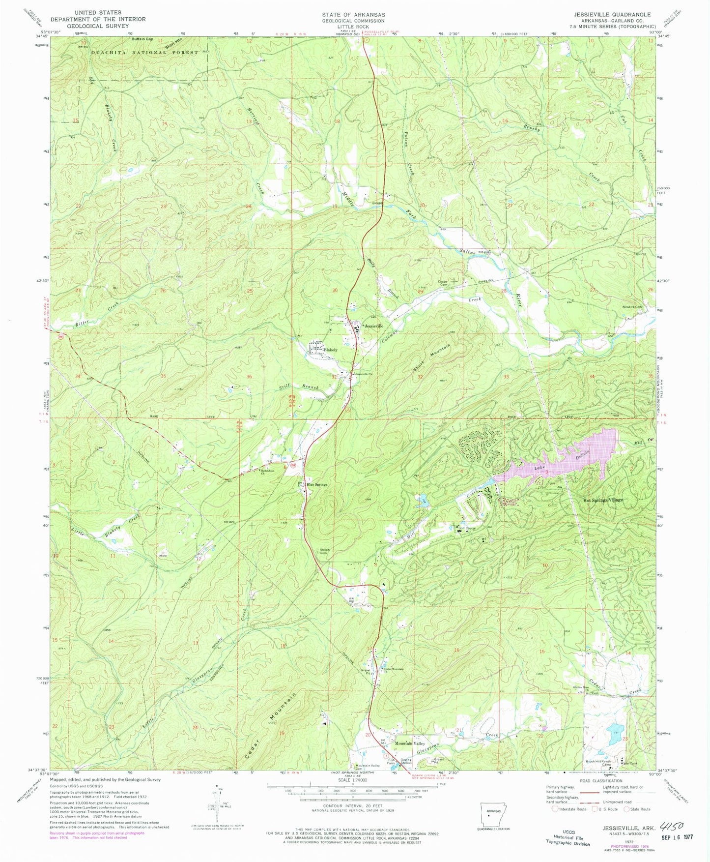
Classic USGS Jessieville Arkansas 7.5'x7.5' Topo Map
Couldn't load pickup availability
Historical USGS topographic quad map of Jessieville in the state of Arkansas. Map scale may vary for some years, but is generally around 1:24,000. Print size is approximately 24" x 27"
This quadrangle is in the following counties: Garland.
The map contains contour lines, roads, rivers, towns, and lakes. Printed on high-quality waterproof paper with UV fade-resistant inks, and shipped rolled.
Contains the following named places: Baily Branch, Bethlehem Church, Big Lake, Big Lake Dam, Blakely, Blue Springs, Brook Hill Ranch Camp, Buffalo Gap, Cedar Mountain, Cedar Mountain Church, Coleman Creek, Cosby Cemetery, Cub Creek, De Soto Golf Course, Glazier Peau Church, Gross Lake, Gross Lake Dam, Hot Springs Dam Number One, Hot Springs Dam Number Two, Hot Springs Village Emergency Medical Services, Hot Springs Village Fire Department Desoto Station, Hot Springs Village Police Department, Hot Springs Village Post Office, Jessieville, Jessieville Church, Jessieville Elementary School, Jessieville Fire Department Blakely Station, Jessieville High School, Jessieville Post Office, Jessieville Work Center, KALR-FM (Hot Springs), Lake Desoto, Lake Segovia, Lena, Merriott Creek, Mountain Valley, Mountain Valley Cemetery, Mountain Valley Church, Newkirk Cemetery, Poison Creek, Shiloh Cemetery, Short Mountain, Still Branch, Township of Jessieville, Township of Marble, Township of Mountain Valley, Township of Wood