MyTopo
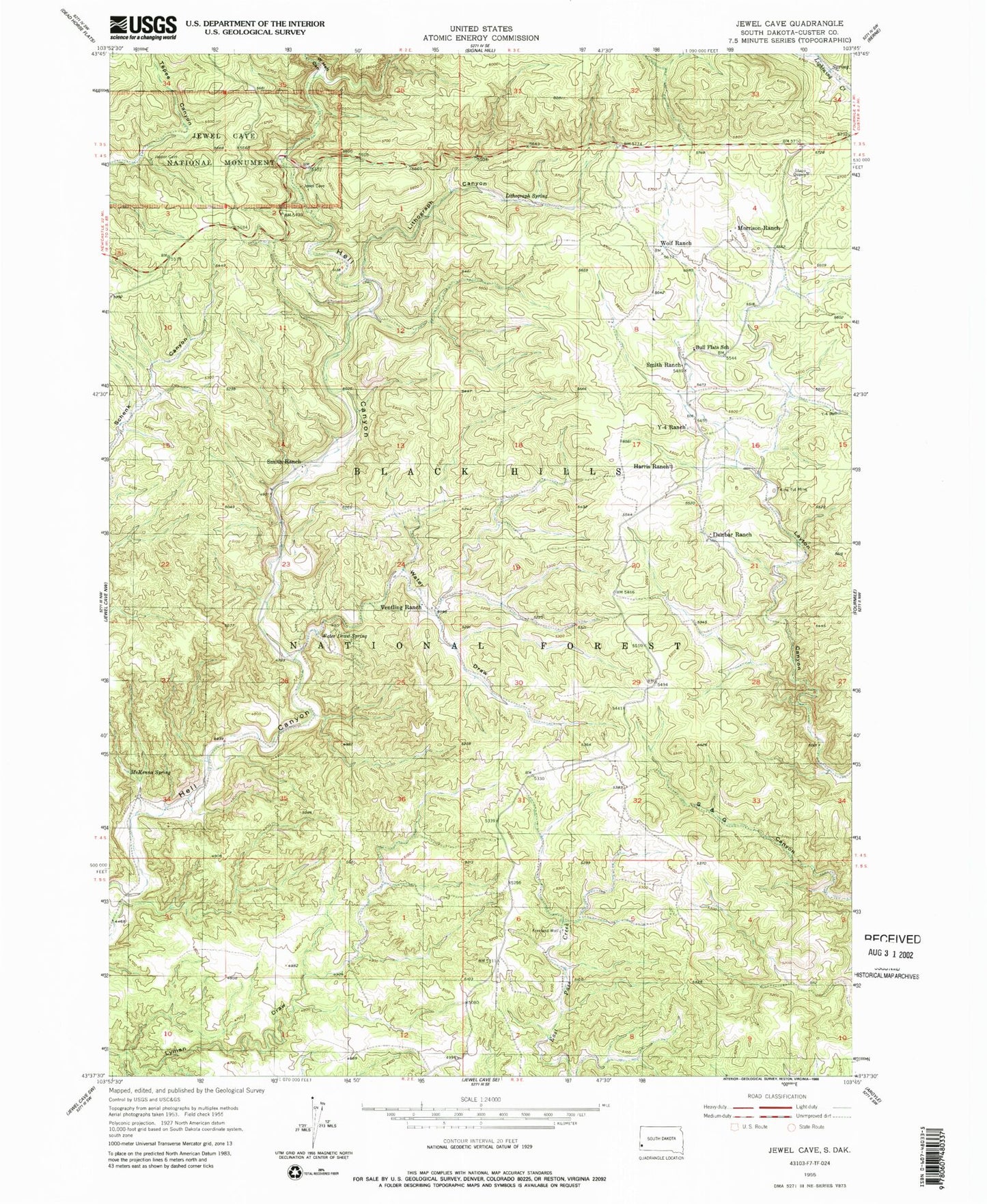
Classic USGS Jewel Cave South Dakota 7.5'x7.5' Topo Map
Couldn't load pickup availability
Historical USGS topographic quad map of Jewel Cave in the state of South Dakota. Map scale may vary for some years, but is generally around 1:24,000. Print size is approximately 24" x 27"
This quadrangle is in the following counties: Custer.
The map contains contour lines, roads, rivers, towns, and lakes. Printed on high-quality waterproof paper with UV fade-resistant inks, and shipped rolled.
Contains the following named places: Bull Flats School, Dunbar Ranch, Freeland Well, Freelands Ranch, Gurneys Ranch, Harris Ranch, Jewel Cave Campground, Jewel Cave National Monument, Jewel Cave Visitor Center, King Tut Mine, Layton Well, Lithograph Canyon, Lithograph Spring, McKenna Spring, Morrison Ranch, Smith Ranch, Stapp Quarry, Unorganized Territory of West Custer, Ventling Ranch, Water Draw, Water Draw Spring, West Hell Canyon, Wolf Ranch, Y-4 Ranch, Y-4 Well