MyTopo
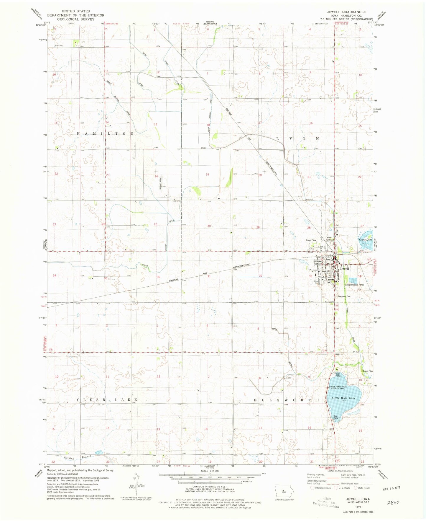
Classic USGS Jewell Iowa 7.5'x7.5' Topo Map
Couldn't load pickup availability
Historical USGS topographic quad map of Jewell in the state of Iowa. Map scale may vary for some years, but is generally around 1:24,000. Print size is approximately 24" x 27"
This quadrangle is in the following counties: Hamilton.
The map contains contour lines, roads, rivers, towns, and lakes. Printed on high-quality waterproof paper with UV fade-resistant inks, and shipped rolled.
Contains the following named places: Bethesda Lutheran Church, Cairo Lake, Central Iowa Cooperative Elevator, City of Jewell Junction, Ditch Number 114, Ditch Number 71, Evergreen Cemetery, Federated United Church of Christ, Good Shepherd Catholic Church, Grove Branch Ditch, Jewel Fire Department, Jewell, Jewell City Hall, Jewell Golf and Country Club, Jewell Police Department, Jewell Post Office, Little Wall Lake, Little Wall Lake County Park, Lund Airport, McFarland Clinic, Montgomery Memorial Library, Rahto Branch Ditch, South Hamilton Elementary School, South Hamilton Middle / High School, Township of Ellsworth, Township of Lyon, Victory Christian Fellowship, ZIP Code: 50130