MyTopo
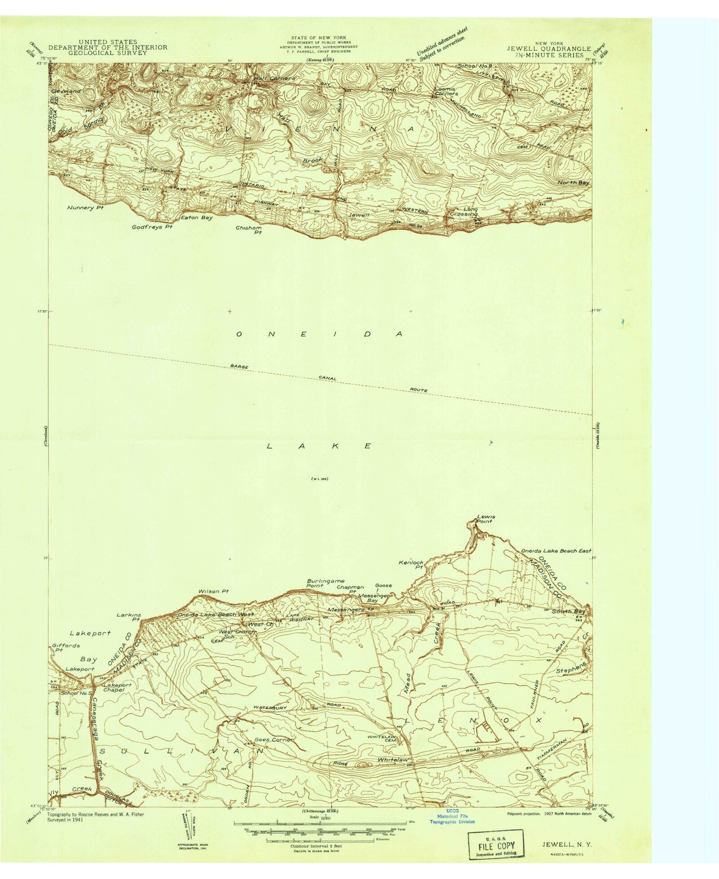
Classic USGS Jewell New York 7.5'x7.5' Topo Map
Couldn't load pickup availability
Historical USGS topographic quad map of Jewell in the state of New York. Map scale may vary for some years, but is generally around 1:24,000. Print size is approximately 24" x 27"
This quadrangle is in the following counties: Madison, Oneida, Oswego.
The map contains contour lines, roads, rivers, towns, and lakes. Printed on high-quality waterproof paper with UV fade-resistant inks, and shipped rolled.
Contains the following named places: Burlingame Point, Canaseraga Creek, Chapman Point, Chishom Point, Cowaselon Creek, Eaton Bay, Gees Corner, Gifford Point, Godfrey Point, Goose Island, Hall Brook, Hall Corners, Hughes Harbor, Jewell, Kawana Bay, Kinloch Point, Lakeport, Lakeport Bay, Lakeport Chapel, Lakeport Shoal, Lakewood Cemetery, Larkins Point, Lewis Point, Long Crossing, Loomis Corners, Mead Creek, Messenger Bay, Messenger Shoal, Miller Airport, North Bay Area School, Nunnery Point, Oneida Lake Beach East, Oneida Lake Beach West, Oneida Lake Cemetery, Oneida Lake Church, Oneido Lake Marina, Pier Number 31 Marina, Saint Mary's Cemetery, Town of Vienna, Vly Creek, Walker's Corners Cemetery, Whitelaw, Whitelaw Cemetery, Willow Run Mobile Home Park, Wilson Point, ZIP Code: 13123