MyTopo
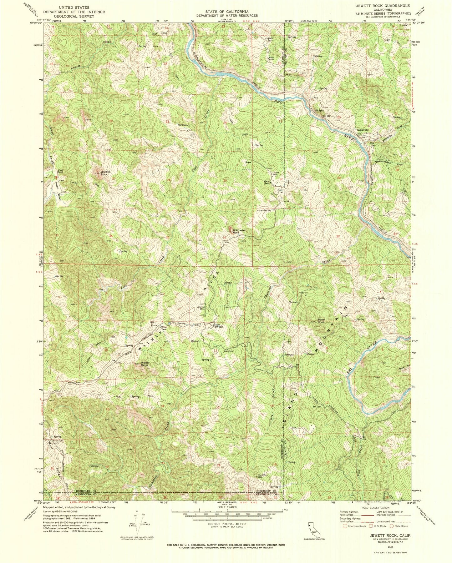
Classic USGS Jewett Rock California 7.5'x7.5' Topo Map
Couldn't load pickup availability
Historical USGS topographic quad map of Jewett Rock in the state of California. Typical map scale is 1:24,000, but may vary for certain years, if available. Print size: 24" x 27"
This quadrangle is in the following counties: Humboldt, Mendocino, Trinity.
The map contains contour lines, roads, rivers, towns, and lakes. Printed on high-quality waterproof paper with UV fade-resistant inks, and shipped rolled.
Contains the following named places: Booth Knoll, Chamise Creek, Dry Creek, Frenchman Creek, Jewett Rock, Jewett Valley, Kekawaka Creek, Lauffer Ranch, Pine Creek, Pipe Creek, Queatchumpah Creek, Schroeder Rock, Two Hundred and One Spur, White Ranch, Wood Ranch, Walker Butte, Walker Ridge, Haman Creek, Kekawaka, Marr Ranch, Palo Verde Volunteer Fire Department, Eel Wild and Scenic River