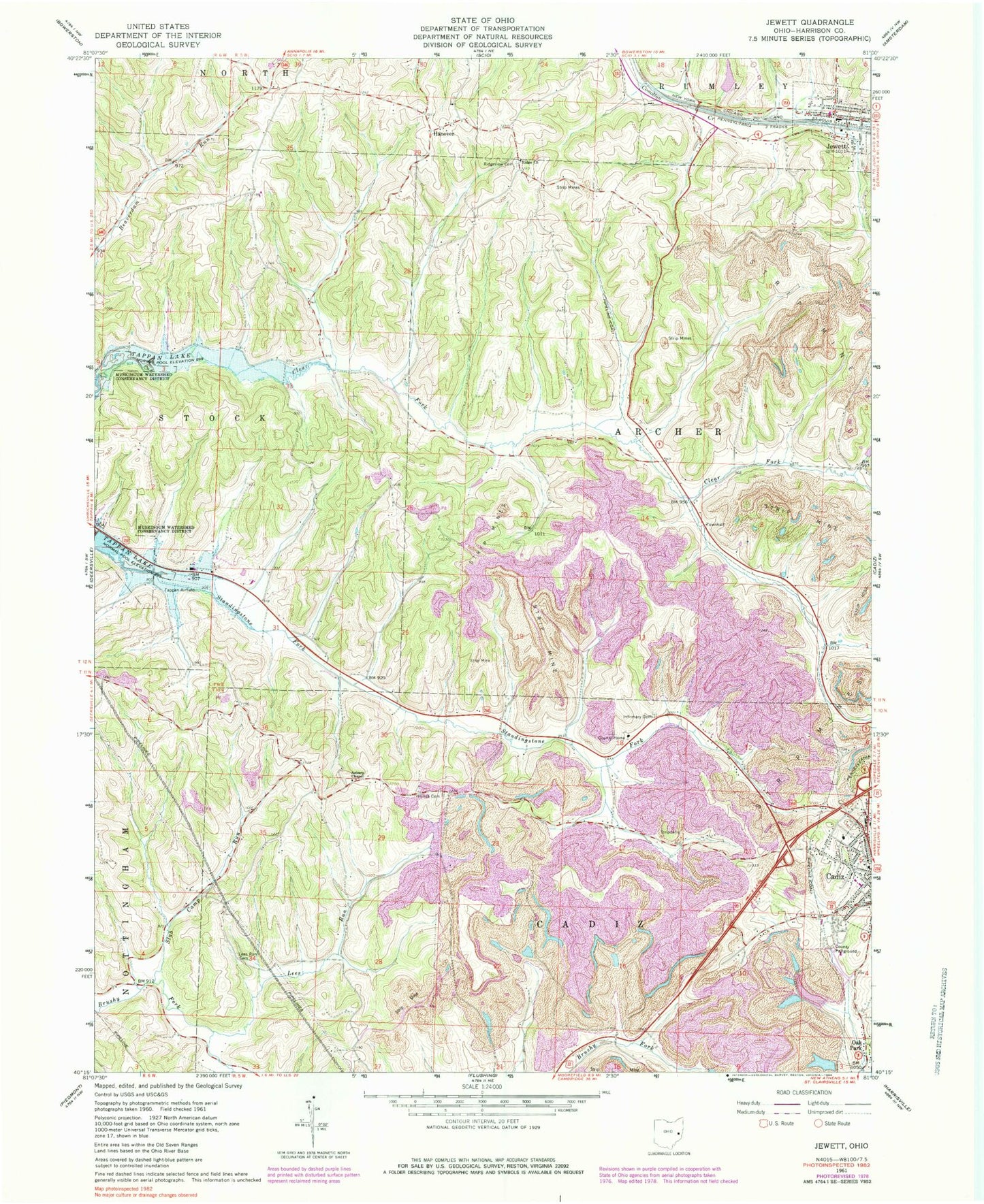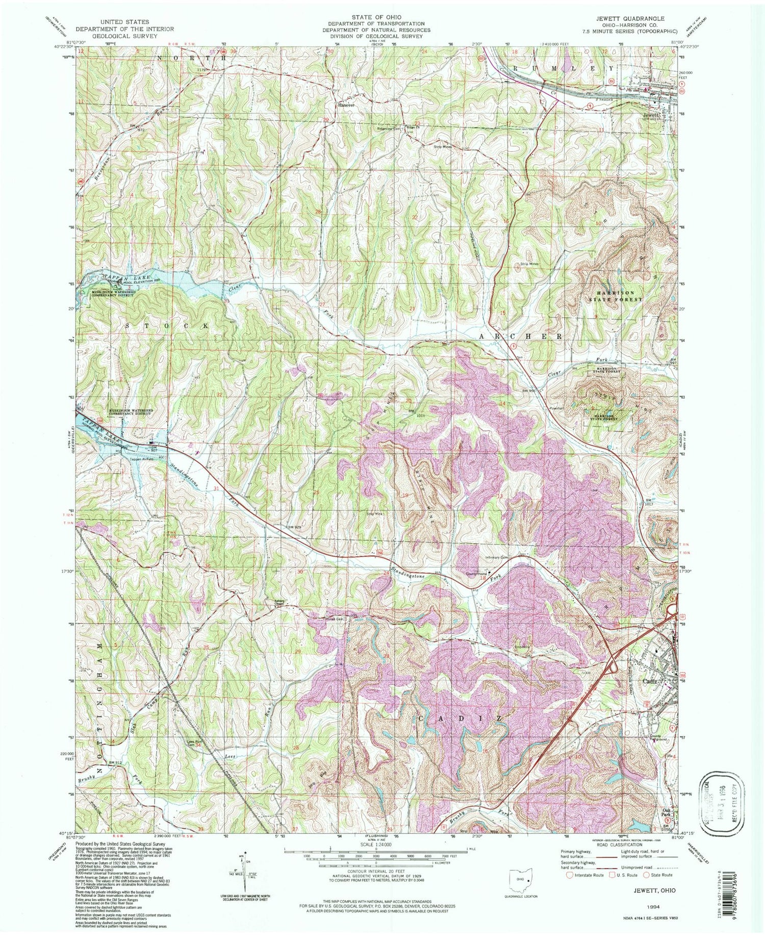

MyTopo
Classic USGS Jewett Ohio 7.5'x7.5' Topo Map
Couldn't load pickup availability
Historical USGS topographic quad map of Jewett in the state of Ohio. Map scale may vary for some years, but is generally around 1:24,000. Print size is approximately 24" x 27"
This quadrangle is in the following counties: Harrison.
The map contains contour lines, roads, rivers, towns, and lakes. Printed on high-quality waterproof paper with UV fade-resistant inks, and shipped rolled.
Contains the following named places: Anderson Mine, Asbury Chapel, B and B Mine, Baltzell Trailer Court, Cadiz Westgate Elementary School, Church of God, CONSOL Energy Pond, Consolidation Coal Pond 0210-010 Dam, Cope Mine, Domestic Mine, Enfield, Enfield Post Office, Foster Lake, Foster Lake Dam, Hanover, Hanover Cemetery, Harris Pond Dam, Harrison County, Harrison County Home, Hines Cemetery, Infirmary Cemetery, Jewett, Jewett Post Office, Jewett Volunteer Fire Department, Jewett-Scio Elementary School, Kerr Mine, Lees Run, Lees Run Cemetery, Moraville, Moraville Post Office, Muskingum Watershed Conservancy District, Pickering Mine, Ridge Church, Ridgeview Cemetery, Sally Buffalo Park Dam, Sally Buffalo Park Dam Number Two, Sally Buffalo Park Lake Number Two, Sally Buffalo Park Reservoir, Slab Camp Run, Stacy, Stacy Post Office, Standingstone Fork, Tappan Airpark, Township of Archer, Township of Cadiz, Village of Jewett