MyTopo
Classic USGS Jim Pond Maine 7.5'x7.5' Topo Map
Couldn't load pickup availability
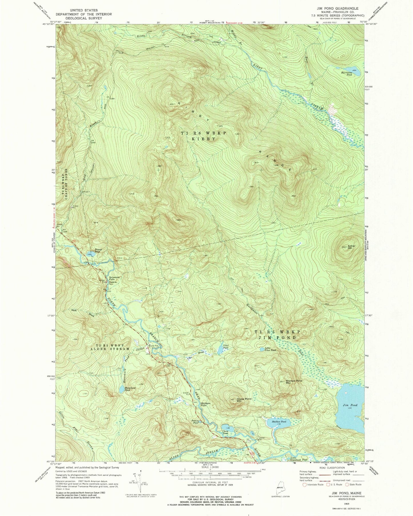
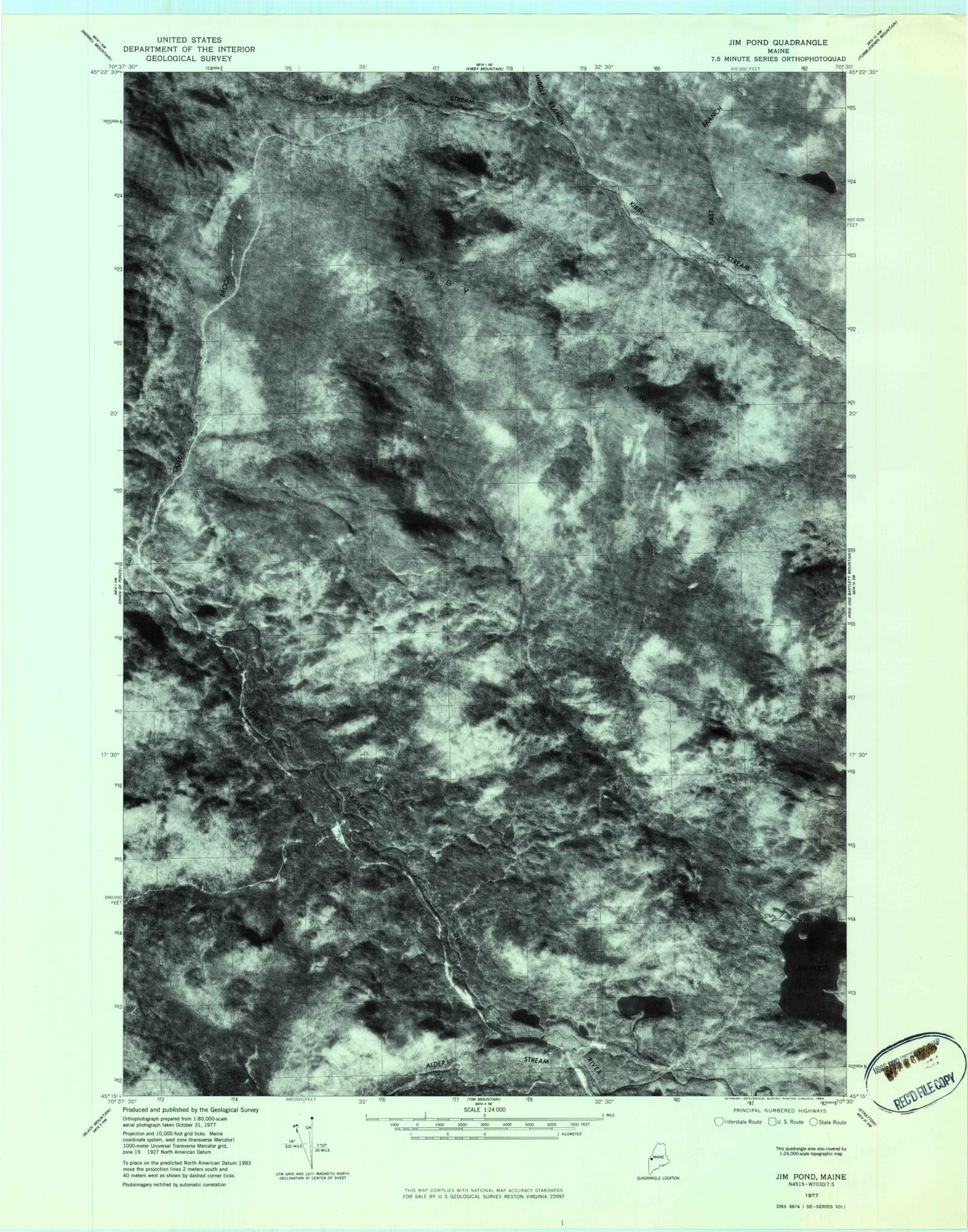
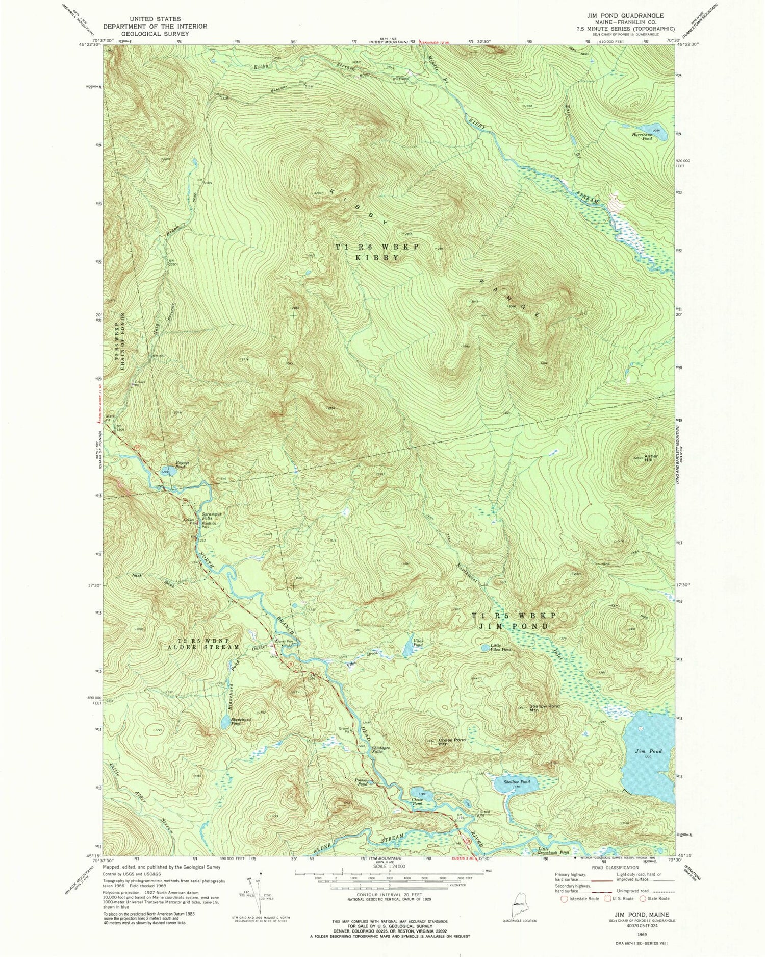
Historical USGS topographic quad map of Jim Pond in the state of Maine. Map scale may vary for some years, but is generally around 1:24,000. Print size is approximately 24" x 27"
This quadrangle is in the following counties: Franklin.
The map contains contour lines, roads, rivers, towns, and lakes. Printed on high-quality waterproof paper with UV fade-resistant inks, and shipped rolled.
Contains the following named places: Alder Stream, Antler Hill, Blanchard Pond, Blanchard Pond Outlet, Bugeye Pond, Chase Pond, Chase Pond Mountain, East Branch Kibby Stream, Gold Brook, Hurricane Pond, Jim Pond, Jim Pond Township, Kibby Range, Kibby Township, Little Greenbush Pond, Little Viles Pond, Middle Branch Kibby Stream, Nash Brook, Northwest Inlet, Poison Pond, Sarampas Falls Campsite, Sarampus Falls, Shadagee Brook, Shadagee Falls, Shallow Pond, Shallow Pond Mountain, Viles Brook, Viles Pond