
MyTopo
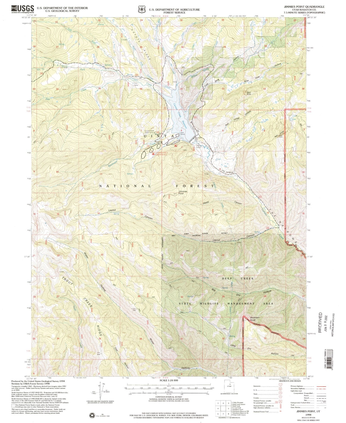
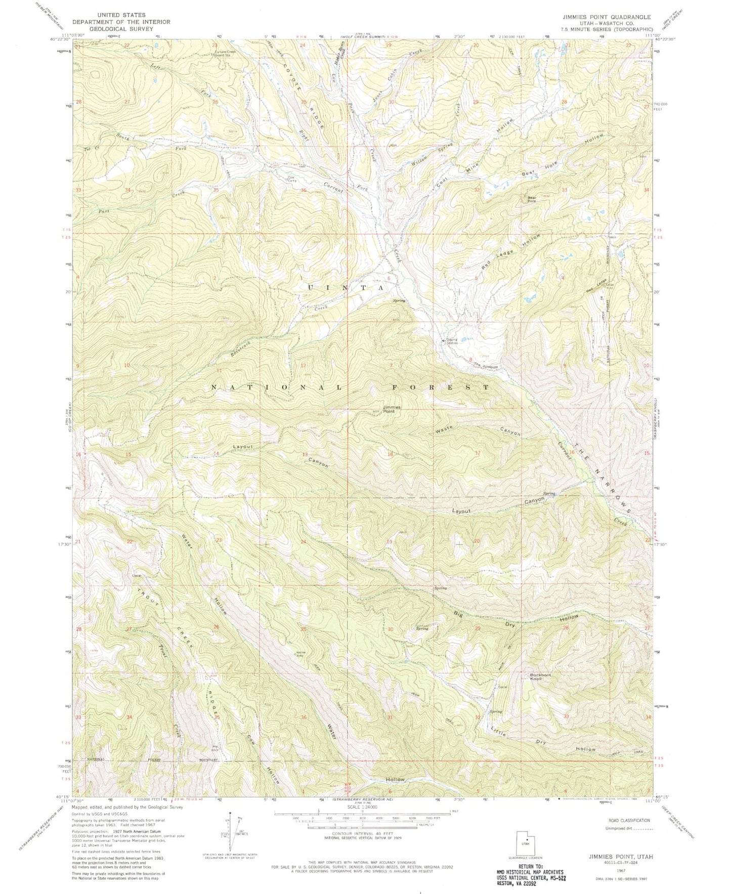
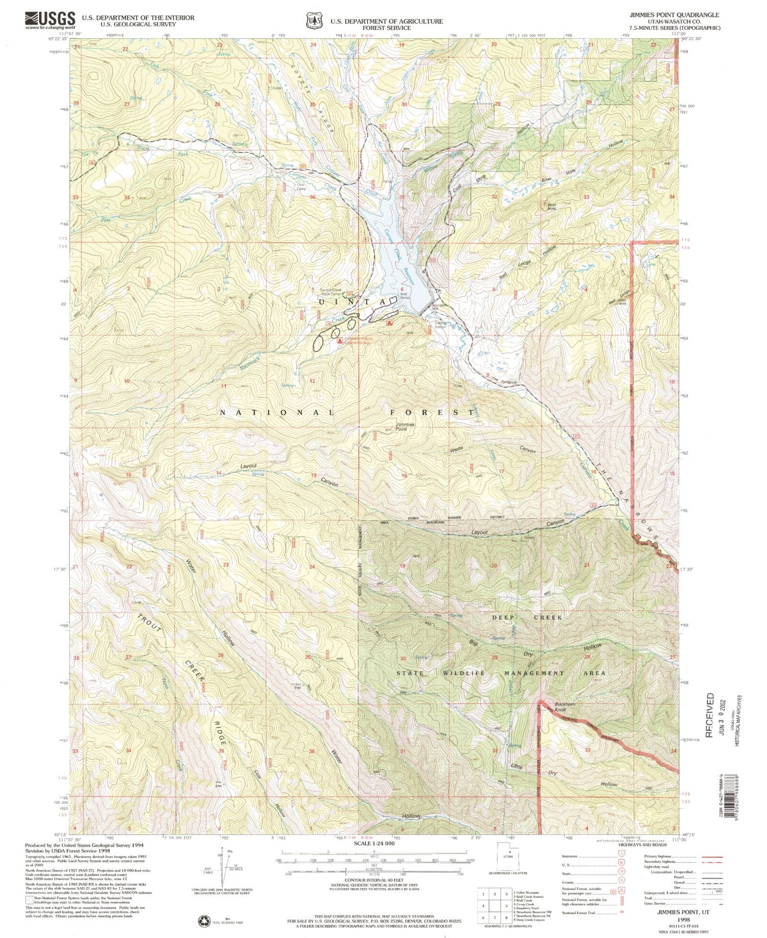
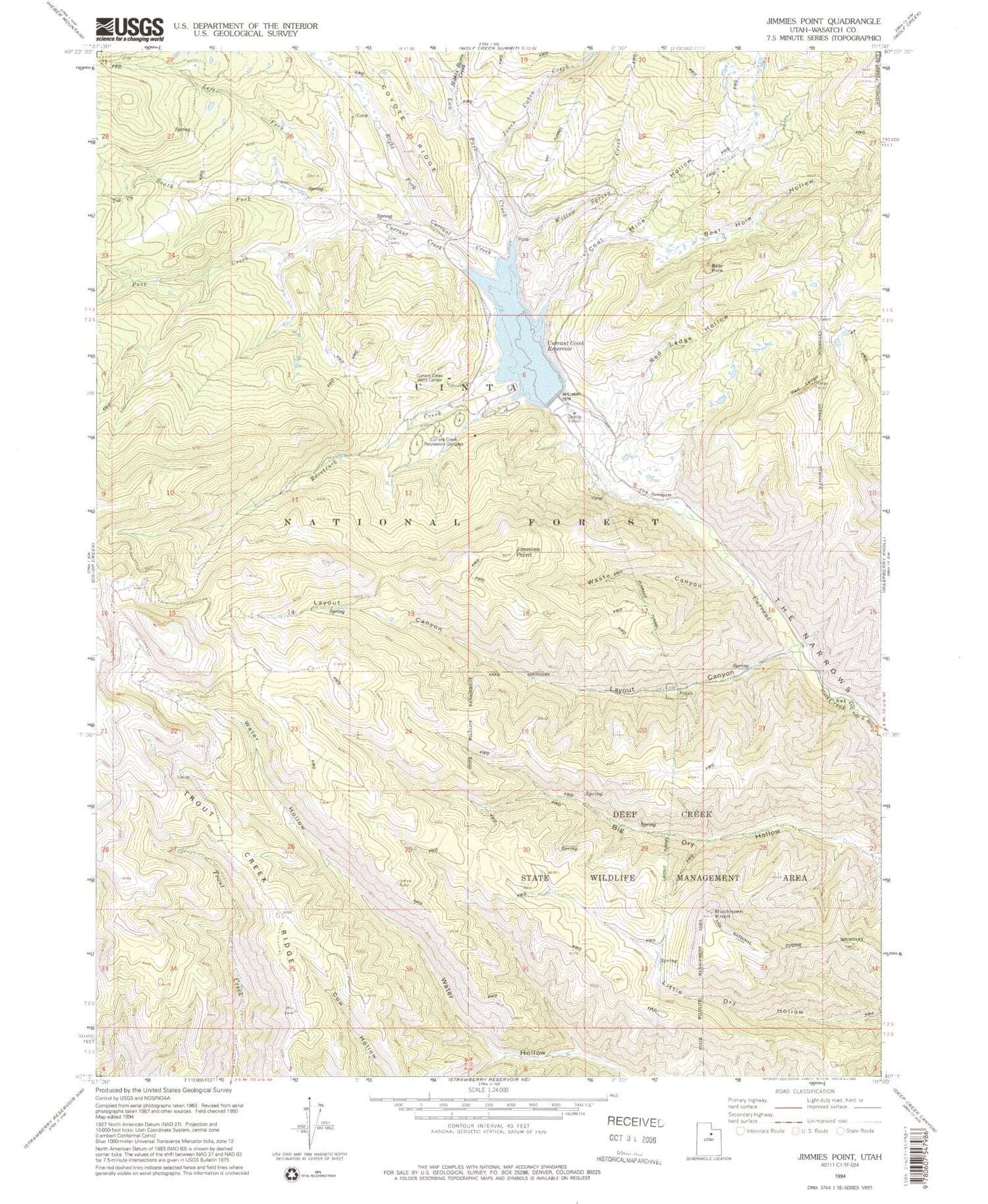
Classic USGS Jimmies Point Utah 7.5'x7.5' Topo Map
Couldn't load pickup availability
Historical USGS topographic quad map of Jimmies Point in the state of Utah. Typical map scale is 1:24,000, but may vary for certain years, if available. Print size: 24" x 27"
This quadrangle is in the following counties: Wasatch.
The map contains contour lines, roads, rivers, towns, and lakes. Printed on high-quality waterproof paper with UV fade-resistant inks, and shipped rolled.
Contains the following named places: Bear Hole, Bear Hole Hollow, Buckhorn Knoll, Coal Mine Hollow, Cow Camp, Currant Creek Guard Station, Hildas Basin Creek, Jimmies Point, Jones Cabin Creek, Layout Canyon, Left Fork Currant Creek, Low Pass Creek, Pass Creek, Racetrack Creek, Red Ledge, Red Ledge Hollow, Right Fork Currant Creek, South Fork Currant Creek, The Jumpoff, The Narrows, Tut Creek, Waste Canyon, Willow Spring Creek, Currant Creek Dam, Currant Creek Reservoir, Trout Creek Ridge, Currant Creek Campground, Layout Tunnel, Currant Tunnel, Bear Hole, Bear Hole Hollow, Buckhorn Knoll, Coal Mine Hollow, Cow Camp, Currant Creek Guard Station, Hildas Basin Creek, Jimmies Point, Jones Cabin Creek, Layout Canyon, Left Fork Currant Creek, Low Pass Creek, Pass Creek, Racetrack Creek, Red Ledge, Red Ledge Hollow, Right Fork Currant Creek, South Fork Currant Creek, The Jumpoff, The Narrows, Tut Creek, Waste Canyon, Willow Spring Creek, Currant Creek Dam, Currant Creek Reservoir, Trout Creek Ridge, Currant Creek Campground, Layout Tunnel, Currant Tunnel