MyTopo
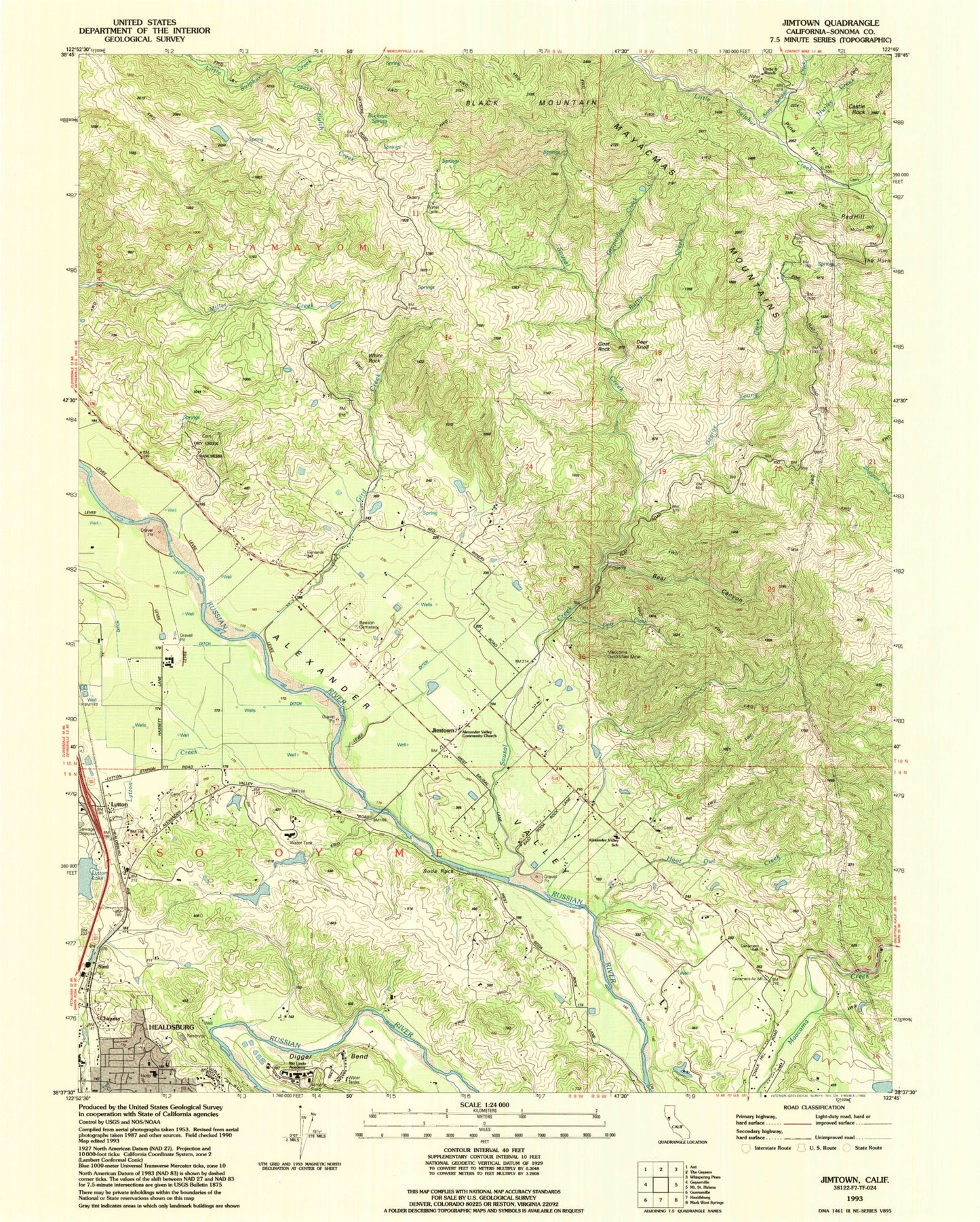
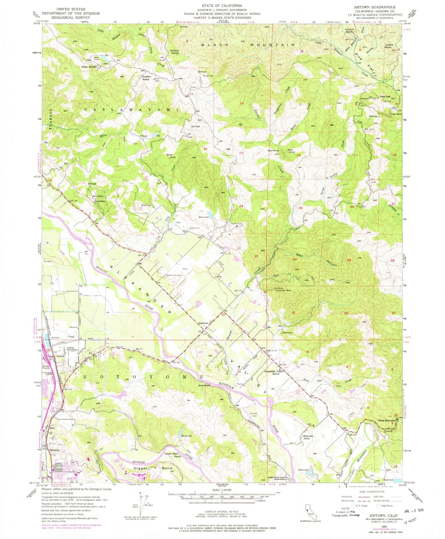
Classic USGS Jimtown California 7.5'x7.5' Topo Map
Couldn't load pickup availability
Historical USGS topographic quad map of Jimtown in the state of California. Map scale may vary for some years, but is generally around 1:24,000. Print size is approximately 24" x 27"
This quadrangle is in the following counties: Sonoma.
The map contains contour lines, roads, rivers, towns, and lakes. Printed on high-quality waterproof paper with UV fade-resistant inks, and shipped rolled.
Contains the following named places: Alexander Valley Community Church, Alexander Valley Elementary School, Alexander Valley Post Office, Alexander Valley Vineyards, Anna Belcher Creek, Bear Canyon, Beeson Cemetery, Black Mountain, Buckeye Spring, Budge 3423 Dam, Burns Creek, Camp Maacama, Castle Rock, Chiquita, Circle S Ranch, Cyrus Alexander Family Cemetery, Deer Creek, Deer Knoll, Department of Forestry and Fire Protection Healdsburg Station, Digger Bend, Digger Bend Ranch, Douglas Ranch, Dry Creek Rancheria, Dry Creek Shopping Center, Field Stone Winery, Foss Creek Elementary School, George Young Creek, Geyserville Fire Protection District Station 2, Gibbs Park, Gird Creek, Goat Rock, Good Shepherd Lutheran Church, Grapevine Creek, Hall Cemetery, Healdsburg District Hospital, Hoot Owl Creek, Hurley Creek, Jimtown, Lovers Gulch Creek, Lytton, Lytton 2424 Dam, Lytton Creek, Mericoma Quicksilver Mine, Montvale Farm, Pine Flat, Red Hill, Ridge Ranch, Rio Lindo Adventist Academy, Sausal Creek, Sausal Winery, Simi, Simi Winery, Soda Rock, Soda Rock Winery, The Horn, White Rock