MyTopo
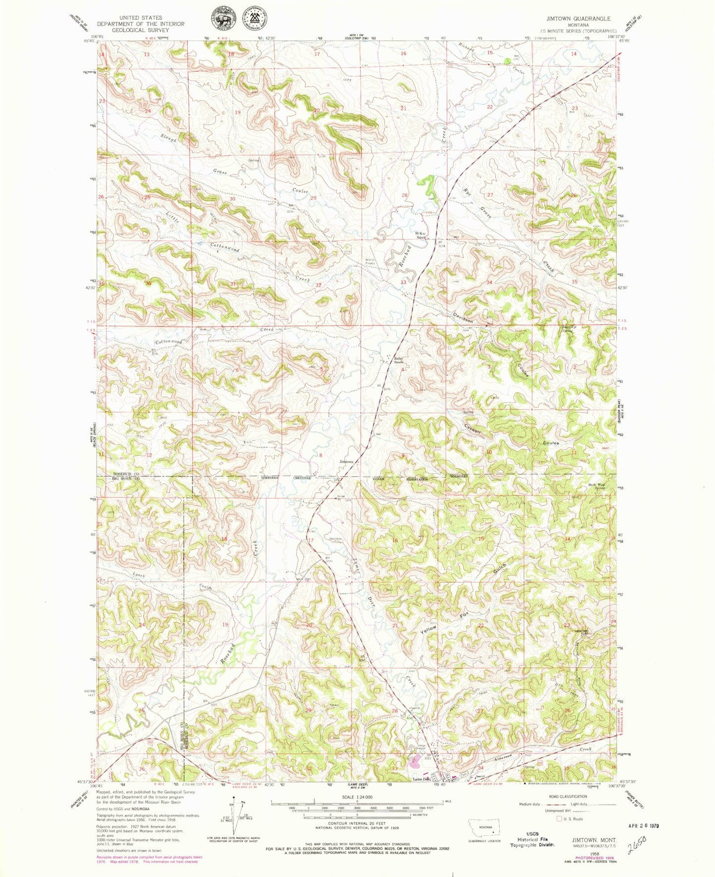
Classic USGS Jimtown Montana 7.5'x7.5' Topo Map
Couldn't load pickup availability
Historical USGS topographic quad map of Jimtown in the state of Montana. Map scale may vary for some years, but is generally around 1:24,000. Print size is approximately 24" x 27"
This quadrangle is in the following counties: Big Horn, Rosebud.
The map contains contour lines, roads, rivers, towns, and lakes. Printed on high-quality waterproof paper with UV fade-resistant inks, and shipped rolled.
Contains the following named places: 01S40E25ABDB01 Well, 01S41E14CCCB01 Well, 01S41E14D___01 Well, 01S41E15DDCA01 Well, 01S41E23BABC01 Well, 01S41E23BACB01 Well, 01S41E23BDBB01 Well, 01S41E23CAAB01 Well, 01S41E31BABC01 Well, 01S41E32CABA01 Well, 01S41E33DBBC01 Well, 02S41E02BABA01 Spring, 02S41E08CAD_01 Well, 02S41E08CAD_02 Well, 02S41E08CDAB01 Well, 02S41E08CDAB02 Well, 02S41E08CDAB03 Well, 02S41E09BCA_01 Well, 02S41E17BAA_01 Well, 02S41E17CCD_01 Well, 02S41E17DDD_01 Well, 02S41E19DAA_01 Well, 02S41E19DABA01 Well, 02S41E20BBC_01 Well, 02S41E20CBB_01 Well, 02S41E28BAA_01 Well, 02S41E34BADC01 Well, 02S44E03CADA01 Well, Bailey Ranch, Barb Wood Spring, Blackstone Corral, Camp Crook, Camp Merritt, Caswell Coulee, Chief Dull Knife College, Cottonwood Creek, Davidson Coulee, Davidson School, Isaac Kye Spring, Jimtown, Lame Deer Cemetery, Lame Deer Creek, Little Cottonwood Creek, Lynch Coulee, McKay Ranch, North Fork Cottonwood Creek, Richard Coulee, Rye Grass Creek, Saints Rest, Slough Grass Creek, South Fork Cottonwood Creek, Yellow Fox Gulch